
Tropical nights, where the temperature doesn’t drop below 20°C, are rare in the UK through September.
There have only been a handful of occurrences in the instrumental record, and there have never been consecutive tropical nights recorded in the UK in September. This could change this week as tropical nights are forecast in parts of southern UK possibly through to Friday night.
The highest UK overnight minimum temperature for September on record is 21.7°C, and this record could be threatened on Thursday and Friday nights in particular.
Following the recording of consecutive tropical nights in July last year, the Met Office completed an attribution study examining the influence of human induced climate change on the probability of recording consecutive tropical nights in July last year.
The scientists found the chance of recording three tropical nights in a row during July was less than 1% in a pre-industrial climate with no human greenhouse gas emissions, the probability is now around 20% chance in our current climate. Although this study examined July 2022, it is possible to infer that there will be an increase in likelihood of tropical nights in September too. The graph below shows how UK minimum temperatures in September have increased over the last 130 years.
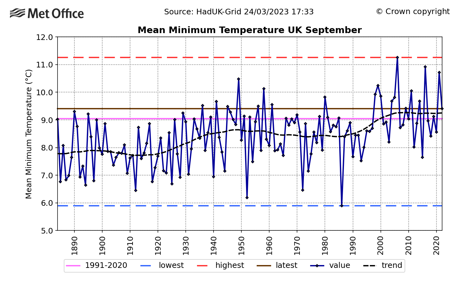
This graph of mean minimum temperatures in UK Septembers shows minimum temperatures have increased by over 1°C on average since 1890.
Met Office Principal Fellow for Climate Extremes, Paul Davies, said: “As our climate warms we know that we will see more frequent and more severe hot spells, and we’re starting to see the increase in frequency already. Tropical nights can have a significant impact on people and infrastructure as there is no time to recover overnight. It is clear that we’re already seeing the impact of climate change, and we’re likely to see even more tropical nights, even in September, as our climate warms.”
For the latest outlook on how long the heatwave will last, watch the latest Met Office 10 Day Trend below.