
Mountain weather
Lake District Mountain weather forecast table
Confidence
High for the general story but some uncertainty in exact timings of weather fronts.
Mountain weather hazards
Hazards apply at or above 300m, reflecting the more severe conditions which can occur at altitude.
 Gales
Gales
Gale force winds (gusts over 50mph) make walking difficult and strenuous with a potential to be blown over by gusts. There is often a marked increase in winds through cols or on exposed ridges and summits. Distances can take longer to cover and compass bearings become harder to follow accurately.
Heavy Persistent Rain
Heavy and persistent rain can lead to drenched clothing and footwear with waterproofs often becoming soaked through, especially if accompanied by strong winds. This can lead to significant loss of body heat and an increased likelihood of hypothermia. Terrain may turn increasingly boggy underfoot while streams can flood and become impassable. There may also be a risk of flooding in valleys or glens. If there is snow cover, a heightened avalanche hazard is possible and avalanche reports should be consulted where available.
Storm Force Winds
Storm force winds (gusts over 70mph) make walking very strenuous with any mobility virtually impossible over exposed ground. Where these conditions occur there is a high risk of being blown over and even standing may be impossible at times with a risk of being blown off one’s feet. Basic tasks such as using a map, eating, putting on extra clothing or communication become extremely difficult away from any shelter.
Poor Visibility
Poor visibility presents challenging route finding conditions. Visibility could be significantly less than 50 metres in all directions with few or no visual references, especially on featureless moors or plateaux. Distances become hard to judge and cliff or cornice edges can be difficult to recognise. These conditions require good navigational skills. There is a risk of white-out conditions when mist or fog is combined with extensive snow cover.
Severe Chill Effect
Wind significantly lowers the ‘feels-like’ temperature relative to the actual temperature, with even moderate winds significantly adding to the chilling effect. Strong winds can result in a severe and debilitating wind chill many degrees below the actual temperature. This effect will be enhanced in rain or wet snow. Without protection, prolonged exposure could result in frost nip or frostbite on exposed parts of the body and/or hypothermia.
Mountain weather forecast
Rain, heavy at times. Very windy with stormy conditions at height.
| 06:00 | 09:00 | 12:00 | 15:00 | 18:00 | 21:00 | |
|---|---|---|---|---|---|---|
Weather (at 800m) |
|
|
|
|
|
|
Chance of precipitation (at 800m) |
>95% | >95% | >95% | 40% | 20% | 20% |
Wind direction and speed (mph)
Altitude above mean sea level
| 06:00 | 09:00 | 12:00 | 15:00 | 18:00 | 21:00 | |
|---|---|---|---|---|---|---|
| 900m |
S
67
|
S
72
|
S
64
|
S
60
|
SW
39
|
S
37
|
| 600m |
S
48
|
S
56
|
S
49
|
S
49
|
SW
33
|
S
32
|
| 300m |
S
14
|
S
18
|
S
20
|
S
20
|
SW
13
|
S
13
|
| Valley |
S
12
|
S
16
|
S
20
|
S
22
|
SW
14
|
S
14
|
Wind gust (mph)
Altitude above mean sea level
| 06:00 | 09:00 | 12:00 | 15:00 | 18:00 | 21:00 | |
|---|---|---|---|---|---|---|
| 900m | 77 | 85 | 78 | 74 | 48 | 46 |
| 600m | 60 | 72 | 66 | 67 | 44 | 43 |
| 300m | 48 | 58 | 56 | 53 | 33 | 33 |
| Valley | 44 | 52 | 53 | 50 | 32 | 32 |
Altitude above mean sea level
| 06:00 | 09:00 | 12:00 | 15:00 | 18:00 | 21:00 | |
|---|---|---|---|---|---|---|
| 900m |
6°
|
6°
|
6°
|
4°
|
3°
|
3°
|
| 600m |
8°
|
8°
|
7°
|
6°
|
5°
|
5°
|
| 300m |
9°
|
10°
|
9°
|
9°
|
6°
|
6°
|
| Valley |
10°
|
11°
|
11°
|
10°
|
8°
|
8°
|
| Freezing Level |
2,300m
|
2,200m
|
2,200m
|
1,700m
|
1,400m
|
1,300m
|
Altitude above mean sea level
| 06:00 | 09:00 | 12:00 | 15:00 | 18:00 | 21:00 | |
|---|---|---|---|---|---|---|
| 900m |
-2°
|
-2°
|
-2°
|
-4°
|
-4°
|
-4°
|
| 600m |
1°
|
1°
|
1°
|
0°
|
-1°
|
-1°
|
| 300m |
6°
|
6°
|
6°
|
5°
|
3°
|
3°
|
| Valley |
8°
|
8°
|
8°
|
7°
|
5°
|
5°
|
Additional weather information
Meteorologist's view
Widespread gales to low levels and gusts of 70 to 90mph will make progress almost impossible on higher slopes with a high risk of being blown over.
Weather
Rain will persist for much of the day, often heavy and accompanied by very strong winds. Becoming drier and brighter during the afternoon with a few passing showers.
Chance of cloud-free hill tops
10% for most of the day, becoming 60% from late afternoon.
Low cloud and visibility
Poor visibility for most of the day in rain with persistent cloud and fog above 500 or 600m. Visibility improving from mid-afternoon with cloud lifting but some areas of fog remaining above 600m, mainly in the southwest.
Ground conditions
Date: Thursday 20 February 2025 Location: Helvellyn summit at 10:24 Full report: It's all change today on the fells with strong winds, heavy rain and higher temperatures! Whilst there are still large areas of snow present and lying ice, there is currently a rapid thaw taking place through to summit level; the snow-pack is now very saturated and softening up and many areas are stripped completely. There is a lot of lying water currently and it's very soggy under foot, the mountain becks are also now in high flow and need care when crossing. Today I witnessed two rock-falls on the Red Tarn face and cornices could be prone to collapsing in these conditions. With the thaw set to continue it is hard to say how much snow will survive into next week. Mountain conditions today, and more so tomorrow, are still very challenging and with the strong winds and driving rain coupled with the wind-chill its essential to have full winter clothing and safety equipment; even though the snow cover is depleting there are still many high level routes that will require an axe and micro-spikes, and where steeper snow is sought out, crampons too. Tomorrow the thaw continues and it's looking quite wet, however it's the wind that will be the biggest problem for safe/any mobility up high with gusts of 80mph forecast, take care! Temperature: plus 6.5 C, Maximum wind speed 58.2 mph, Wind chill: minus 1.1 C, Average wind speed: 36.6 mph.
Mountain weather information
Weather
Mostly dry but the odd brief shower is possible. Rather cloudy overnight and morning then lengthening sunny or clear spells through the afternoon and evening. Feeling cold on the tops with a significant wind chill.
Chance of cloud-free hill tops
20% in morning becoming 80% during afternoon.
Maximum wind speed expected
Southwest 20 to 25mph gusts 35mph.
Temperature
- At 800m Plus 3 or 4C.
- Valley Plus 8 to 10C.
- Freezing level Above summits.
Low cloud and visibility
Areas of cloud above 500 or 600m in the morning, but higher and more broken in the northeast. Cloud lifting and breaking up through the afternoon. The visibility will be good away from low cloud.
Mountain weather information
Sun 23 Feb
Sunrise:
Sunset:
Severe conditions expected in the hills. Very strong winds reaching storm force even at fairly low levels. Heavy and persistent rain with streams and rivers in spate. Becoming showery through the afternoon. Freezing level well above summits.
Mon 24 Feb
Sunrise:
Sunset:
Sunny spells and a few showers, wintry above 700m. Feeling cold with strong southwesterly winds, gales on the tops. Freezing level 900m.
Tue 25 Feb
Sunrise:
Sunset:
Sunny spells and blustery showers, wintry above 600m, some perhaps heavy and thundery. Strong to gale force westerly winds. Feeling cold at height.
Updated at:
Summit specific forecast
Mountain summit forecast map
Loading map…
Key
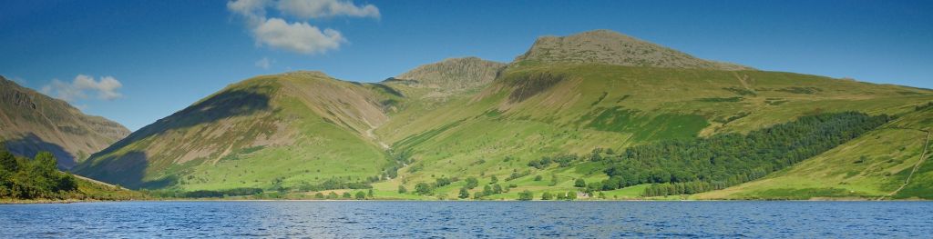
The Lake District covers an area of 885 square miles with its highest point, Scafell Pike, standing at 978 metres.