
Mountain weather
Bannau Brycheiniog / Brecon Beacons Mountain weather forecast table
Confidence
High for largely cold through the coming days, but confidence low from Saturday afternoon due to uncertainties in the track of a low across England and Wales and how quickly the milder air gets across the Brecon Beacons.
This evening forecast
Dry, clear and cold. Mainly light northwesterly winds.
Mountain weather hazards
Hazards apply at or above 300m, reflecting the more severe conditions which can occur at altitude.
 Severe Chill Effect
Wind significantly lowers the ‘feels-like’ temperature relative to the actual temperature, with even moderate winds significantly adding to the chilling effect. Strong winds can result in a severe and debilitating wind chill many degrees below the actual temperature. This effect will be enhanced in rain or wet snow. Without protection, prolonged exposure could result in frost nip or frostbite on exposed parts of the body and/or hypothermia.
Mountain weather forecast
Cold and sunny. Mainly light winds.
| 00:00 | 03:00 | 06:00 | 09:00 | 12:00 | 15:00 | 18:00 | 21:00 | |
|---|---|---|---|---|---|---|---|---|
Weather (at 600m) |
|
|
|
|
|
|
|
|
Chance of precipitation (at 600m) |
00% | 00% | <05% | <05% | <05% | <05% | <05% | <05% |
Wind direction and speed (mph)
Altitude above mean sea level
| 00:00 | 03:00 | 06:00 | 09:00 | 12:00 | 15:00 | 18:00 | 21:00 | |
|---|---|---|---|---|---|---|---|---|
| 600m |
N
7
|
NW
7
|
NW
8
|
W
9
|
W
10
|
W
8
|
W
7
|
W
4
|
| 300m |
W
2
|
W
3
|
W
4
|
W
5
|
W
6
|
W
4
|
W
4
|
SW
3
|
| Valley |
W
2
|
W
3
|
NW
4
|
W
5
|
W
6
|
W
4
|
W
4
|
NW
3
|
Wind gust (mph)
Altitude above mean sea level
| 00:00 | 03:00 | 06:00 | 09:00 | 12:00 | 15:00 | 18:00 | 21:00 | |
|---|---|---|---|---|---|---|---|---|
| 600m | 10 | 11 | 12 | 13 | 14 | 12 | 11 | 7 |
| 300m | 5 | 6 | 9 | 10 | 12 | 10 | 8 | 5 |
| Valley | 5 | 6 | 8 | 10 | 12 | 9 | 8 | 5 |
Altitude above mean sea level
| 00:00 | 03:00 | 06:00 | 09:00 | 12:00 | 15:00 | 18:00 | 21:00 | |
|---|---|---|---|---|---|---|---|---|
| 600m |
-3°
|
-3°
|
-3°
|
-2°
|
0°
|
0°
|
-2°
|
-2°
|
| 300m |
-3°
|
-3°
|
-2°
|
-1°
|
2°
|
2°
|
0°
|
-1°
|
| Valley |
-3°
|
-3°
|
-2°
|
-1°
|
3°
|
2°
|
0°
|
-1°
|
| Freezing Level |
0m
|
0m
|
0m
|
0m
|
500m
|
500m
|
300m
|
0m
|
Altitude above mean sea level
| 00:00 | 03:00 | 06:00 | 09:00 | 12:00 | 15:00 | 18:00 | 21:00 | |
|---|---|---|---|---|---|---|---|---|
| 600m |
-7°
|
-8°
|
-7°
|
-7°
|
-5°
|
-4°
|
-6°
|
-5°
|
| 300m |
-5°
|
-5°
|
-5°
|
-4°
|
-1°
|
0°
|
-3°
|
-3°
|
| Valley |
-5°
|
-5°
|
-4°
|
-4°
|
0°
|
1°
|
-2°
|
-3°
|
Additional weather information
Meteorologist's view
Significant chill mainly light winds.
Weather
Clear and dry through the early hours then a dry and largely sunny day. During the evening cloud above the summits begins to increase.
Chance of cloud-free hill tops
Close to 100%.
Low cloud and visibility
Little or no cloud below the summits, with generally excellent visibility.
Recent rainfall
Location: Neuadd (Near Pontsticill)
Altitude: 353m
| Last 24 hours | Last 48 hours | Last 72 hours |
|---|---|---|
| 0.4mm | 29.8mm | 34mm |
Measurement date:
Rainfall data provided by Natural Resources Wales. The Met Office is not responsible for content provided by third parties and may remove this data without warning.
Mountain weather information
Weather
A cold, bright start but cloud thickening and lowering through the morning. Occasionally heavy snow, with blizzard conditions possible over higher mountains, spreads northeast in the afternoon, perhaps turning to freezing rain in the late afternoon and evening.
Chance of cloud-free hill tops
Close to 100% through the morning falling close to zero through the afternoon.
Maximum wind speed expected
Variable less than 10mph through the morning becoming easterly or southeasterly 10-15mph by midday, then increasing 20-30mph in the afternoon, with gusts around 50mph over ridges and summits by evening.
Temperature
- At 600m Around minus 2 Celsius
- Valley Around minus 3 Celsius at dawn rising to plus 5 or 6 Celsius by day
- Freezing level 300m or less
Low cloud and visibility
Little or no cloud below the summits through the morning becoming periods or persistent above 450-600m, with patches below, in the afternoon. Away from cloud, visibility excellent falling to a kilometre or two in snow and freezing rain and near zero in heavier snow and blizzards.
Mountain weather information
Sun 5 Jan
Sunrise:
Sunset:
Cloudy with heavy snow, or freezing rain, turning to rain with a thaw of lying snow by dawn, the rain slowly easing before clearing during the evening. Strong easterly then southwesterly winds with summit gales. Freezing level 300m or less rising above the summits by dawn.
Mon 6 Jan
Sunrise:
Sunset:
Clear or sunny spells and occasional showers, turning increasingly to snow above about 450m. Strong westerly winds. Freezing level falling to around 600m.
Tue 7 Jan
Sunrise:
Sunset:
Mainly dry with clear or sunny spells. Westerly winds easing. Freezing level around 300-450m.
Updated at:
Summit specific forecast
Mountain summit forecast map
Loading map…
Key
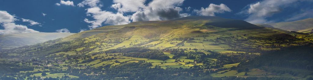
The Bannau Brycheiniog / Brecon Beacons is a mountain range in South Wales comprising six main peaks, with the highest peak, Pen y Fan, standing at 886 metres.