
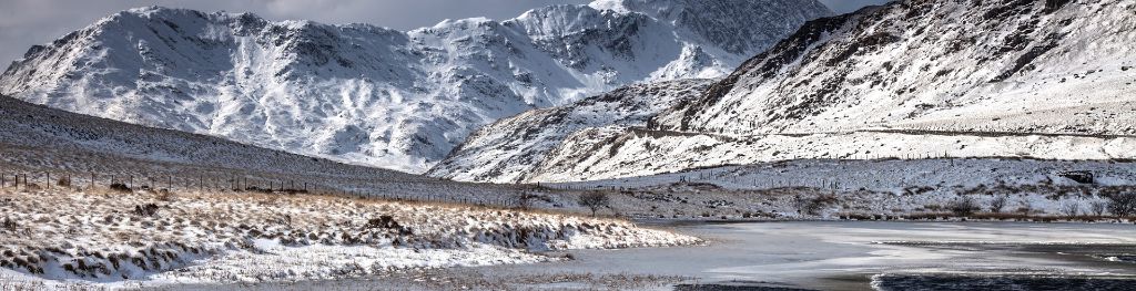
Mountain weather
Eryri / Snowdonia Mountain weather forecast table
Confidence
High for general developments. Medium for cloud details.
Mountain weather hazards
Hazards apply at or above 300m, reflecting the more severe conditions which can occur at altitude.
 Gales
Gales
Gale force winds (gusts over 50mph) make walking difficult and strenuous with a potential to be blown over by gusts. There is often a marked increase in winds through cols or on exposed ridges and summits. Distances can take longer to cover and compass bearings become harder to follow accurately.
Severe Chill Effect
Wind significantly lowers the ‘feels-like’ temperature relative to the actual temperature, with even moderate winds significantly adding to the chilling effect. Strong winds can result in a severe and debilitating wind chill many degrees below the actual temperature. This effect will be enhanced in rain or wet snow. Without protection, prolonged exposure could result in frost nip or frostbite on exposed parts of the body and/or hypothermia.
Poor Visibility
Poor visibility presents challenging route finding conditions. Visibility could be significantly less than 50 metres in all directions with few or no visual references, especially on featureless moors or plateaux. Distances become hard to judge and cliff or cornice edges can be difficult to recognise. These conditions require good navigational skills. There is a risk of white-out conditions when mist or fog is combined with extensive snow cover.
Storm Force Winds
Storm force winds (gusts over 70mph) make walking very strenuous with any mobility virtually impossible over exposed ground. Where these conditions occur there is a high risk of being blown over and even standing may be impossible at times with a risk of being blown off one’s feet. Basic tasks such as using a map, eating, putting on extra clothing or communication become extremely difficult away from any shelter.
Blizzards
Blizzards and whiteouts present challenging and serious conditions due to a combination of falling or blowing snow, strong winds and cold temperatures. They can be highly disorientating, often resulting in near-zero visibility with limited or no visual references and no distinction between ground and sky. Cliff edges and cornices may not be apparent, even close up. These conditions require very good navigational skills.
Heavy Persistent Snow
Heavy snow can lead to rapid changes in underfoot conditions and paths may become treacherous or hidden. It also brings very poor visibility and often makes navigation much more challenging. When deep snow accumulates progress is often time consuming and strenuous, significantly affecting the distance one can travel on foot. Deep drifts can develop if snow is combined with strong winds. A heightened avalanche risk is possible and avalanche reports should be consulted where available.
Thunderstorms
Lightning is a significant mountain hazard which can result in serious injury or death. Mountain terrain often leaves one highly exposed to lightning strikes. Hail may give unpleasant conditions with torrential rain and localised flash flooding also possible, mainly in Summer months.
Heavy Persistent Rain
Heavy and persistent rain can lead to drenched clothing and footwear with waterproofs often becoming soaked through, especially if accompanied by strong winds. This can lead to significant loss of body heat and an increased likelihood of hypothermia. Terrain may turn increasingly boggy underfoot while streams can flood and become impassable. There may also be a risk of flooding in valleys or glens. If there is snow cover, a heightened avalanche hazard is possible and avalanche reports should be consulted where available.
Mountain weather forecast
Rain then heavy wintry showers. Very windy with severe wind chill.
| 06:00 | 09:00 | 12:00 | 15:00 | 18:00 | 21:00 | |
|---|---|---|---|---|---|---|
Weather (at 800m) |
|
|
|
|
|
|
Chance of precipitation (at 800m) |
90% | 70% | 30% | 60% | 60% | 60% |
Wind direction and speed (mph)
Altitude above mean sea level
| 06:00 | 09:00 | 12:00 | 15:00 | 18:00 | 21:00 | |
|---|---|---|---|---|---|---|
| 900m |
SW
46
|
SW
51
|
W
38
|
W
41
|
W
47
|
W
38
|
| 600m |
SW
34
|
SW
35
|
W
26
|
W
27
|
W
31
|
W
29
|
| 300m |
SW
21
|
SW
23
|
W
17
|
W
18
|
W
22
|
W
20
|
| Valley |
SW
21
|
SW
23
|
W
18
|
W
19
|
W
23
|
W
21
|
Wind gust (mph)
Altitude above mean sea level
| 06:00 | 09:00 | 12:00 | 15:00 | 18:00 | 21:00 | |
|---|---|---|---|---|---|---|
| 900m | 55 | 60 | 48 | 52 | 60 | 49 |
| 600m | 41 | 44 | 35 | 37 | 43 | 40 |
| 300m | 34 | 39 | 31 | 33 | 40 | 36 |
| Valley | 35 | 39 | 31 | 33 | 40 | 37 |
Altitude above mean sea level
| 06:00 | 09:00 | 12:00 | 15:00 | 18:00 | 21:00 | |
|---|---|---|---|---|---|---|
| 900m |
4°
|
6°
|
3°
|
2°
|
0°
|
-1°
|
| 600m |
6°
|
7°
|
6°
|
4°
|
3°
|
2°
|
| 300m |
7°
|
9°
|
8°
|
7°
|
5°
|
4°
|
| Valley |
9°
|
10°
|
9°
|
8°
|
7°
|
6°
|
| Freezing Level |
2,100m
|
1,800m
|
1,100m
|
1,000m
|
900m
|
700m
|
Altitude above mean sea level
| 06:00 | 09:00 | 12:00 | 15:00 | 18:00 | 21:00 | |
|---|---|---|---|---|---|---|
| 900m |
-4°
|
-2°
|
-5°
|
-7°
|
-9°
|
-10°
|
| 600m |
-1°
|
2°
|
0°
|
-2°
|
-4°
|
-6°
|
| 300m |
3°
|
5°
|
4°
|
2°
|
0°
|
-1°
|
| Valley |
4°
|
6°
|
6°
|
4°
|
2°
|
1°
|
Additional weather information
Meteorologist's view
Note the wind speeds and significant wind chill at height with buffeting. Gusts of around 70mph possible over the summits.
Weather
Low cloud and outbreaks of rain and drizzle into Saturday morning. Cloud beginning to lift and break from late-morning. Bright or sunny spells and heavy blustery showers during the afternoon, these turning to snow over the summits. Further heavy snow and hail showers in the evening.
Chance of cloud-free hill tops
10% overnight and early morning, rising to 60% during the day, but lowering significantly as the showers pass through.
Low cloud and visibility
Extensive cloud, base 300 to 600m Saturday morning. This lifting and breaking near the summits by midday. However, falling significantly, base 400m or less as the heavy, blustery showers push through. Mostly moderate to very poor visibility becoming mostly very good or excellent as the cloud lifts and breaks, lowering significantly in showers and temporary blizzard and whiteout conditions as the heavy snow showers push through late in the day.
Ground conditions
Please see - https://yrwyddfa.live/
Mountain weather information
Weather
Heavy snow showers overnight and during the morning with some drifting and whiteout conditions. The snow showers becoming more scattered through the afternoon and evening with sunny or clear spells developing. Stormy over the summits.
Chance of cloud-free hill tops
30% becoming 70% by dusk
Maximum wind speed expected
West or Northwest 50mph gusting around 70mph with severe wind chill, buffeting and the risk of being blow over.
Temperature
- At 800m Minus 2 to Minus 4 degrees Celsius.
- Valley Zero rising to Plus 6 degrees Celsius.
- Freezing level Around 500m for much of Sunday.
Low cloud and visibility
Extensive cloud around the summits overnight and during the morning, broken bases falling to 400m or less in heavy snow showers. Cloud becoming well scattered or clear at times during the afternoon and evening. Visibility very poor in snow with white out and blizzard conditions, but becoming mostly very good or excellent in the afternoon.
Mountain weather information
Mon 23 Dec
Sunrise:
Sunset:
Clear and cold at first. Rain and snow developing, rain at all levels by evening with a thaw setting in. Fresh to strong northwest, becoming southwest winds at height. Freezing most levels at first, rising above the summits by evening.
Tue 24 Dec
Sunrise:
Sunset:
Cloudy with occasional rain and drizzle. Fresh to strong southwesterly winds at height. Mild.
Wed 25 Dec
Sunrise:
Sunset:
Mostly cloudy. Patchy rain and drizzle. Strong to gale force southwesterly winds at height. Mild.
Updated at:
Summit specific forecast
Mountain summit forecast map
Loading map…
Key
The Eryri (Snowdonia) mountains are made up of 90 mountain peaks including the tallest mountain in Wales, Yr Wyddfa (Snowdon), standing at 1,085 metres.