
Mountain weather
Bannau Brycheiniog / Brecon Beacons Mountain weather forecast table
Confidence
High for westerly pattern, but lowering for the timing and detail of the series of fronts that cross the area from the northwest.
Mountain weather hazards
Hazards apply at or above 300m, reflecting the more severe conditions which can occur at altitude.
 Strong Sunlight
Harmful UV levels from sunlight increase with altitude giving a greater risk of sunburn and eye damage, even on some overcast days. On breezy days, the cooling effect of wind on exposed skin may disguise any feeling of sunburn until it is too late. If there is snow cover, glare increases the effect of UV rays especially on the eyes. It is advisable to wear sun block, protective clothing such as a long-sleeved top and hat and have good quality eye protection.
Mountain weather forecast
East cloudier with some patchy rain. West mainly dry with some afternoon brightness. Summit winds fresh to strong from afternoon.
| Time | 00:00 | 03:00 | 06:00 | 09:00 | 12:00 | 15:00 | 18:00 | 21:00 |
|---|---|---|---|---|---|---|---|---|
Weather (at 600m) |
|
|
|
|
|
|
|
|
Chance of precipitation (at 600m) |
10% | 10% | <05% | <05% | 20% | <05% | 10% | 20% |
Wind direction and speed (mph)
Altitude above mean sea level
| Time | 00:00 | 03:00 | 06:00 | 09:00 | 12:00 | 15:00 | 18:00 | 21:00 |
|---|---|---|---|---|---|---|---|---|
| 600m |
W
9
|
SW
8
|
SW
11
|
SW
14
|
SW
17
|
SW
18
|
SW
19
|
SW
22
|
| 300m |
SW
6
|
SW
5
|
SW
7
|
SW
11
|
SW
13
|
SW
14
|
SW
12
|
SW
14
|
| Valley |
W
4
|
W
3
|
SW
4
|
SW
9
|
SW
11
|
SW
12
|
SW
10
|
SW
12
|
Wind gust (mph)
Altitude above mean sea level
| Time | 00:00 | 03:00 | 06:00 | 09:00 | 12:00 | 15:00 | 18:00 | 21:00 |
|---|---|---|---|---|---|---|---|---|
| 600m | 15 | 13 | 15 | 19 | 23 | 25 | 25 | 31 |
| 300m | 14 | 11 | 15 | 19 | 23 | 25 | 23 | 27 |
| Valley | 12 | 9 | 12 | 17 | 22 | 24 | 21 | 25 |
Additional weather information
Meteorologist's view
Some risk of sunburn in exposure in seasonally strong afternoon sunshine.
Weather
Most dry overnight with best of clear spells in east. A largely dry but mainly cloudy morning. Best of the days brighter spells developing in the east of the Park and during the afternoon. Cloud increasing during the evening bringing the chance of some more organised rain towards midnight.
Chance of cloud-free hill tops
During the morning 20% in west, 60% in east, by late afetrnoon 50% in west, 80% in east, before lowering during the evening
Low cloud and visibility
Good, becoming moderate or poor in rain, very poor within cloud with bases frequently down to 600m in the west during the morning, before lifting and breaking a little for the afternoon, then becoming extensive during the evening.
Recent rainfall
Location: Neuadd (Near Pontsticill)
Altitude: 353m
| Last 24 hours | Last 48 hours | Last 72 hours |
|---|---|---|
| 0.2mm | 0.2mm | 1.4mm |
Measurement date:
Rainfall data provided by Natural Resources Wales. The Met Office is not responsible for content provided by third parties and may remove this data without warning.
Updated at:
Summit specific forecast
Mountain summit forecast map
Loading map…
Key
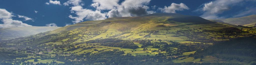
The Bannau Brycheiniog / Brecon Beacons is a mountain range in South Wales comprising six main peaks, with the highest peak, Pen y Fan, standing at 886 metres.