MAVIS - Met Office Aeronautical Visualisation Service
The Met Office is developing a new visualisation system for aeronautical users.
From 1 October 2025, Public BETA testing is available.We encourage you to sign-up and explore the features available.You can see what is up coming here, and what has beenrecently released hereSign-up via mavis.metoffice.gov.ukPLEASE NOTE : During BETA testing, this product is not feature complete and must NOT be used operationally. |
|---|
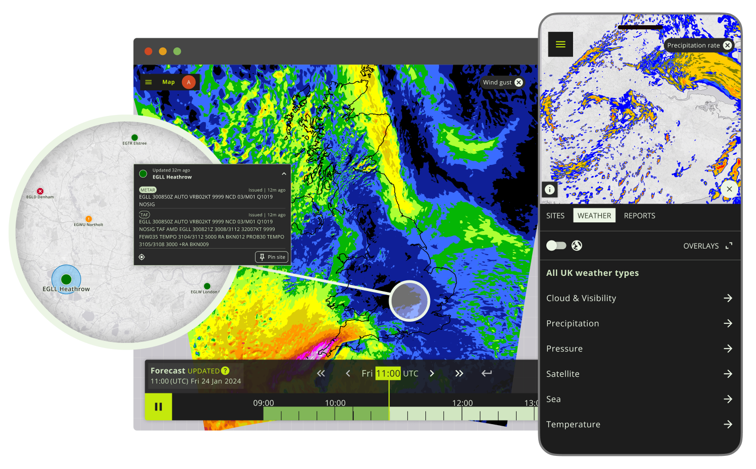
The Met Office Aeronautical Visualisation Service® (MAVIS®) will bring together 4 products: Aviation Briefing Service, Network Weather Resilience, Helibrief® and Open Runway™ into 1 user-friendly service, enabling access to meteorological information such as METARS (Meteorological Aerodrome Report), TAFs (Terminal Aerodrome Forecast) and charts, as well as weather map layers. This will ensure consistency in the information accessed.
Whether a glider pilot, balloonist, helicopter pilot, airline or airport, all required weather information will be accessible in one place.
Aviation Briefing Service, Network Weather Resilience, Helibrief® and Open Runway™ are all due to be retired in Spring 2026.
The image shown above shows early prototypes
Benefits of MAVIS®
Development of the service will enable:
- A more user focused product - customer research is directly feeding into the development of the service, making for a more user-friendly intuitive product
- Simplification of services, enabling adaptation to future user need
- Consistent messaging – the current services were built in isolation, resulting in inconsistent experiences.
Additional Resources
MAVIS Resources Visit our MAVIS resources page, where we have created a number of additional resources for you to learn how to use MAVIS, including an explainer video.
MAVIS Features and Benefits Learn more about the features and benefits of MAVIS.
MAVIS FAQs We have compiled a list of frequently asked questions on our FAQ page.
MAVIS Updates Visit this page to see the latest updates on MAVIS.
To discuss your weather aviation needs, please email [email protected] or fill out the contact form on this webpage.
Get in touch
Call us
We are available 24/7.
0370 900 0100Email us
Fill out this short form and we'll get back to you.
Contact Us formFollow us
Linkedin XGet in touch
Call us
We are available 24/7.
0370 900 0100Email us
Fill out this short form and we'll get back to you.
Contact Us form


