

4D-Trajectory API (4DT)
The Met Office 4D Trajectory API (4DT) service supplies global meteorological data for tailored flight trajectory requests to support flight planning services and software products.
The Met Office 4 Dimensional Trajectory API provides access to forecast data for aviation-relevant weather parameters. This data can be used for flight planning, route optimisation, and hazard management, and can be uplinked to on-board flight management systems and ground-based support tools. Using an API trajectory allows for quicker, more agile data transfer to suit users' needs.
The benefits of exploiting 10km resolution meteorological data for flight planning and in-flight decision making include:
- Increased flight efficiency using favourable wind data resulting in fuel saving.
- Increased environmental sustainability of aviation operations due to CO2 reduction.
- Improved Flight Management Computer (FMC) calculation to save fuel.
- Supplied notifications of weather hazards for situational awareness and improved safety.
Using 4DT, you can access high-resolution data as needed without interrogating a full global model dataset locally. Trajectory requests let you specify latitude, longitude, atmospheric height, date/time, and weather parameters to map meteorological data to a flight path.
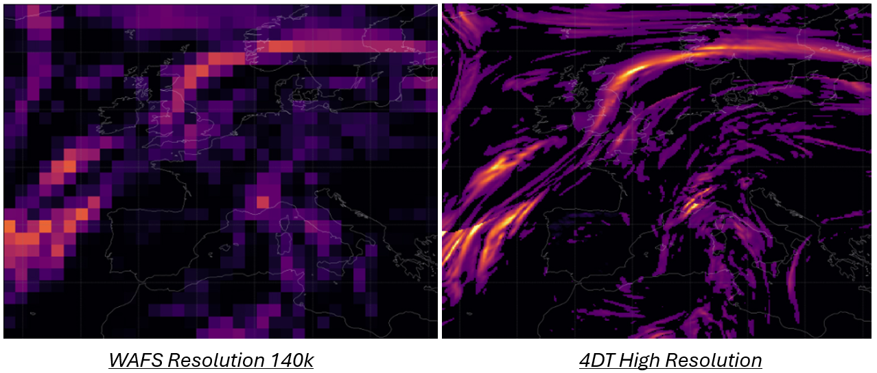
Turbulence/Wind examples
The data available comes from the Met Office Global Model, which has a horizontal resolution of ~10km, one-hourly timesteps, and covers the whole globe. Data is valid between T=0 and T=+36hrs. It is available in CovJSON format. Two API’s are available to supply the following weather parameters:
- The 'MAIN' dataset includes our core weather parameters for aviation operations (winds, temperature, relative humidity).
- The 'HAZARDS' dataset includes turbulence severity.
- Icing and CB Cloud Base/Top Height could be made available in due course.
- Convection data is currently available in 17km resolution. Please note that the Met Office is currently undertaking validation work to supply 10km resolution CB data.
This API service conforms to the Open Geospatial Consortium Environmental Data Retrieval (EDR) Specification, delivering data in coverage JSON format. SWIM compliant API providing High Resolution data for user defined flight paths
Pricing
4DT is a pay-per-request service.
All potential users can sign up for a free 30-day trial. This enables access to high resolution weather data and testing to ascertain potential efficiencies, including fuel cost savings.
To express interest in using the service or to learn more, you can email: [email protected]
Get in touch
Call us
We are available 24/7.
0370 900 0100Email us
Fill out this short form and we'll get back to you.
Contact Us formFollow us
Linkedin XGet in touch
Call us
We are available 24/7.
0370 900 0100Email us
Fill out this short form and we'll get back to you.
Contact Us form