

Intensive testbed: Daily updates March 2025, Mozambique
Mozambique hosts international, multidisciplinary WISER EWSA team from 22 March to 27 March for WISER EWSA’s fourth testbed.
Six weeks after the intensive testbed in Zambia, Mozambique is having its turn to welcome the international, multidisciplinary team from 22 March to 27 March for WISER EWSA’s fourth testbed.
Flexibility to achieve goals
Why four testbeds? The original project plan included two intensive testbeds – with testbed preparatory, co-production and -design meetings and activities occurring throughout the project. The first testbed took place in Zambia, with centres in Mozambique and South Africa, in January/February 2024. A steep learning curve followed, especially as the country was experiencing a drought, making the issuing of nowcasts challenging. Recognising the importance of issuing early warnings during real-world conditions, technical and community participants requested the incorporation of a longer-term testbed over the rainy period. Hence, the ‘king-size’ testbed kicked off in October 2024 and will run until April 2025. Still requiring an intensive two-week period where nowcasts are issued more than once during the day instead of only when severe weather hits, the team again gathered in Zambia during January/February 2025.
This event was intended to take place in Mozambique (after Zambia in early 2024), but that nation’s political situation at the time prohibited it. While colleagues from the Mozambican National Meteorological Institute (INAM) joined the testbed in January and February with their colleagues from South Africa and Zambia, the benefit of them applying what they have learnt on their home ground while engaging with their own target communities was deemed invaluable. Thus, the fourth testbed was scheduled, including two days of training before the official start of the Mozambican testbed on Saturday, the 22nd of March. Essentially, the intensive testbed within the 2024–25 king-size testbed was split into two: testbed 2Z and testbed 2M. All three countries participate in the event.
The additional learning opportunities resulting from the collaboration between the technical team and community observers, including intermediary organisations, community members (involving people with disabilities), to finetune nowcast messages are immense. This co-production and mutual sharing of experiences have added significant value to advance the project team in testing and implementing accessible and timely short-term forecasts.
First day, 22 March 2025
Lessons from the technical team on the first day included:
- It is great to include advisory images in the nowcast.
- More caution is needed when using METARs (a format for reporting weather information). Including locations outside the forecast domain should be avoided.
- Thunderstorms can be formed due to high sea surface temperatures in the Mozambique Channel and light winds toward the coast.
- It is important to consider the next steps after the testbed and the creation of a significant weather database.
- Emphasising collaboration with disaster management entities is crucial.
Community hub activities start in earnest during the week and include visits to the target community of Boane. In one recent activity, community mobilisers have been doing a social network analysis exercise in Boane to trace how messages are distributed after they receive them and, where possible, to see how they are then passed on (e.g. if a mobiliser tells a teacher, how many learners does that teacher tell, etc.).
Sunday, 23 March 2025
Today was the commemoration of World Meteorological Day. The 2025 theme is particularly apt considering the WISER EWSA team’s work: ‘Closing the Early Warning Gap Together’.
The technical team’s activities highlighted the importance of ground observation and determined that a strategy is needed to use/enhance ground observations for nowcasting.
Other deliberations included:
- The Mozambique-manned weather stations’ data will be evaluated retrospectively as the data typically take more than a day to be reported.
- Nowcasters were reminded of the importance to include the date and the time of validity in the voice notes.
- The proximity of nearby locations for warnings must be clearly defined.
- The feasibility of extending the operational process to additional locations depends on specific site conditions.
- A clear strategy is needed to manage WhatsApp messaging and other communication channels effectively when issuing impact-based forecasting for multiple locations.
World Meteorological Day celebration
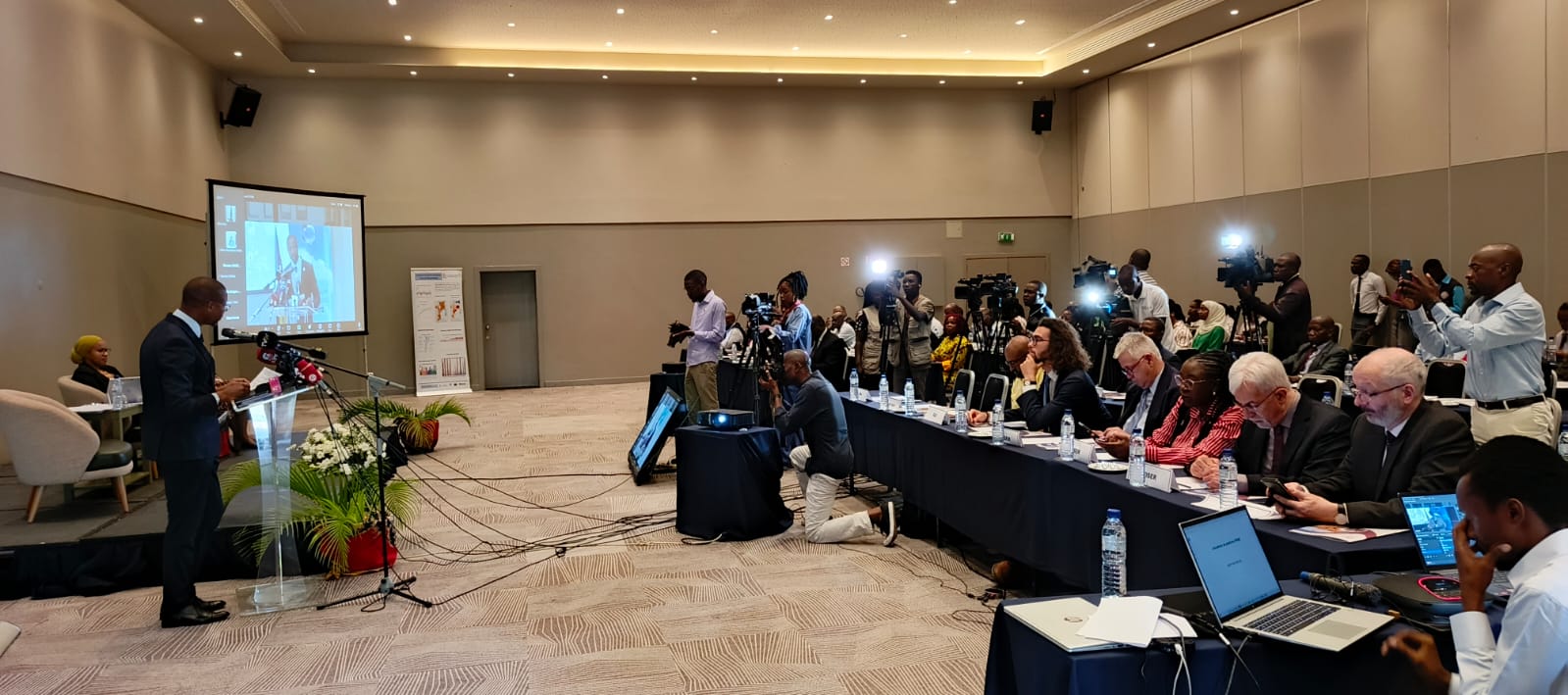 On 24 March 2025, WISER EWSA team members attended a celebration of World Meteorological Day hosted by INAM and addressed by, among others, the Permanent Secretary of the Ministry of Communications and Digital Transformation, Nilza Miquidade.
She reminded attendees of Mozambique’s precarious geographical location which is prone to cyclical vulnerabilities, “Changes in our environment are causing more extreme weather phenomena. The tropical cyclones that rapidly intensify, the devastating precipitation, the storm surges, the floods, the deadly droughts, and the wildfires are increasing globally… This event occurs when the country is feeling the impacts of the passage of cyclones Chido, Dikeledi, and Jude, particularly in the provinces of Cabo Delgado and Nampula. For example, according to preliminary data from the National Institute for Disaster Risk Management, tropical cyclone JUDE affected about 302,653 people and various socioeconomic infrastructures.”
Referring to the Early Warnings for All (EW4All) initiative of the United Nations, which aims to ensure that by 2027 every person on Earth has access to early warnings, and to the WISER programme with its focus on short-term forecasts (i.e. nowcasts), she related that as part of the country's ‘One district, one meteorological station’ programme, the Mozambican Government acquired “two more meteorological radars to be installed, one in Xai Xai and another in Nacala. These are part of the seven meteorological radars that the country needs to improve the early warning system, leading to proactive action.”
INAM General Director, Adérito Celso Félix Aramuge, echoed the Permanent Secretary’s welcome, “Our greetings are extended to our international partners from the WISER EWSA Project, from the United Kingdom, Finland, South Africa and Zambia present here, who are in Mozambique implementing activities that support the EW4All initiative, led by the World Meteorological Organization. These activities are crucial for enhancing INAM's ability to prepare short-term weather forecasts, in particular.”
Weather song released
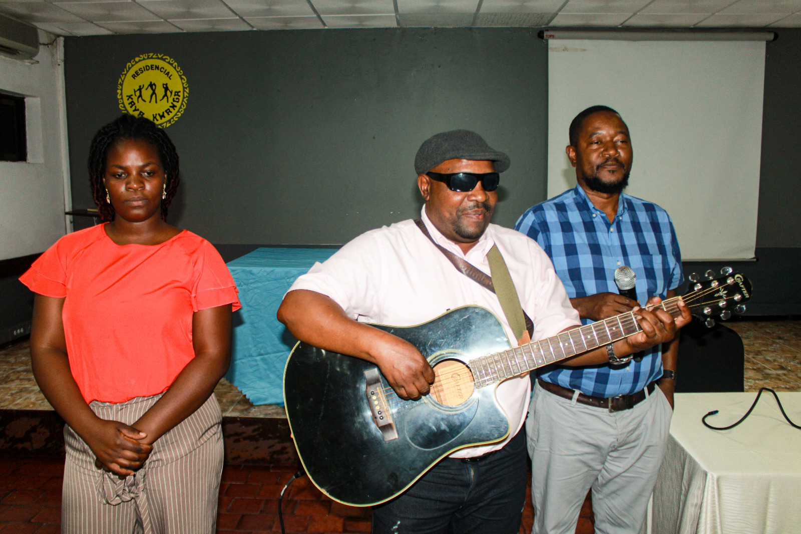
Later in the day, a popular local artist who has been part of the WISER EWSA community engagement activities as a person with a sight disability released a song (a first for the project) he had composed about the importance of (early) weather forecasts for all. The artist, Rafael Bata (centre), was joined by Katia Cumaio (left) in performing the song, Previsão de Tempo Para Todos.
Technical evaluations and nowcasting
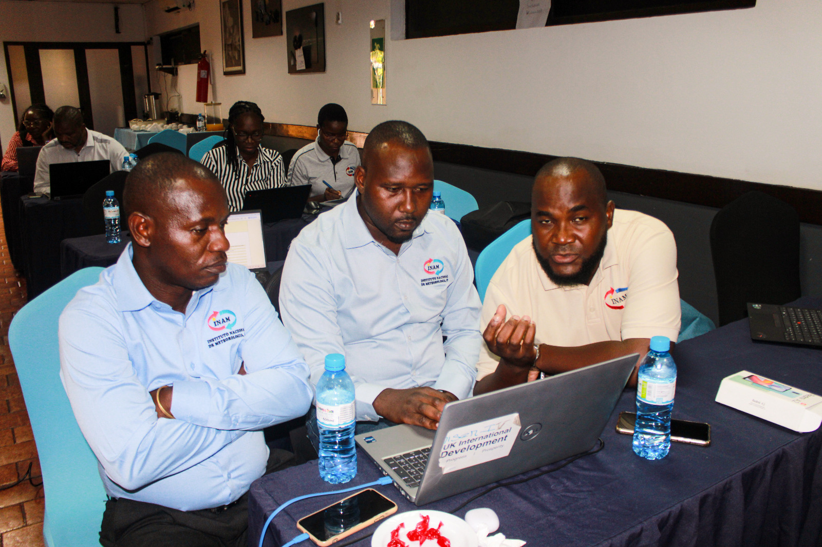
No INE was recorded, and none was expected in the coming hours. Lessons learnt included a reminder to consider carefully the interpretation of CRR data. It mainly captures rainfall intensity from convective storms using satellite-derived cloud-top temperature and infrared data but may underestimate stratiform rains.
The team also considered that when defining alert levels, local information must be considered such as the number of the population, topography, etc. in addition to rain intensity.
Data interruptions can affect storm evaluations and as such, results should be interpreted with caution.
Questions that require further discussion include whether satellite data can be integrated into the nowcasting sheet when forecasters are confident about the weather structure, such as the ITCZ or a cyclone. Also, which products should be made public in this case? Some may be too complex to interpret.
For storms with comparable speeds, the team found that colder cloud-top temperatures are associated with higher precipitation rates and warmer cloud-top temperatures are associated with lower precipitation rates.
Intensive testbed in Mozambique concludes
The short but rigorous testbed in Mozambique (T2-M) concluded on 27 March 2025. Days four to six involved a continuation of exploits by the forecasters and meteorologists to identify which technical products deliver the best and most accurate results. Community engagements continued in the target areas. In addition, interviews were held with intermediary stakeholders to hone the socio-economic benefit analysis of the project.
On the technical front, the team revisited the Standard Operating Procedures (SOPs) – both those previously used (ECMWF, UKMET, WRF, GFS, and EUMETSAT [via the RSMC portal], along with GSM and Synergie platform models) and SOPs for the newly used models (WISER portal models, including CEH, NWC-SAF-ADAGUG, FASTA, and the WISER_EWSA_DATACATALOGUE).
The team’s work reinforced the importance of short-term forecasting and led to the introduction of operational procedures for short-term forecast production, including verification, synoptic analysis, and impact-based forecasting.
INAM Director Dr Adérito highlighted the project’s role in strengthening forecasters’ skills, improving INAM’s services, and fostering collaboration between Mozambique, Zambia, and South Africa to enhance weather information for end users.
Insights about specific tools
- RDT: Increases confidence; could assist in detecting rapid dissipation and strong localised winds.
- CRR & RoA: Require functionality to adjust accumulation periods and spatial coverage.
- WISER-EWSA Catalogue: Provides historical weather data for review.
- In-situ Ground Observations: Useful for real-time verification, essential for product validation.
- Upper-Air Sounding: Currently available only in RSA; helps identify potential weather inhibitors.
- FASTA: Enables quick weather assessments.
- CEH Portal: Offers lightning observation, estimated rainfall amounts, and surface temperature insights.
Community engagement
Team discussions identified challenges such as a lack of awareness about forecasting institutions, limited availability of technical terms in the local language, and restricted communication channels.
The impacts of scientist-community interactions on forecasting include improved information packaging, simplified communication for better understanding, and the integration of symbols to complement text. Effective methods highlighted for forecasting to disadvantaged groups include Braille, sign language interpreters, flags, voice notes, and text messages. Educating communities on impact tables helps translate forecasts into actionable information.
There was broad agreement that future engagements must commit to reaching all communities with weather and early warning information, using local languages for clearer communication. A key question, however, is how improvements, intentions, and future engagements should be measured.
Importance of continued engagement reaffirmed
On the final day of T2-M, colleagues in Maputo—alongside community observers—worked in small groups to reflect on the nowcasting process and ways to ensure its sustainability. A key insight reaffirmed during the session was that engagement between forecasters and community observers is key for making weather information accessible and useful to people of all abilities. This collaboration not only benefits end users but also enriches forecasters' work, providing them with valuable guidance and reinforcing the importance of their efforts. These insights will help shape the remaining king-size testbed activities, the project’s outputs, and inform future projects and INAM’s operations. The agenda also included a presentation of the FASTA app and its benefits.
During a reflection session, community observers shared the following, among other comments:
- We feel very happy to be part of this project, especially because it changed our approach within the community when an extreme event was approaching;
- Now we have an opportunity to speak in the community meetings, and take those opportunities to raise awareness of the importance of weather information; and
- We are very happy with the forecasters who came to the field and explained [to] us the technical terms and other phenomens [sic] that we didn’t know much about (e.g. local rains vs widespread rains).
In support of the socio-economic benefit analysis and the necessary data required to complete this, meetings were held with an economic researcher at UNU-WIDER – the United Nations University World Institute for Development Economics Research – familiar with hazard impact economics, and with a representative of the Ministry of Transport and Communications.
Final review meeting
The last review meeting of T2-M focused more on the lessons learnt and impressions made by the king-size testbed thus far. All the participants, divided into groups, had the opportunity to share how the testbed impacted their work.
Group A shared the forecast tools they started using after the testbed and their advantages. They felt encouraged to keep on using those tools after the testbed because of the importance of having an accurate forecast to share with the community.
Group B shared that before the beginning of the project, few community members knew about INAM and its services. The meteorologists shared that being in the field changed the way they produce forecasts because of the feedback that the information was sometimes not understood. Being part of the project made them realise that they must also produce forecasts for disadvantaged people (through, for example, voice messages, sign language, flags, text messages and so on). They reinforced their willingness to engage more with the community in the future to fill the gap between the met services and end users, communicating weather information in local languages to ensure clear understanding.
Group C presented the nowcasting products that they are currently using and what they want from the researchers in future.
What is next?
A detailed report on T2-M will be shared early in April 2025.
The team’s work on the king-size testbed will resume on 31 March 2025 with the necessary changes in the working methodology where, among other things, nowcasting is only conducted in the case of severe weather events and not, as in the case of the intensive testbeds, several times during the day regardless of imminent severe weather observations.