

Observed and forecast tracks: southern hemisphere 2024-25
All tropical cyclones in the southern hemisphere season in 2024-25 are listed below including details of their start and end dates, lowest central pressure and maximum sustained wind (MSW).
Click on the name of the tropical cyclone to see a chart of the observed track and forecast tracks from the Met Office global model. Verification statistics on each tropical cyclone are available upon request from [email protected]. At the end of the season a verification report on the performance of the Met Office global model will be published.
| Name & ID | Start & end dates | Central pressure, 1-/10-minute MSW | Comments on Met Office global model forecasts |
|---|---|---|---|
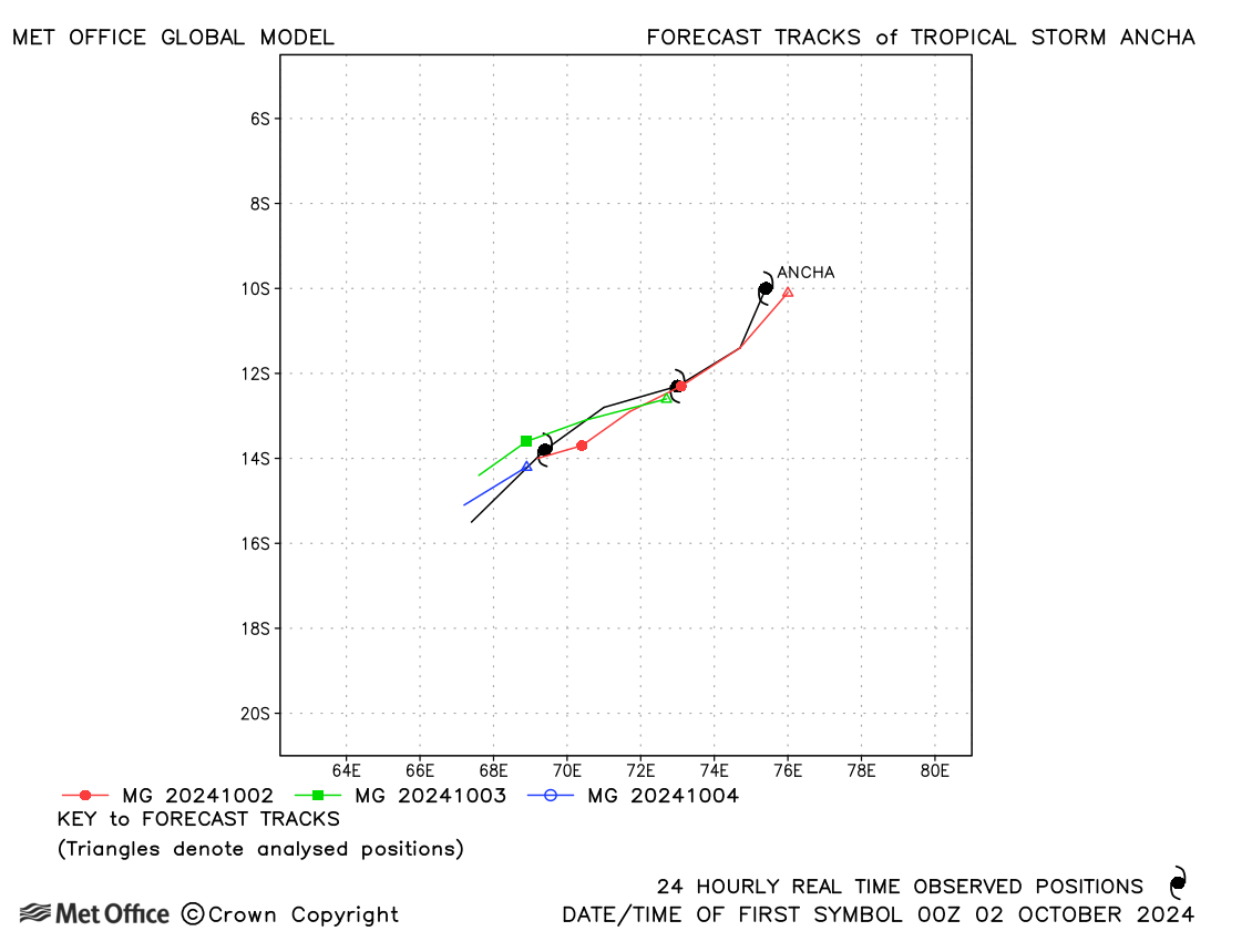
| Ancha (01S) | 01-04 October | 992 mb, 50/45 knots | The track of Ancha was well predicted with a slight slow bias. |
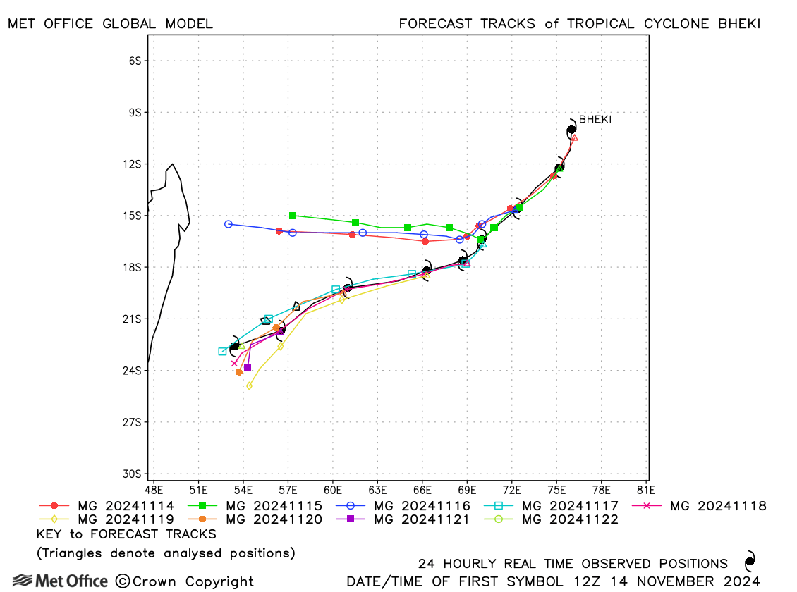
| Bheki (02S) | 14-22 November | 943 mb, 115/105 knots | Track forecast errors were mostly low, except at long lead times due to a right-of-track bias in early forecasts. |
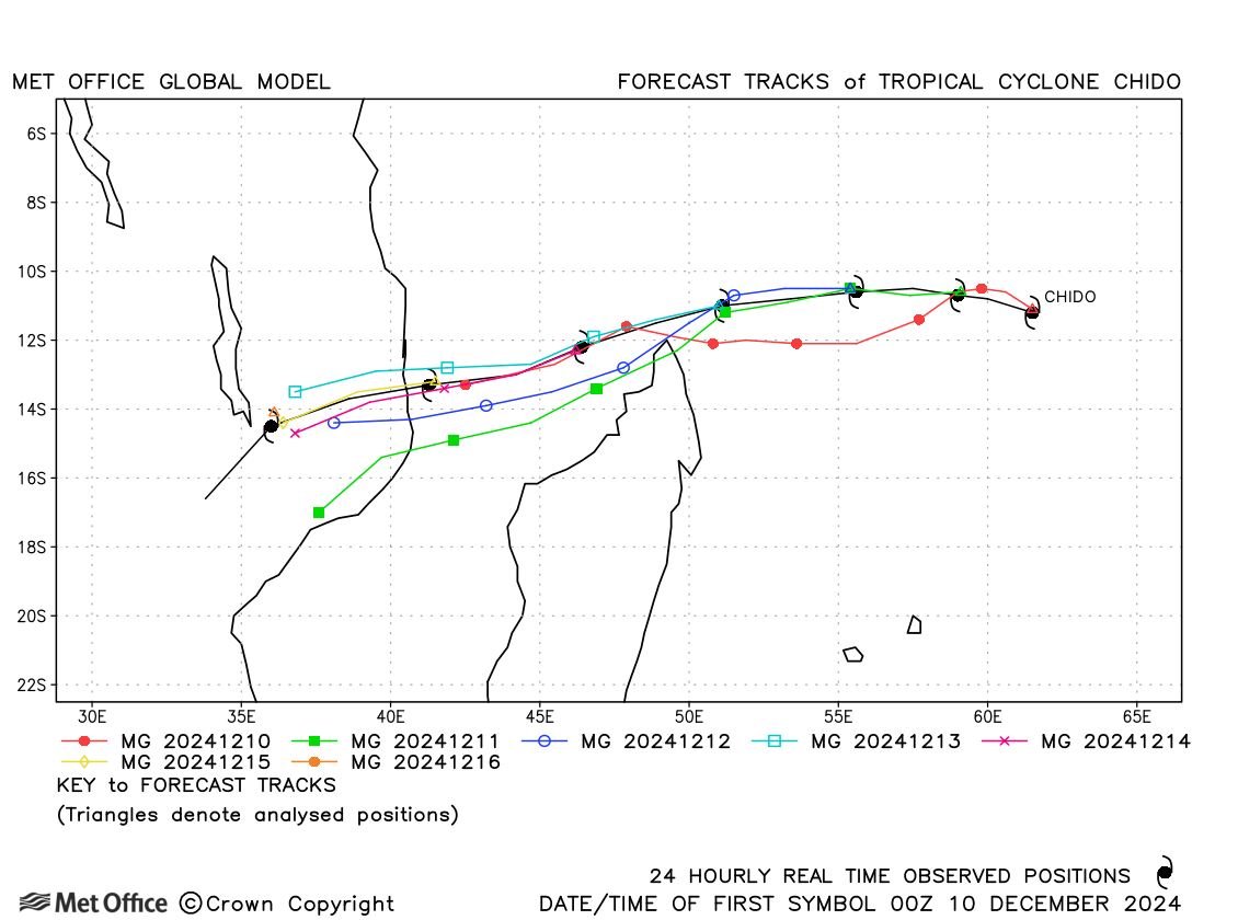
| Chido (04S) | 09-16 December | 935 mb, 135/115 knots | A slow bias at longer lead times resulted in large track forecast errors. |
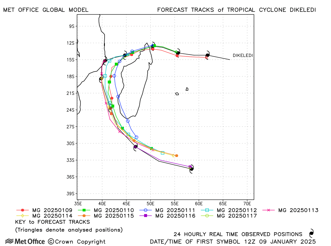
| Dikeledi (07S) | 09-17 January | 945 mb, 100/95 knots | There was a slow and left-of-track bias resulting in large track forecast errors. |
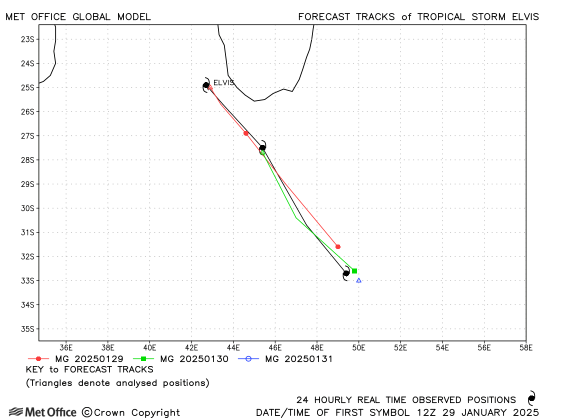
| Elvis (12S) | 29-31 January | 990 mb, 45/45 knots | Track forecast errors were close to the recent mean values. |
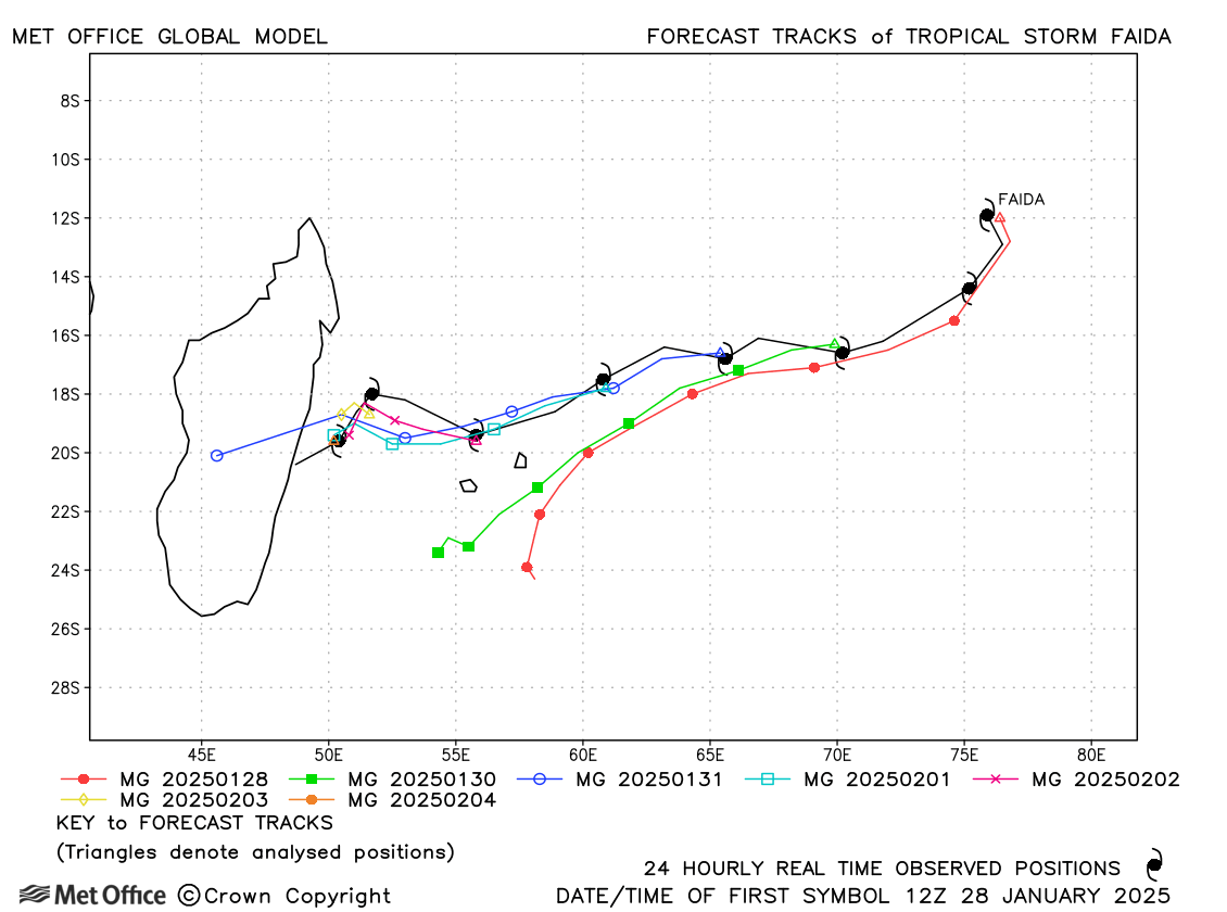
| Faida (11S) | 28 January - 05 February | 996 mb, 45/35 knots | There was a left-of-track bias resulting in some large forecast errors. |
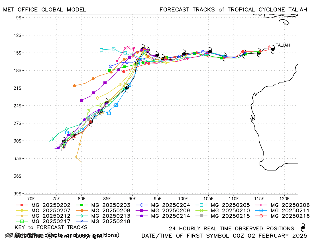
| Taliah (14S) * | 01-18 February | 965 mb, 85/75 knots | Track forecast errors were close to or below the recent mean values for this long-lived storm. |
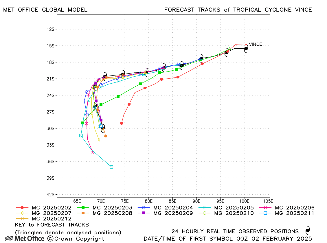
| Vince (13S) * | 01-12 February | 930 mb, 135/115 knots | Track forecast errors were mostly below the recent mean apart from for long lead times, due to a left-of-track bias. |
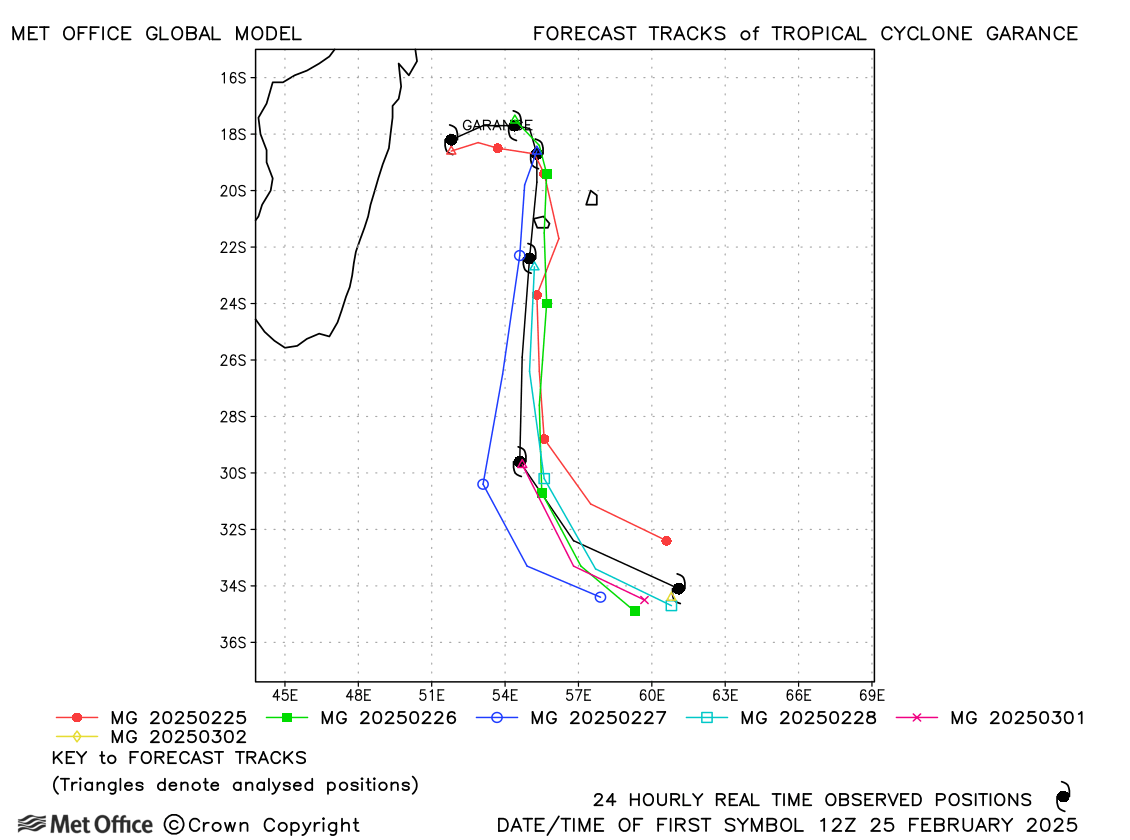
| Garance (22S) | 25 February - 02 March | 951 mb, 105/95 knots | At short lead times track forecast errors were near to the recent mean values, but much lower at longer lead times. |
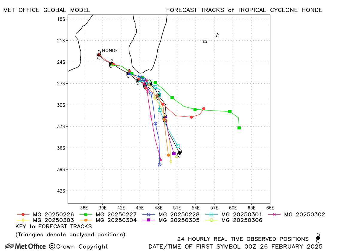
| Honde (23S) | 25 February - 05 March | 968 mb, 70/65 knots | Early forecasts had large track errors at longer lead times, but other forecasts mostly had errors below the recent mean values. |
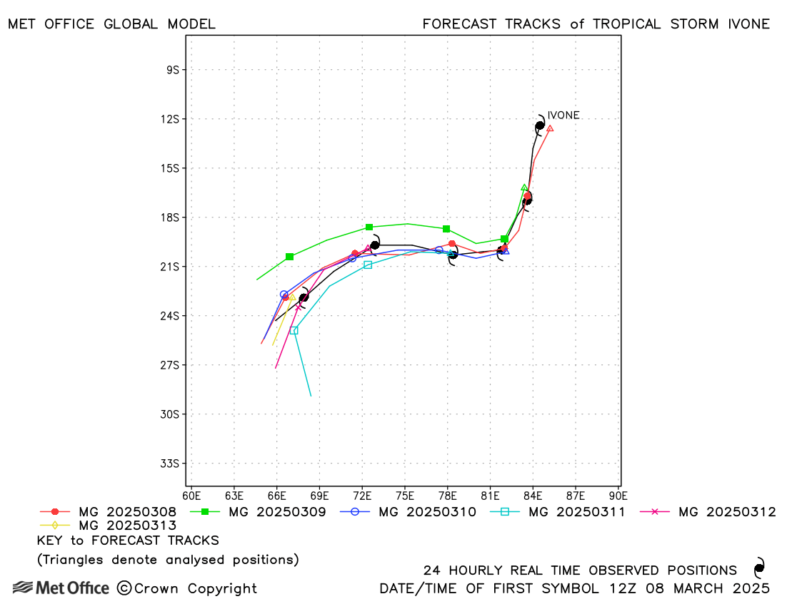
| Ivone (24S) | 08-14 March | 981 mb, 50/50 knots | At long lead times track forecast errors were well below the recent mean values. |
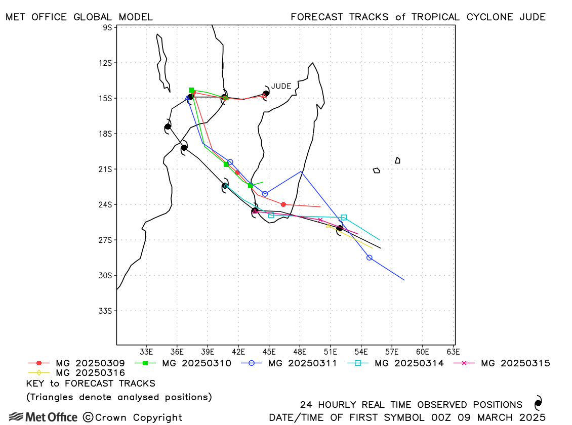
| Jude (25S) | 08-16 March | 970 mb, 80/75 knots | At most lead times track forecast errors were below the recent mean values, although there was a left-of-track bias. |
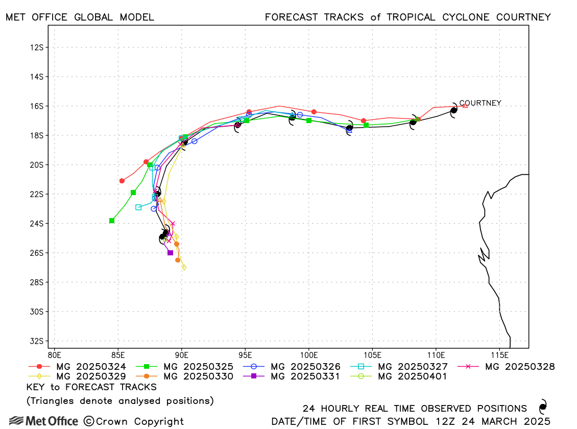
| Courtney (27S) * | 24 March - 01 April | 929 mb, 130/120 knots | Track forecast errors were well below the recent mean values and skill scores were high. |
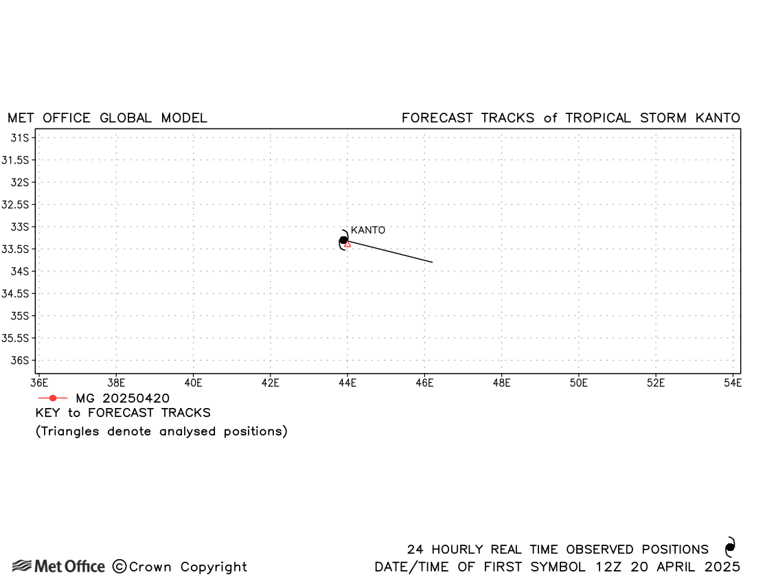
| Kanto (-) | 20-21 April | 993 mb, -/40 knots | Kanto was a brief subtropical storm and no forecasts were verified. |
* Taliah, Vince and Courtney originated in the Australian region
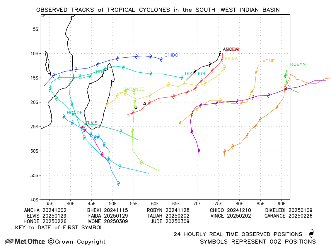
South-west Indian observed tracks in 2024-25
| Name & ID | Start & end dates | Central pressure, 1-/10-minute MSW | Comments on Met Office global model forecasts |
|---|---|---|---|
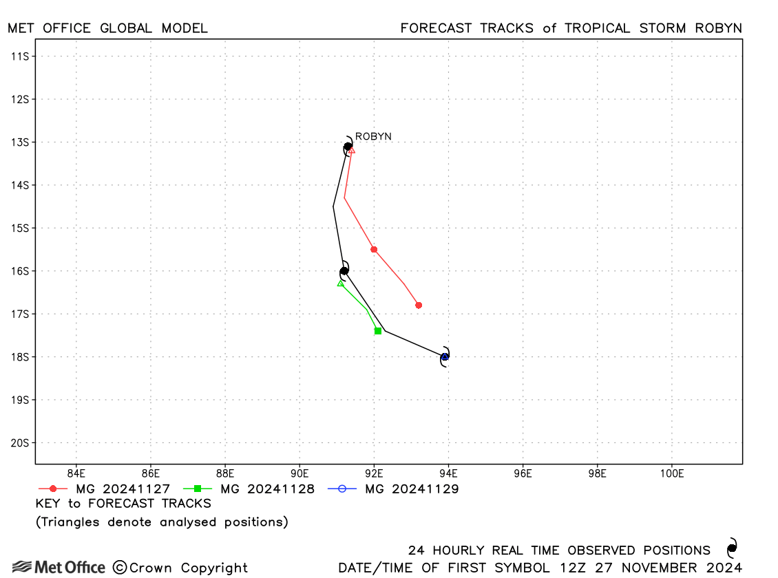
| 27-29 November | 985 mb, 55/55 knots | Track forecast errors were a little above the recent mean values. | |
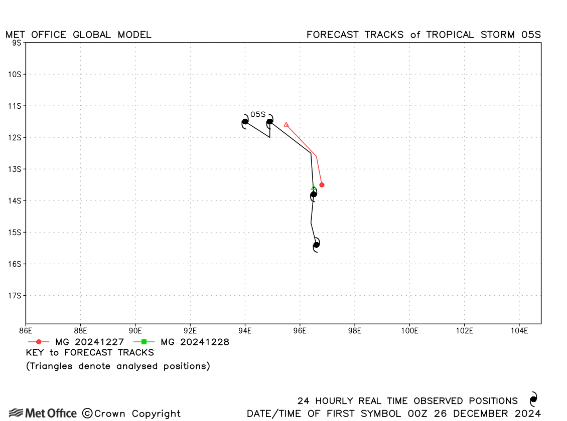
| 05S | 26-29 December | 998 mb, 35/35 knots | 05S was short-lived. Track forecast errors were low. |
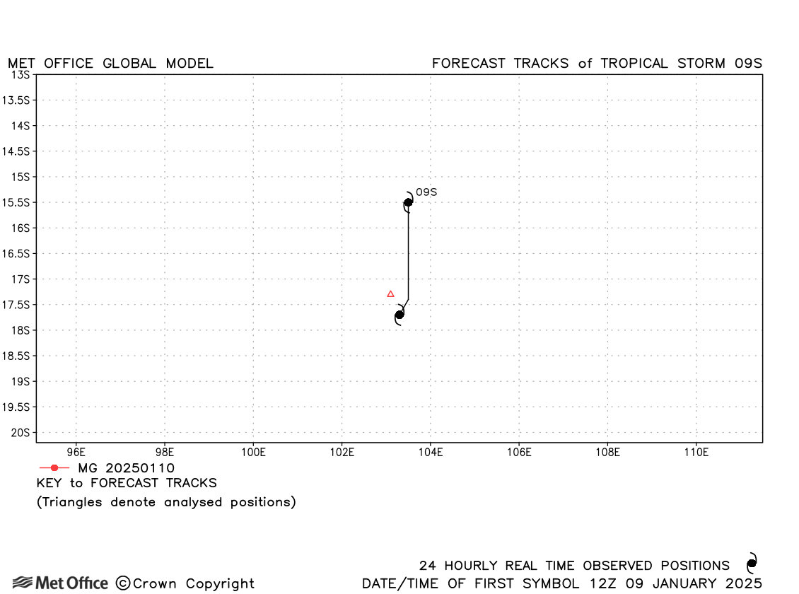
| 09S | 09-10 January | 1003 mb, 35/30 knots | This was a short-lived storm with few forecasts verified. |
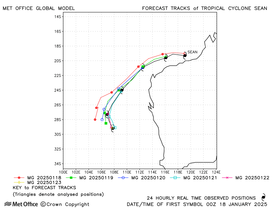
| Sean (10S) | 18-23 January | 945 mb, 115/95 knots | Track forecast errors were mostly very low for this cyclone. |
| Taliah (14S) * | 01-18 February | 965 mb, 85/75 knots | Track forecast errors were close to or below the recent mean values for this long-lived storm. |
| Vince (13S) * | 01-12 February | 930 mb, 135/115 knots | Track forecast errors were mostly below the recent mean apart from for long lead times, due to a left-of-track bias. |
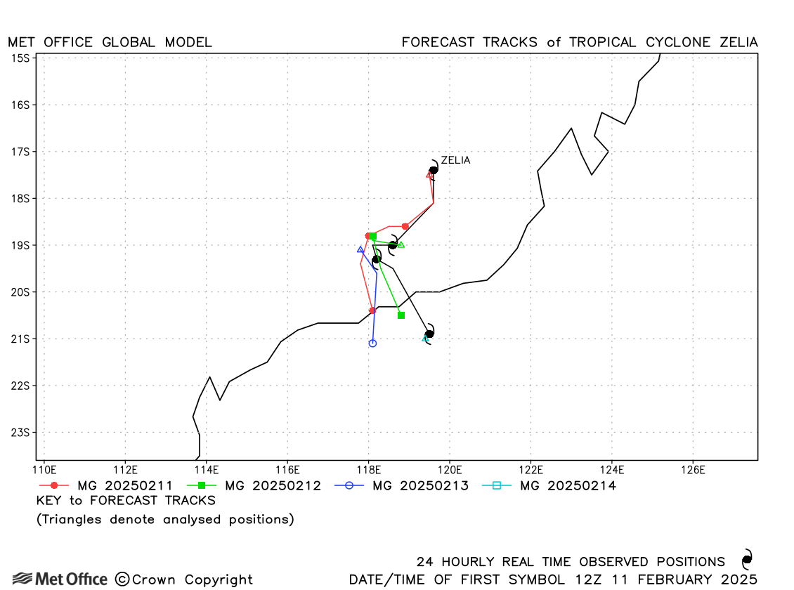
| Zelia (17S) | 11-14 February | 928 mb, 130/110 knots | Track forecast errors were low, although the landfall location was farther east than predicted. |
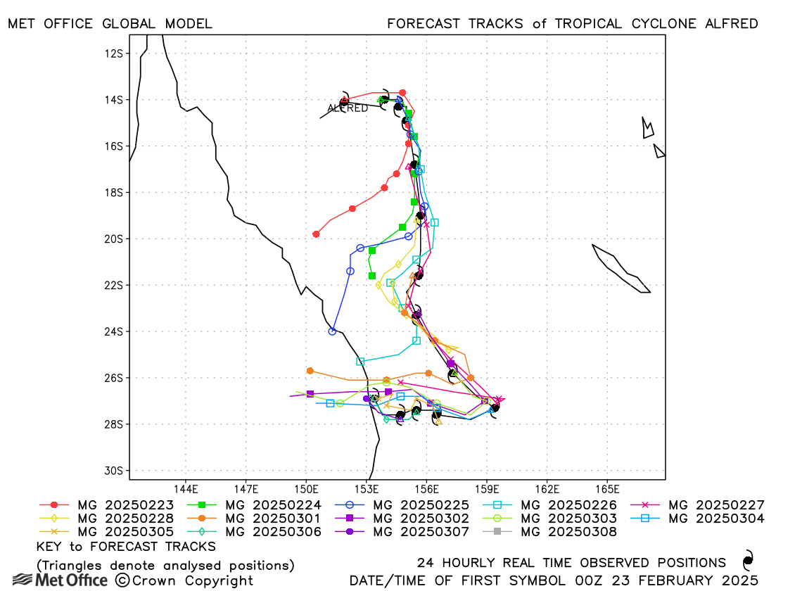
| Alfred (18P) | 22 February - 08 March | 951 mb, 115/90 knots | Despite having a slow and right-of-track bias in several forecasts track forecast errors were below the recent mean values at most lead times. The sharp turn westwards towards landfall over Australia was well predicted by all forecasts. |
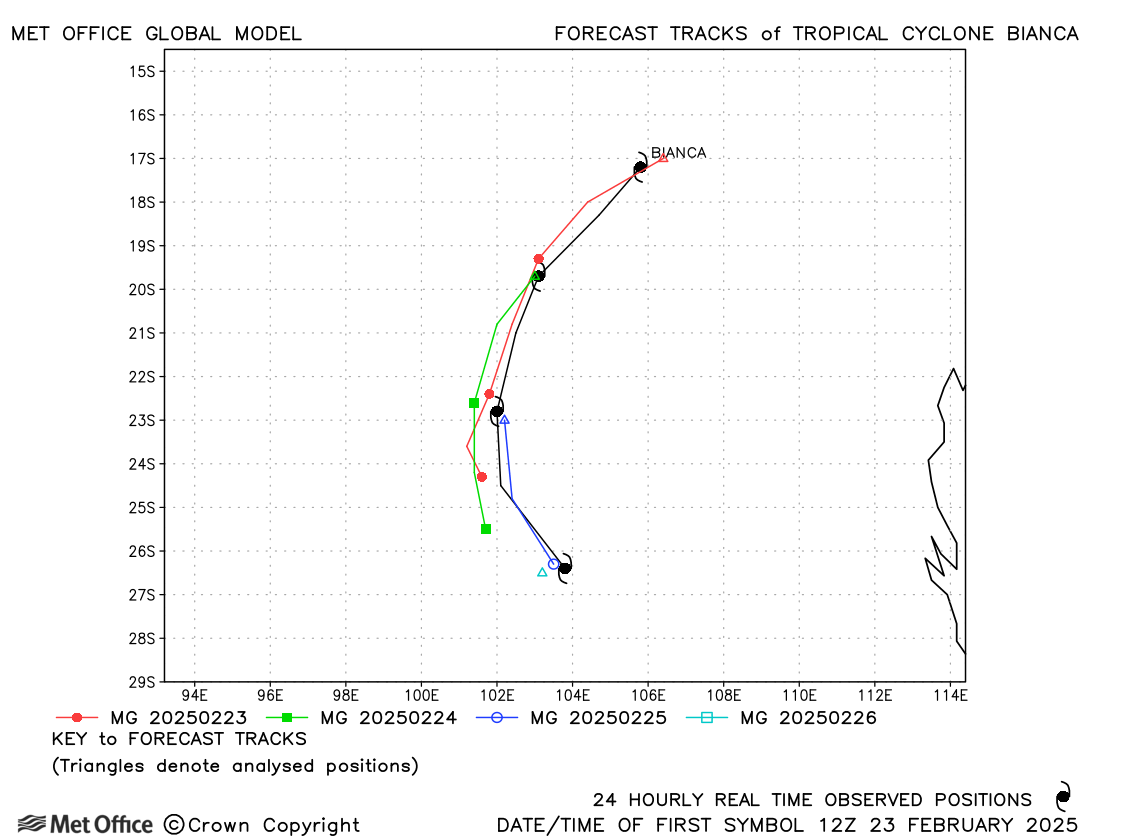
| Bianca (20S) | 23-26 February | 958 mb, 100/90 knots | Short lead time forecasts were good, but there was a slow bias for longer lead times forecasts |
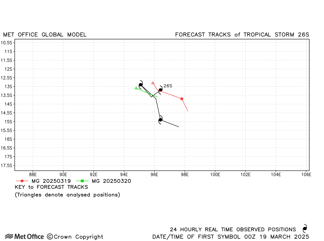
| 26S | 18-21 March | 991 mb, 45/45 knots | Few forecasts were verified for this short-lived storm, but track forecast errors were above the recent mean values. |
| Courtney (27S) * | 24 March - 01 April | 929 mb, 130/120 knots | Track forecast errors were well below the recent mean values and skill scores were high. |
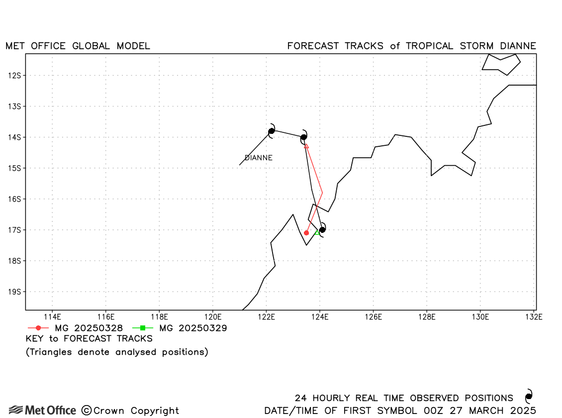
| Dianne (28S) | 26-29 March | 989 mb, 45/40 knots | Dianne was short-lived, but the landfall was well predicted. |
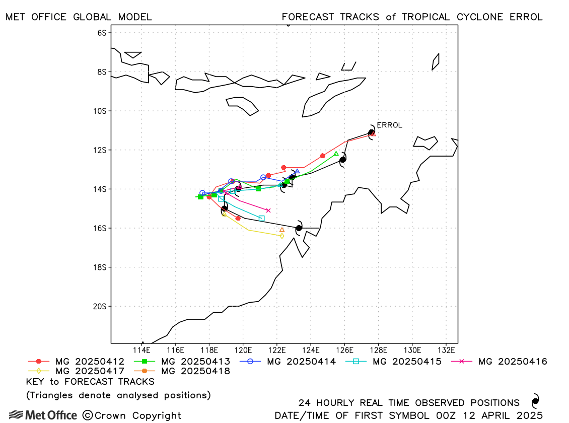
| Errol (29S) | 11-18 April | 945 mb, 140/100 knots | Track forecast errors were near to the recent mean values. |
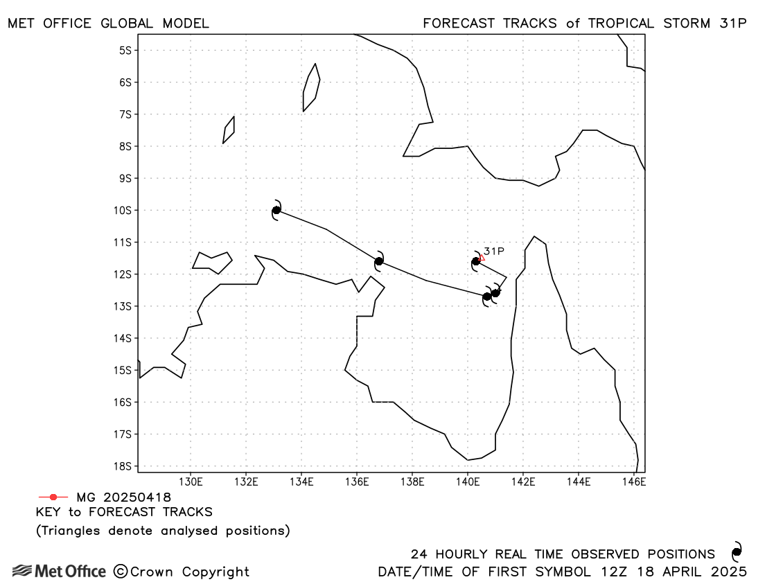
| 31P | 18-22 April | 998 mb, 35/35 knots | 31P was not named and briefly had winds of tropical storm strength. No forecasts were verified. |
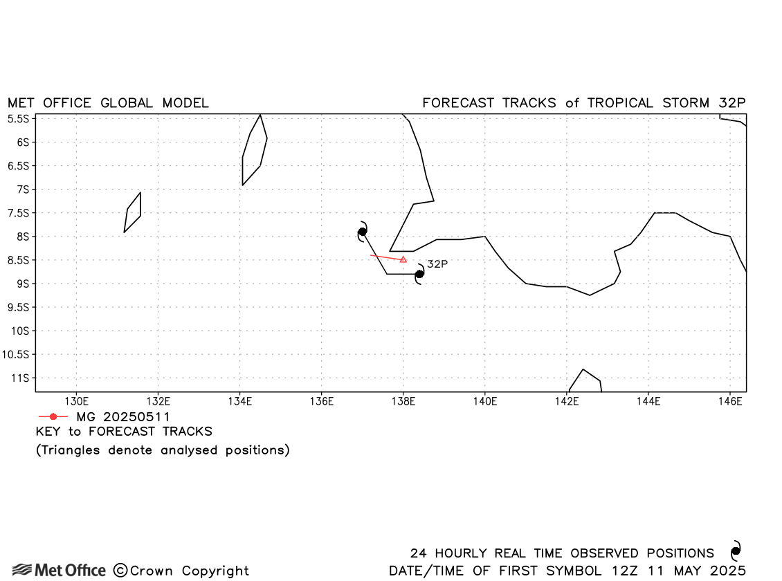
| 32P | 11-12 May | 1000 mb, 35/35 knots | 32P was not named and briefly had winds of tropical storm strength. Few forecasts were verified. |
* Taliah, Vince and Courtney moved into the South-West Indian region.
| Name & ID | Start & end dates | Central pressure, 1-/10-minute MSW | Comments on Met Office global model forecasts |
|---|---|---|---|
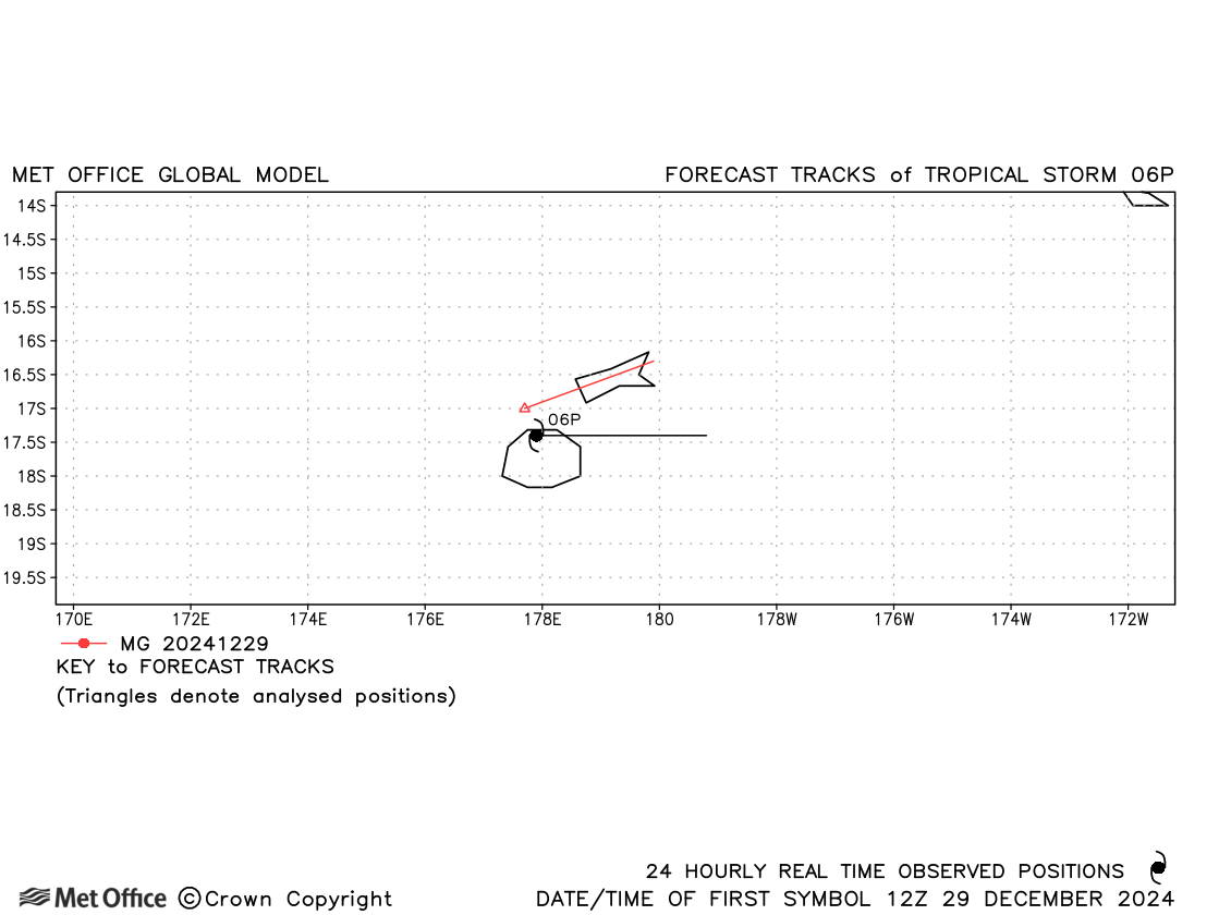
| 06P | 29-30 December | 997 mb, 50/30 knots | 06P was a short-lived storm. |
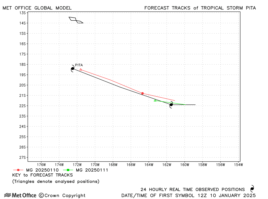
| Pita (08P) | 10-12 January | 993 mb, 40/35 knots | Pita did not last long, but track forecast errors were large due to a slow bias. |
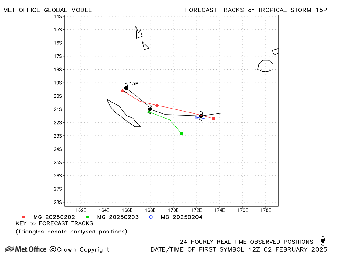
| 15P | 02-05 February | 993 mb, 45/30 knots | Track forecast errors were mixed for this storm |
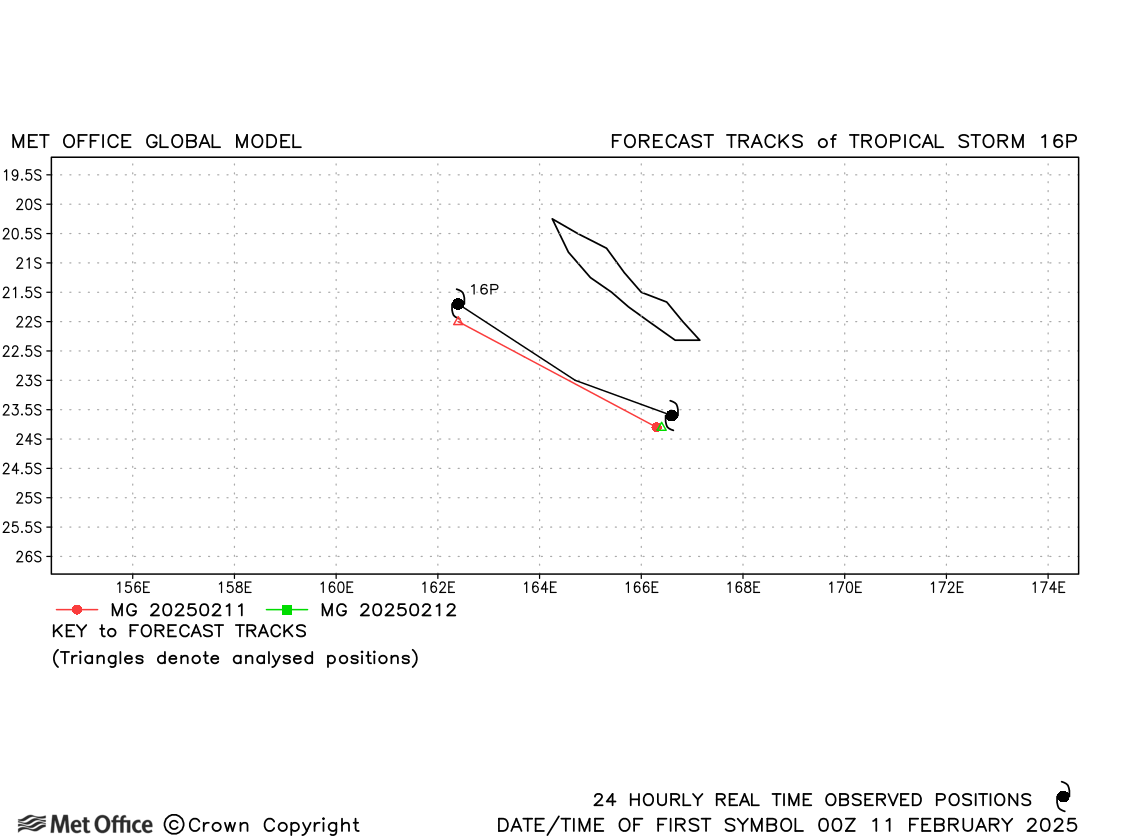
| 16P | 11-12 February | 998 mb, 40/30 knots | 16P was short-lived with few forecasts verified. |
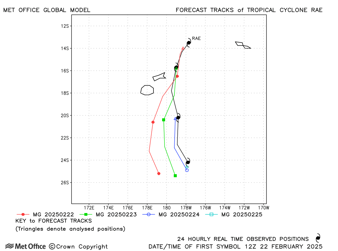
| Rae (19P) | 22-25 February | 975 mb, 90/60 knots | There was a right-of-track bias in forecasts resulting in some large errors. |
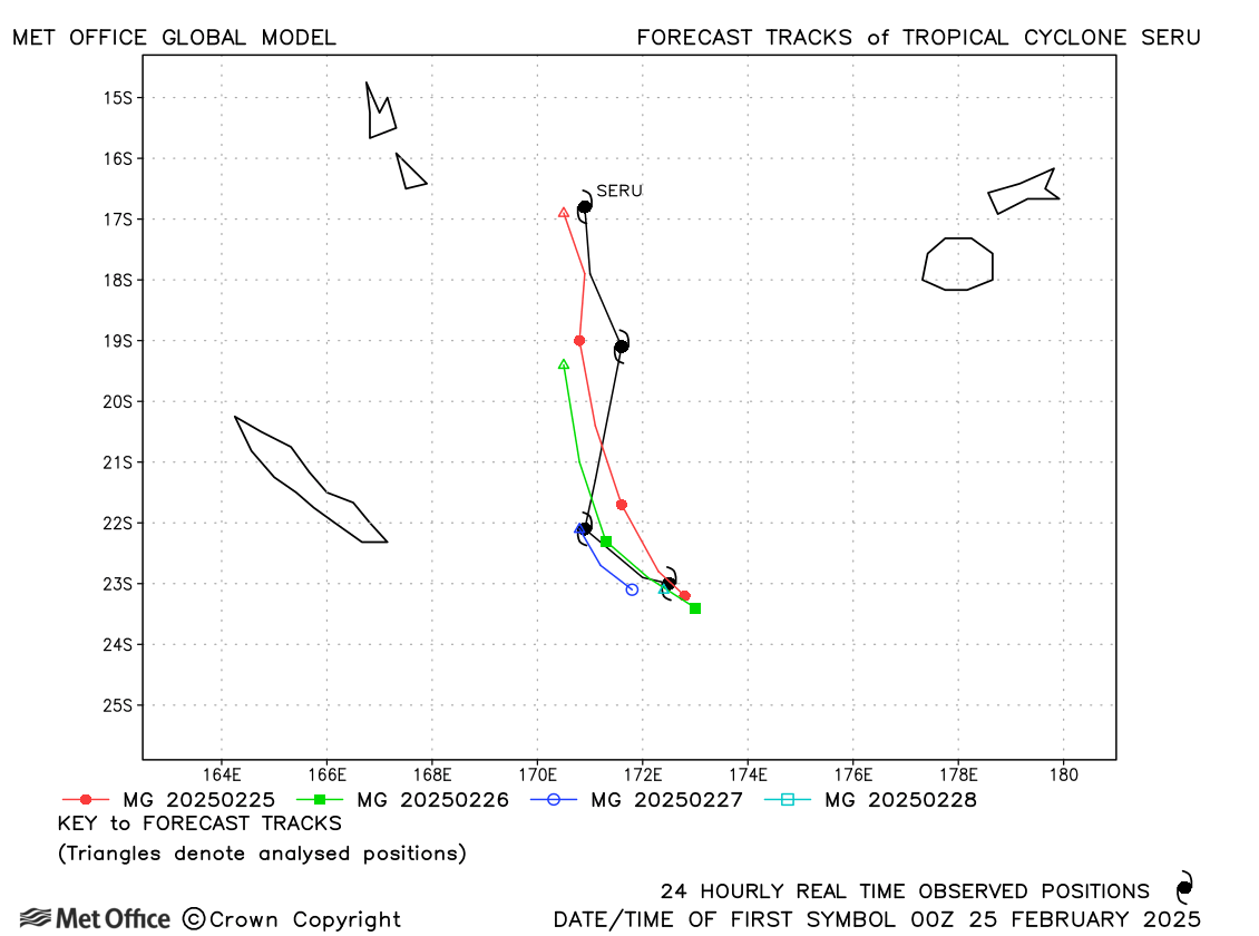
| Seru (21P) | 24-28 February | 981 mb, 65/55 knots | Track forecast errors were very low for this storm. |
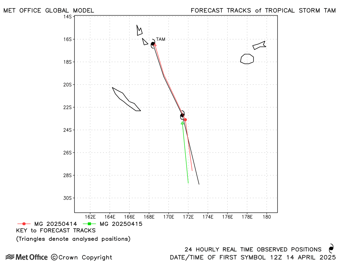
| Tam (30P) | 14-16 April | 984 mb, 50/45 knots | Track forecasts for Tam had errors close to the recent mean. |
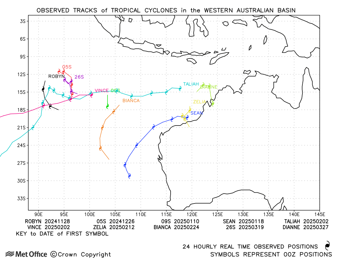
Western Australian observed tracks in 2024-25
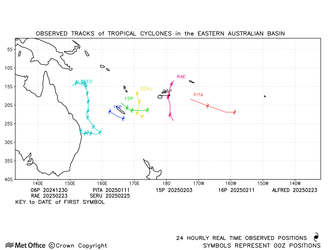
Eastern Australian observed tracks in 2024-25
| Name & ID | Start & end dates | Central pressure, 10-minute MSW | Comments on Met Office global model forecasts |
|---|---|---|---|
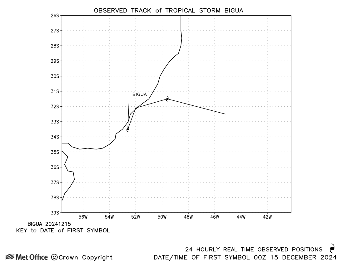
| 14-16 December | 998 mb, 40 knots | Bigua was short-lived as a subtropical storm. |
South Atlantic observed tracks in 2024-25
Note on estimated wind speeds
1-minute MSW: Maximum sustained wind (knots) averaged over one minute (JTWC Hawaii)
10-minute MSW: Maximum sustained wind (knots) averaged over 10 minutes (Southern Hemisphere RSMCs and TCWCs)
Note: Although 1-minute average winds should be stronger than 10-minute average, this may not be the case here since estimates are obtained from different warning centres using different analysis techniques.

