

Observed and forecast tracks: southern hemisphere 2014-15
All tropical cyclones in the southern hemisphere season in 2014-15 are listed below including details of their start and end dates and maximum sustained wind (MSW). Qualitative comments are included on the performance of the Met O
Click on the name of the tropical cyclone to see a chart of the observed track and forecast tracks from the Met Office global model. Verification statistics on each tropical cyclone are available upon request from [email protected]. At the end of the season a verification report on the performance of the Met Office global model will be published.
| Name & ID | Start & end dates | Central pressure, 1-/10-minute MSW | Comments on Met Office global model forecasts |
|---|---|---|---|
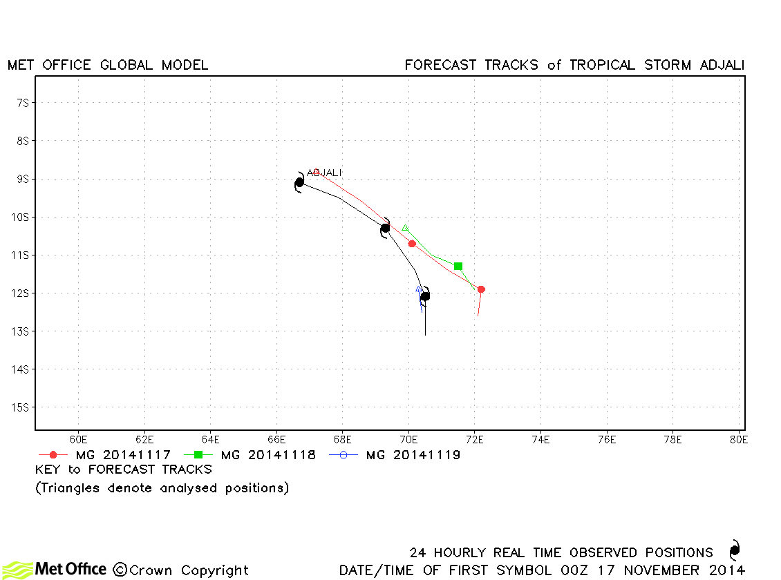
| Adjali (01S) | 16-19 November | 986 mb, 60/55 knots | Track forecast errors were mostly a little higher than last season's average. |
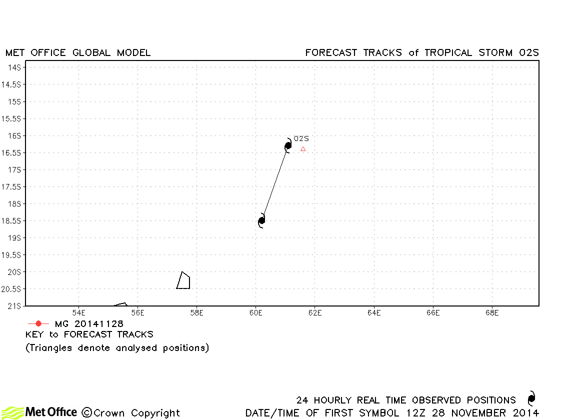
| 02S | 28-29 November | 997 mb, 35/30 knots | No forecasts were verified for this short-lived storm. |
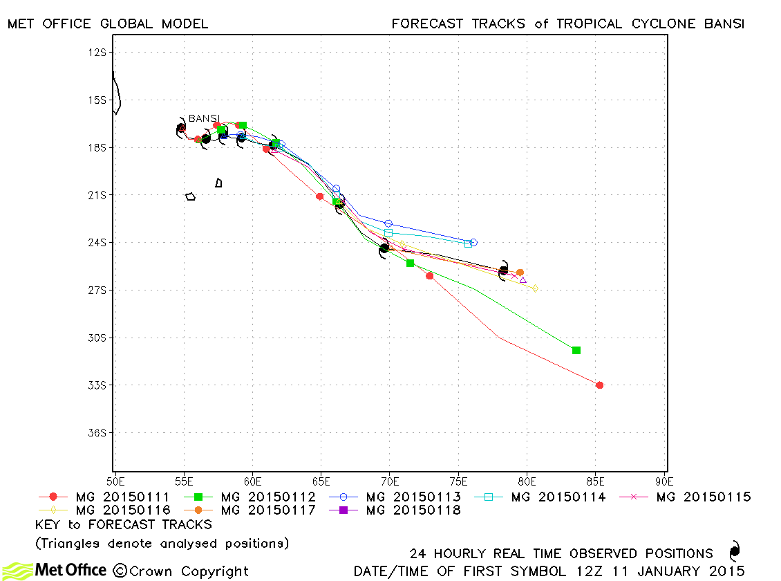
| Bansi (05S) | 10-18 January | 923 mb, 130/120 knots | At all but the longest lead times track errors were well below last season's average. Skill scores against CLIPER were very high. |
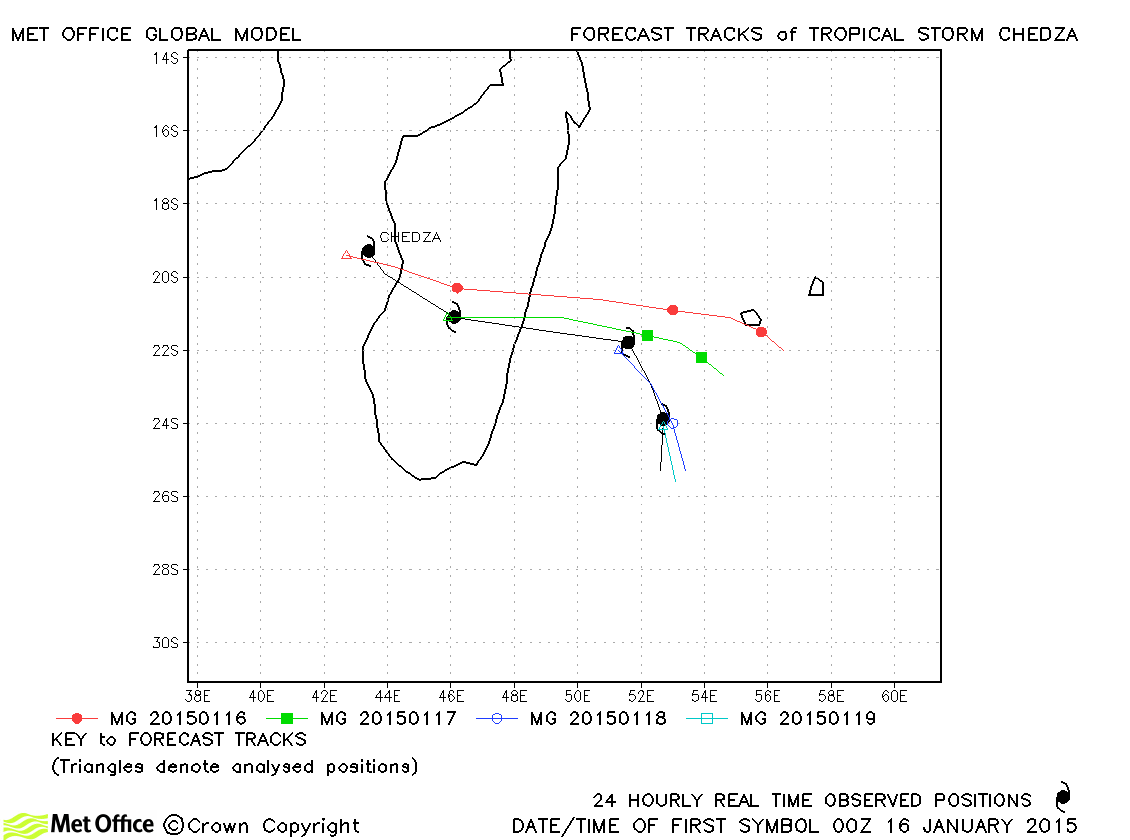
| Chedza (06S) | 16-19 January | 980 mb, 50/55 knots | Track forecast errors were low at short lead times, but high at longer lead times. |
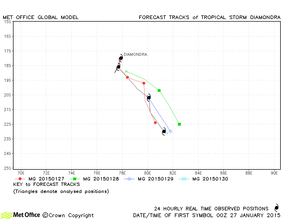
| Diamondra (08S) | 26-30 January | 988 mb, 45/45 knots | Track forecast errors were below last season's average for this storm. |
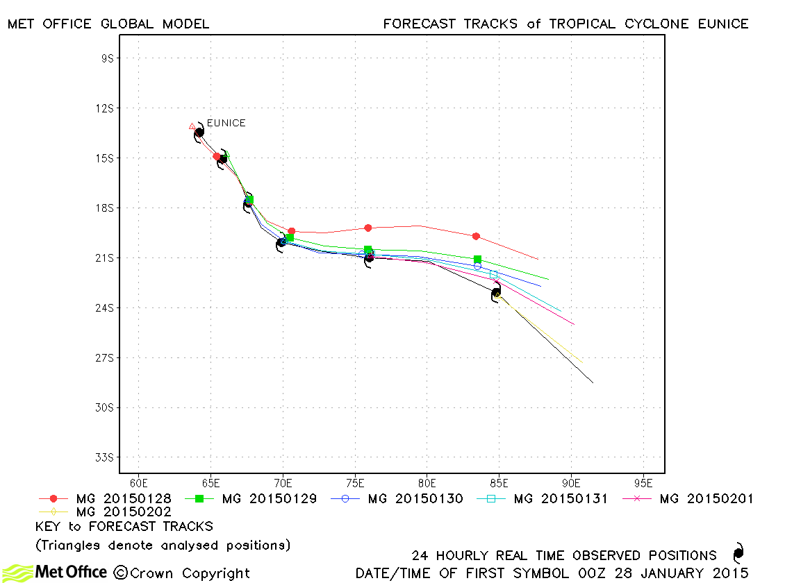
| Eunice (09S) | 27 January-02 February | 900 mb, 140/130 knots | Eunice was well predicted by the model with track forecast errors below last season's average at all but the longest lead time. |
| Fundi (11S) | 06-08 February | 988 mb, 40/40 knots | Fundi was relatively short-lived and forecast errors were mostly low. |
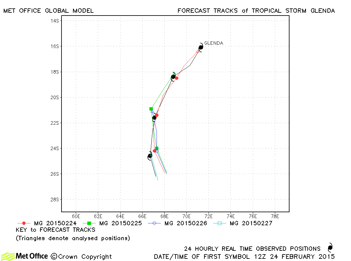
| Glenda (14S) | 24-28 February | 979 mb, 55/45 knots | Track forecast errors were very low and skill scores high for this storm. |
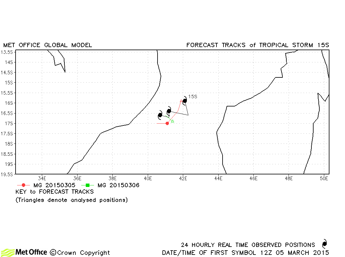
| 15S | 05-07 March | 996 mb, 35/30 knots | Track errors were below last season's average for this storm. |
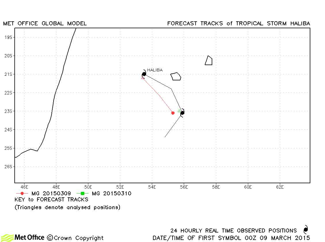
| Haliba (16S) | 08-10 March | 993 mb, 40/40 knots | Haliba was a short-lived storm and track errors were below last season's average. |
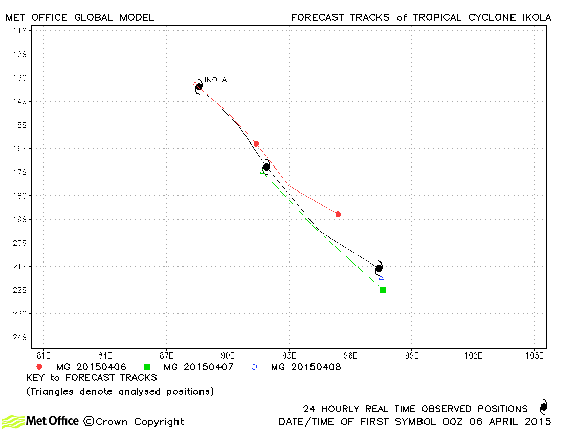
| Ikola (21S) | 05-08 April | 951 mb, 100/95 knots | Early forecasts had a slow bias resulting in some above-average forecast errors. |
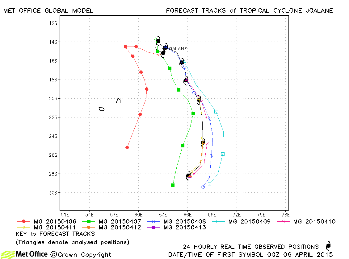
| Joalane (22S) | 06-13 April | 970 mb, 90/80 knots | There was a westwards bias in some early forecasts, but overall track forecast errors were below last season's average. |
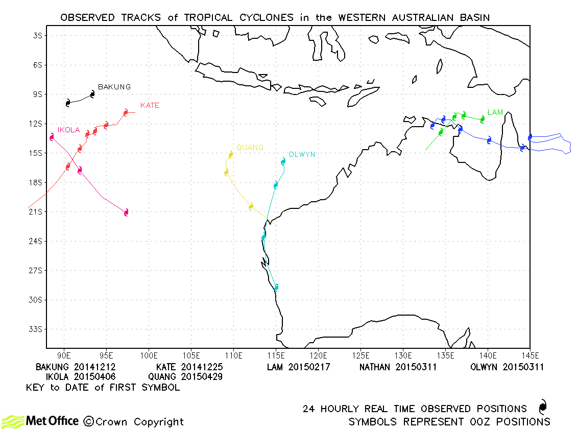
South-west Indian observed tracks in 2014-15
| Name & ID | Start & end dates | Central pressure, 1-/10-minute MSW | Comments on Met Office global model forecasts |
|---|---|---|---|
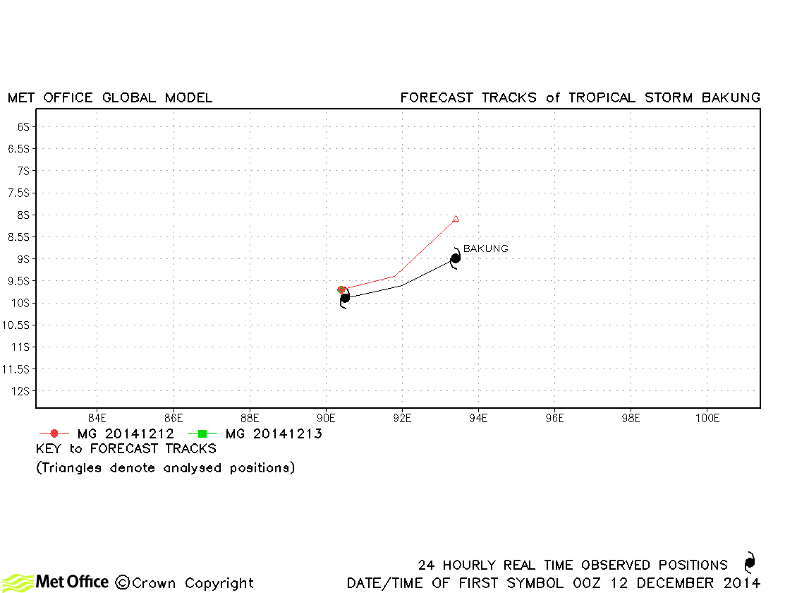
| Bakung (03S) | 11-13 December | - mb, 40/50 knots | Very few forecasts were verified, but track errors were low. |
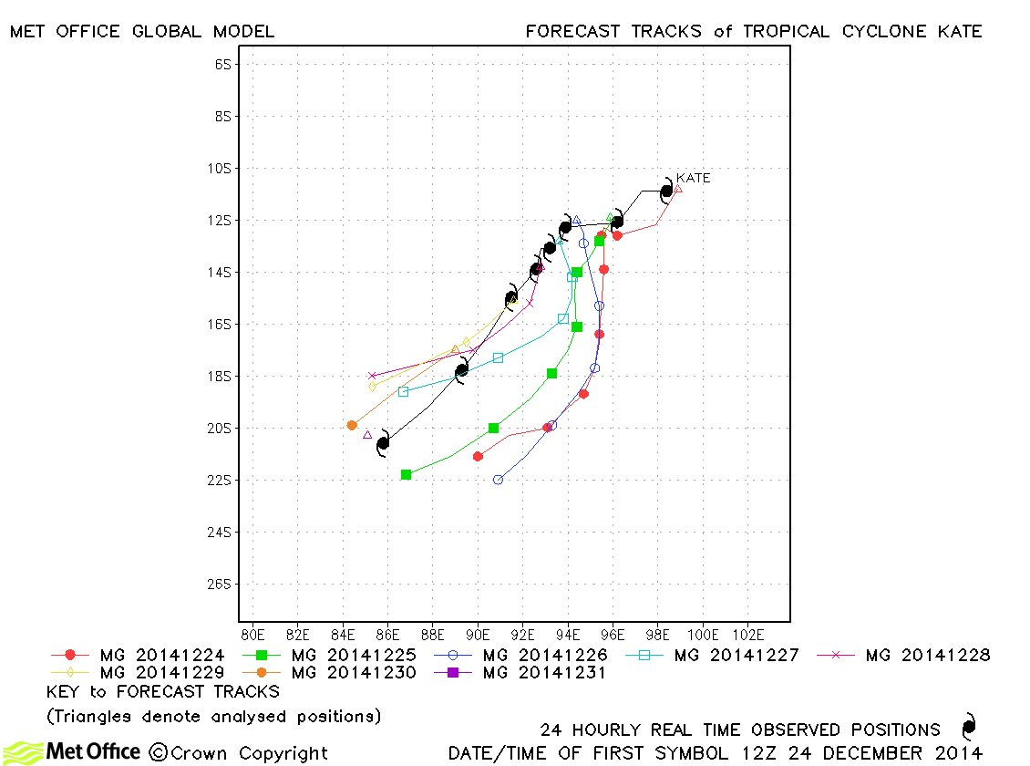
| Kate (04S) | 24-31 December | 947 mb, 105/95 knots | Despite a marked left-of-track bias, errors for this storm were lower than last season's average. |
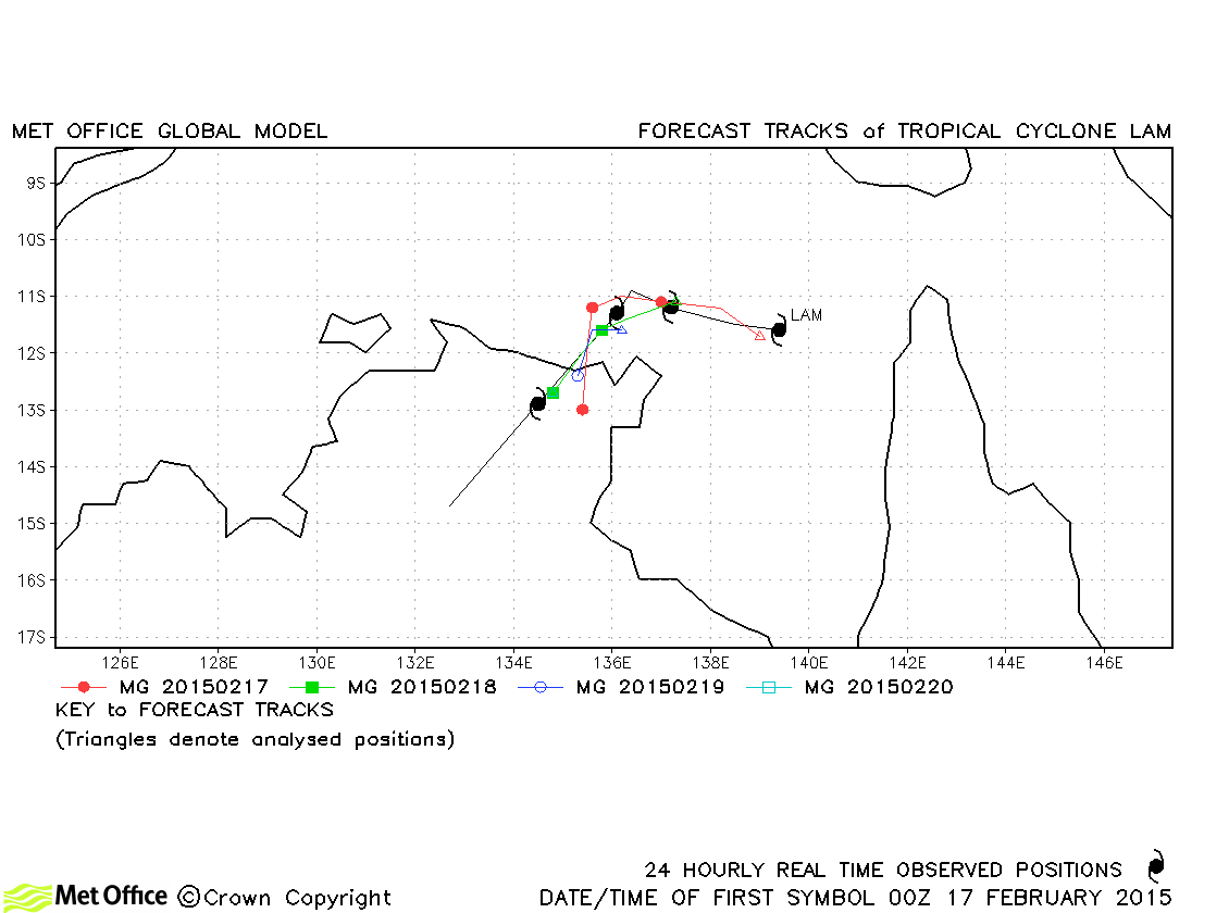
| Lam (12P) | 16-20 February | 943 mb, 100/100 knots | Track forecast errors were low and skill scores high for this storm. |
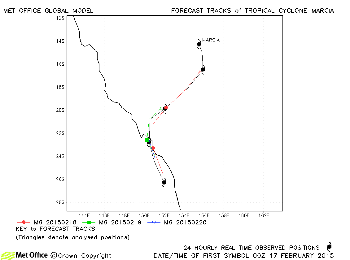
| Marcia (13P) | 16-21 February | 929 mb, 115/110 knots | Although the rapid intensification of Marcia was not well predicted, the track, including the sharp turn just a few hours before landfall, were well predicted by the model. Track errors were very low and skill scores were exceptionally high. |
| Nathan (18P) | 10-24 March | 963 mb, 90/90 knots | Nathan was a long-lived storm with a complex track including a loop in the Coral Sea. The initial 180 degree turn was well predicted. However, a few forecasts did not predict the second 180 degree turn. Thereafter predictions of landfall over northern Australia were good. Thus short lead time forecast errors were very low and skill scores high. Longer lead time errors were higher, but only at the longest lead times exceeded last season's mean errors for this region. |
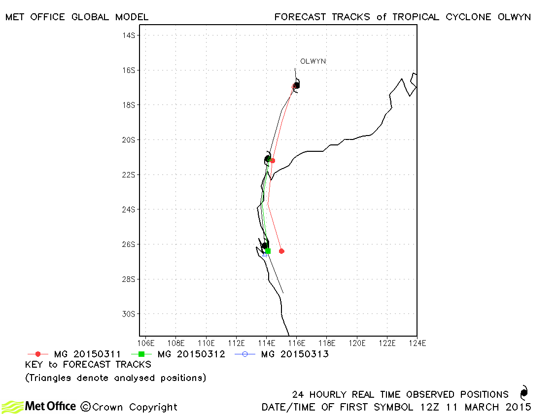
| Olwyn (19S) | 11-14 March | 960 mb, 85/80 knots | Track forecast errors for Olwyn were low. |
| Quang (24S) | 28 April-01 May | 945 mb, 115/105 knots | There was a left-of-track bias in forecasts resulting in some track forecast errors being above last season's average. |
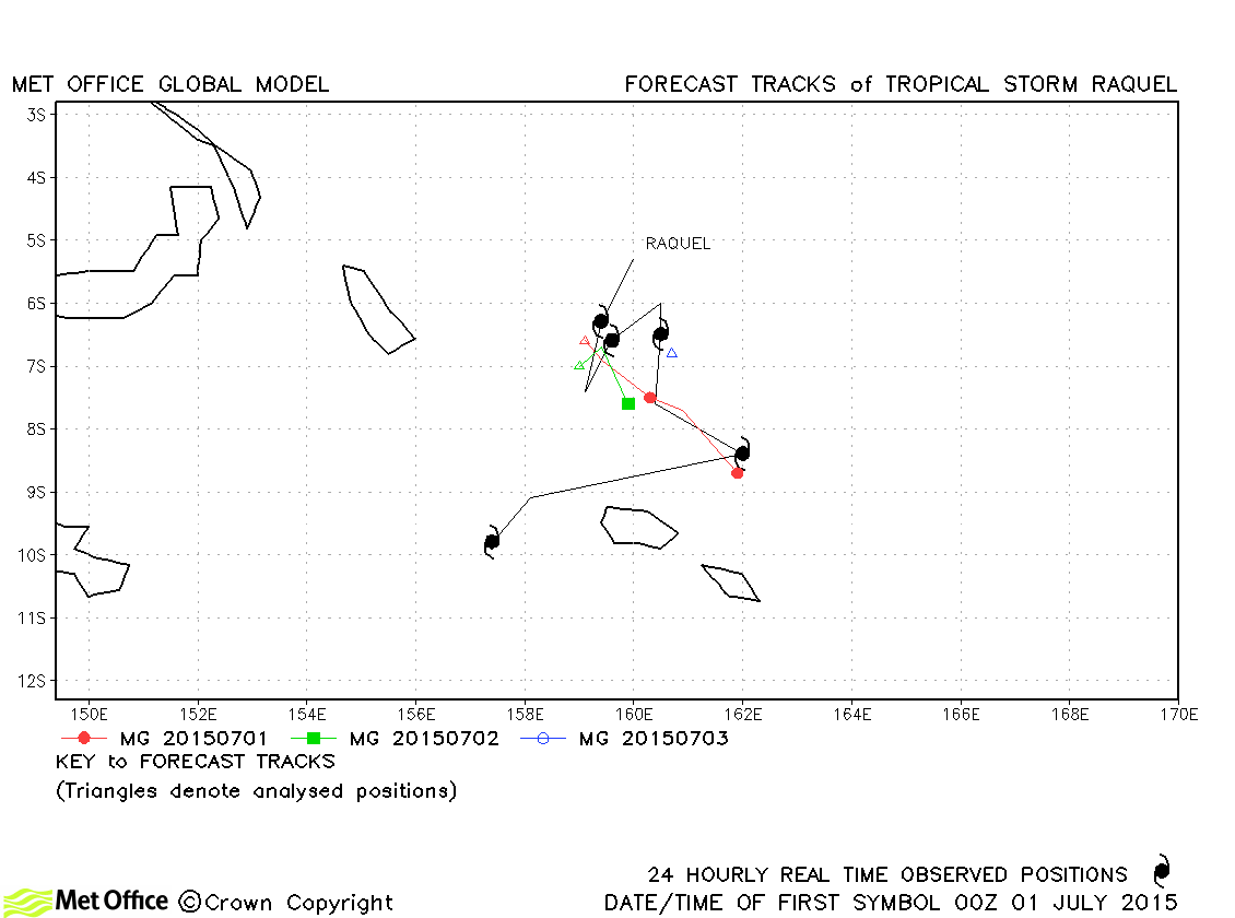
| Raquel (25P) | 30 June - 05 July | 996 mb, 45/40 kots | Track forecast errors were near to or above last season's average. Skill scores against CLIPER were very high. |
Indonesian tropical cyclone names
Papua New Guinea tropical cyclone names
| Name & ID | Start & end dates | Central pressure, 1-/10-minute MSW | Comments on Met Office global model forecasts |
|---|---|---|---|
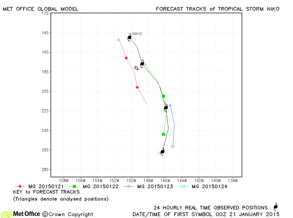
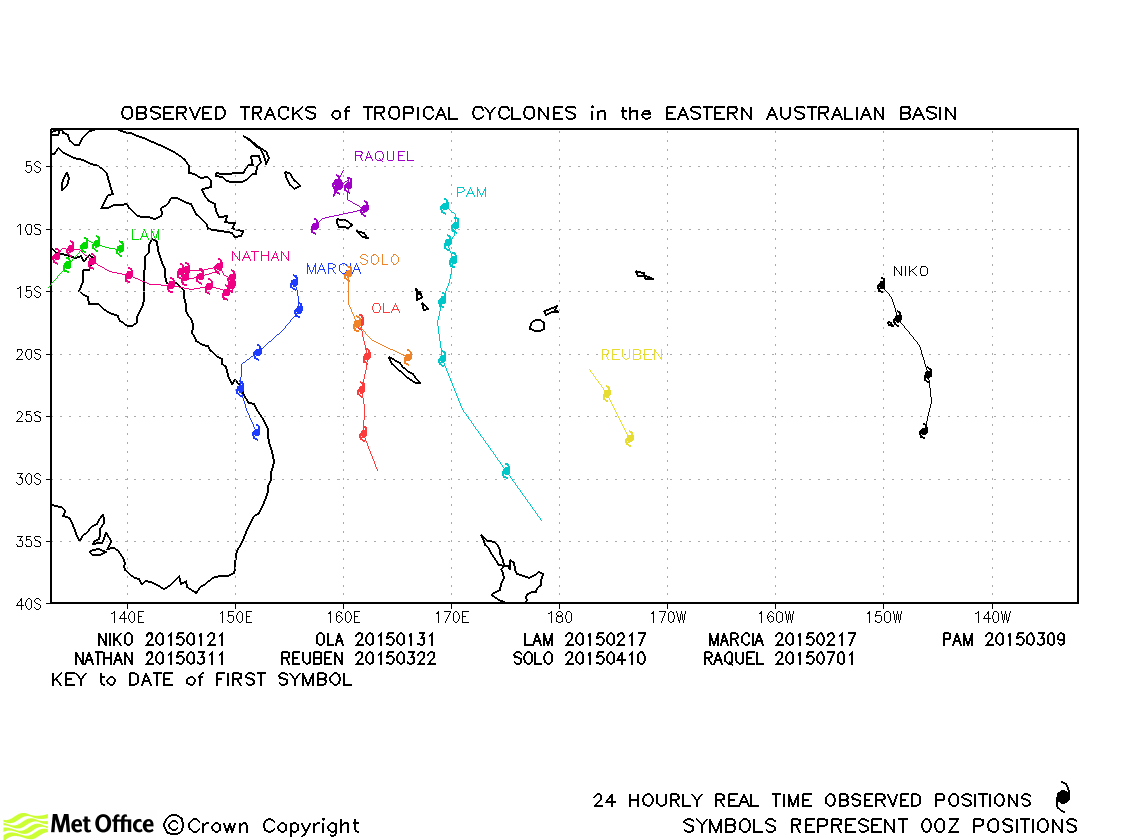
| Niko (07P) | 20-24 January | 982 mb, 55/55 knots | Due to a slow bias track errors were above last season's average. |
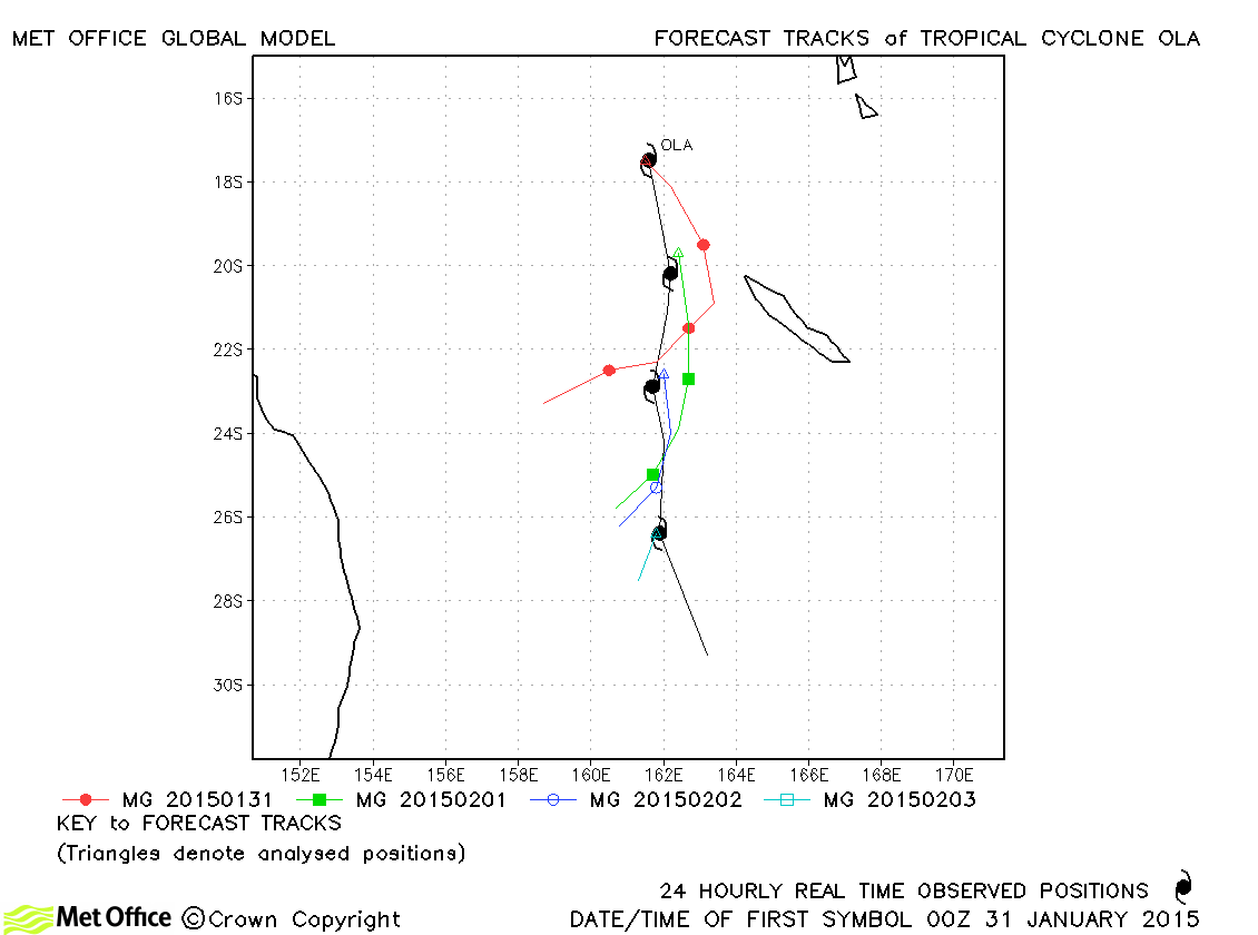
| Ola (10P) | 30 January-03 February | 965 mb, 80/80 knots | Due to a right-of-track bias track errors were above last season's average. |
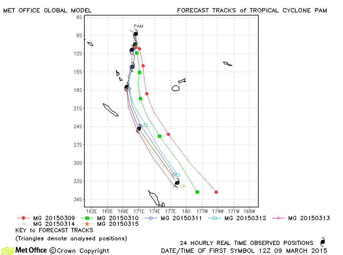
| Pam (17P) | 09-15 March | 896 mb, 145/135 knots | Forecasts for Cyclone Pam initially had a left-of-track bias. However, at lead times of 60 hours and less, the track across Vanuatu was well predicted. Thus, short lead time track errors were low and skill scores high. At longer lead times, track errors were above last season's average. |
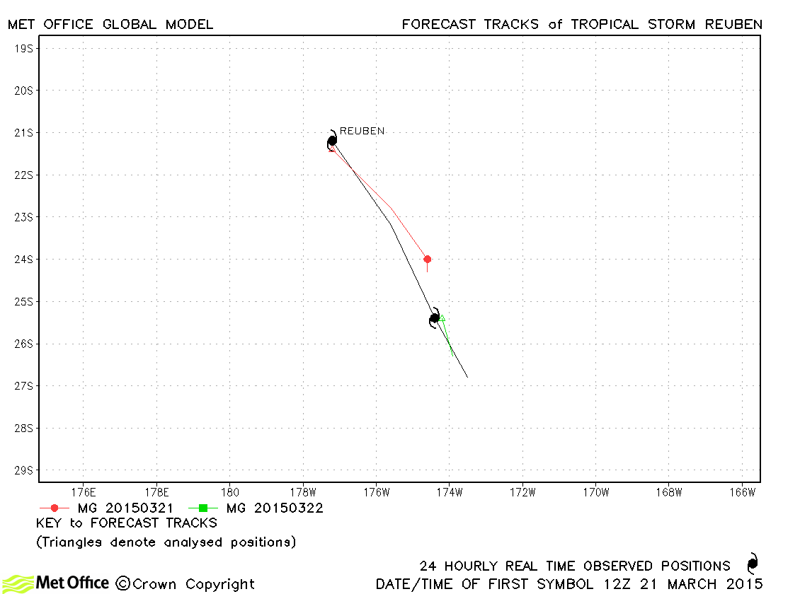
| Reuben (20P) | 21-23 March | 990 mb, 45/40 knots | Reuben was a short lived storm. Track forecast errors were a little above last season's average. |
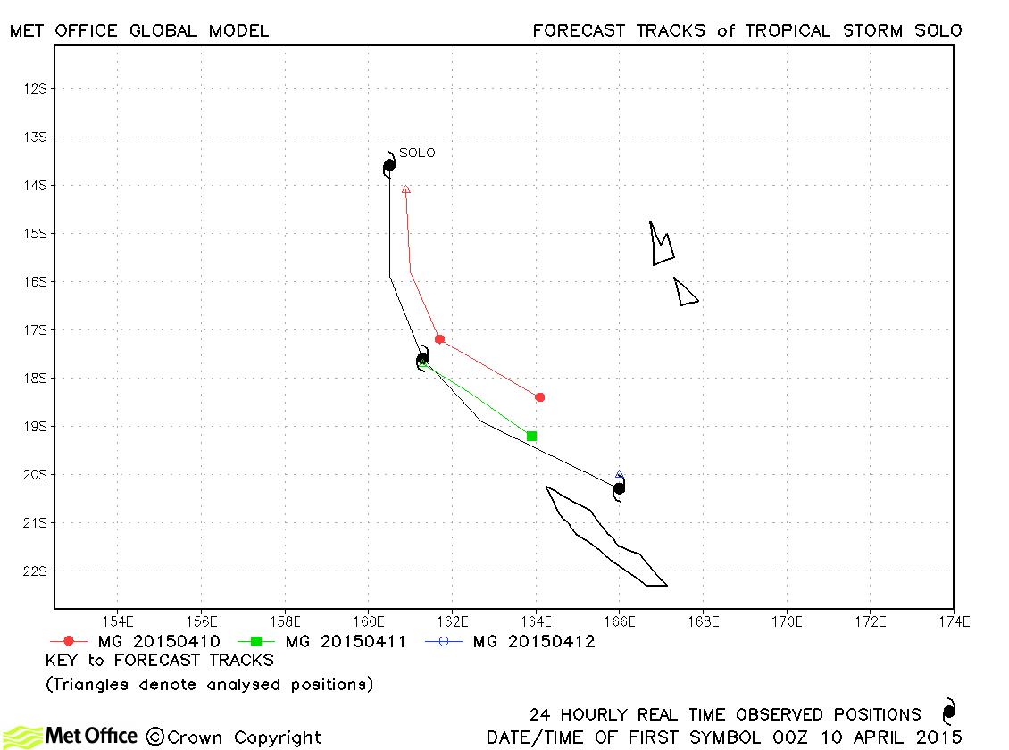
| Solo (23P) | 10-12 April | 985 mb, 55/55 knots | Track forecast errors were a little above last season's average due to a slow bias. |
Western Australian observed tracks in 2014-15
Eastern Australian observed tracks in 2014-15
| Name & ID | Start & end dates | Central pressure, 1-/10-minute MSW | Comments on Met Office global model forecasts |
|---|---|---|---|
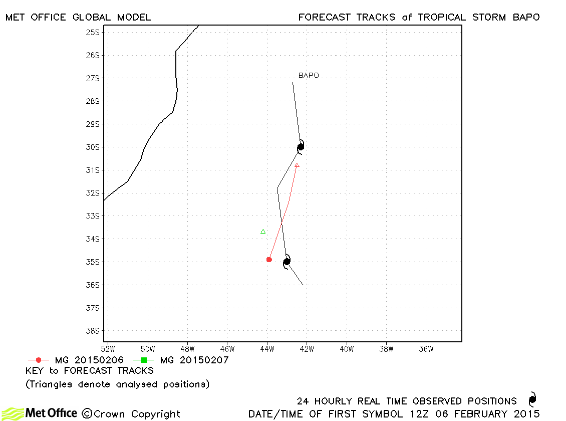
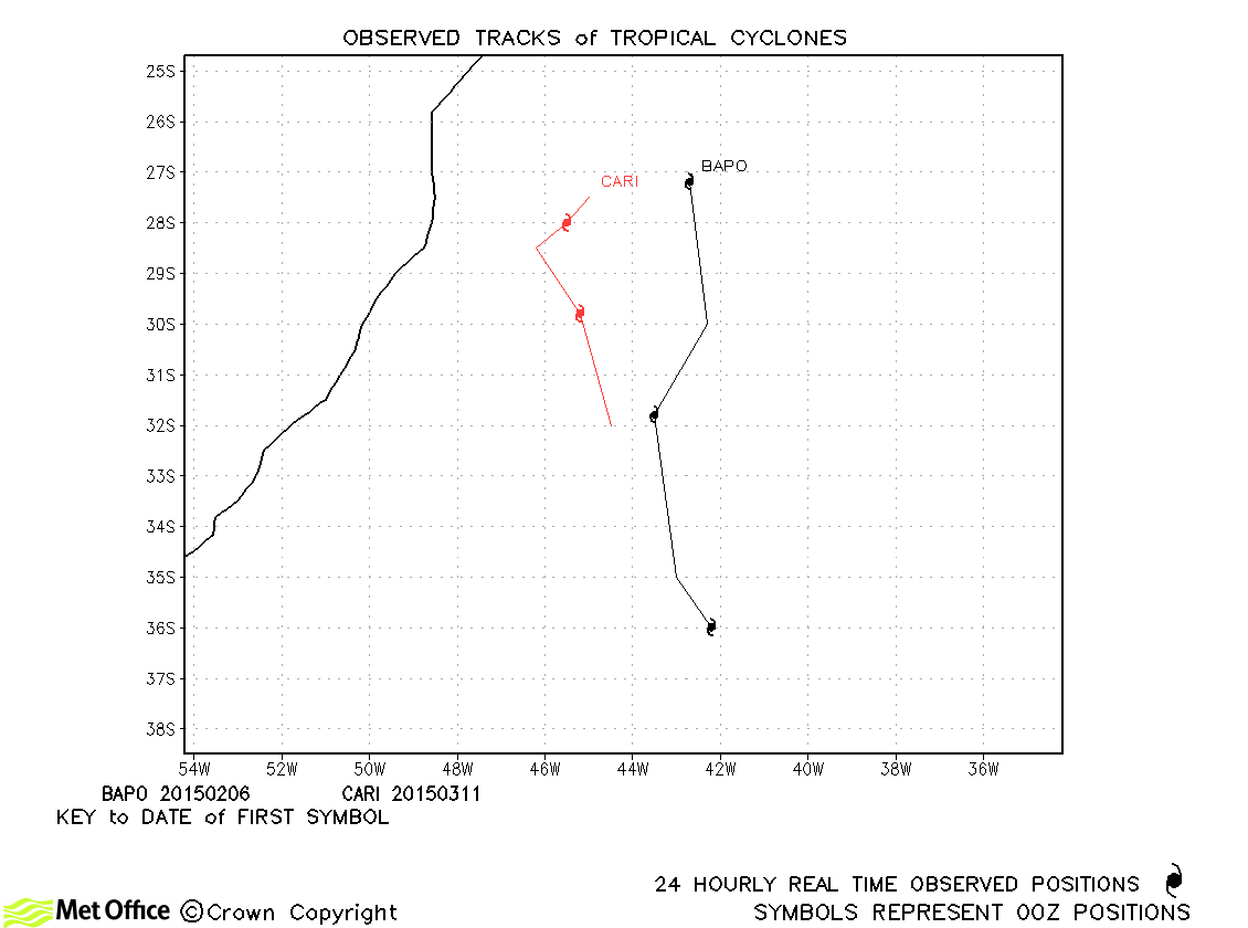
| Bapo (01T) | 06-08 February | 992 mb, -/35 knots | Bapo was a tropical storm for about a day. |
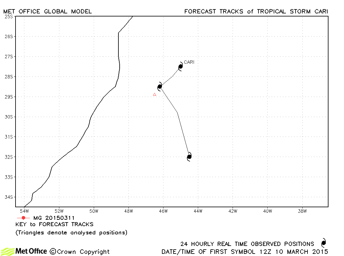
| Cari (02T) | 10-12 March | 1000 mb, -/35 knots | Cari was briefly designated a subtropical storm and no forecasts were verified. |
South Atlantic tropical cyclone names
South Atlantic observed tracks 2014-15
Note on estimated wind speeds
1-minute MSW: Maximum sustained wind (knots) averaged over one minute (JTWC Hawaii)
10-minute MSW: Maximum sustained wind (knots) averaged over 10 minutes (Southern Hemisphere RSMCs and TCWCs)
Note: Although 1-minute average winds should be stronger than 10-minute average, this may not be the case here since estimates are obtained from different warning centres.

