Low pressure arrives for the weekend
Author: Press Office
12:50 (UTC+1) on Fri 2 Sep 2022
As low pressure parks up in the southwest for the next week, more unsettled weather is expected for many. However, mild southerly air means there will still be some warm sunshine on offer.
This weekend
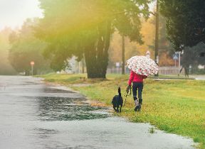
Over the weekend, rain and showers are most likely across western parts of the UK and it will be windy at times too. A yellow warning for rain has been issued for much of Northern Ireland and western Scotland.
In the latest weekend weather forecast Alex Deakin said: “Low pressure will dominate through the weekend and into next week and churning around this low pressure, we're going to see slow moving weather fronts.”
On Saturday, rain will be persistent in Northern Ireland and western Scotland, where there is a warning in force. Further east, there will be some showers, but not for everyone, Alex continues: “A few showers over parts of eastern England, they could be quite lively. Some thunderstorms are possible, but they will be hit and miss here, so not to be relied upon if you are desperate for some rain”.
On Sunday, rain or showers, with a risk of thunderstorms, will push further east into southwestern parts of the UK as well as eastern Scotland, accompanied by stronger winds. Eastern England and the Northern Isles will remain drier at first, but rain is more likely by the evening.
Although the weather is becoming more autumnal, windier and wetter, this weekend temperatures will remain above average for many areas, by day and night, and it will feel warm in the sunshine.
Next Week
The unsettled theme continues into next week, low pressure will sit to the southwest maintaining a feed of warm and moist air initially from the continent, but by mid-week, from the Atlantic. Though the main theme is unlikely to change, the details are still evolving.
Deputy Chief, Jason Kelly added: “Whilst we are confident that low pressure will dominate the weather well into next week, the day-to-day forecast is not certain at this stage. But more generally, each day there will be a risk of showers or longer spells of rain for many areas of the country. It is likely that more prolonged showers will bring a risk of thunderstorms too. And in some areas, most likely in the southwest, rainfall totals will build through the week.”
Temperatures are expected to continue to remain above average, with many areas in the low 20s Celsius by day and the mid-teens Celsius by night.
Find out how to stay safe in thunder and lightning as part of WeatherReady.
Travel advice
During periods of unsettled weather including rain, thunder and gales, National Highways advise motorists to check weather forecasts before travel and carry out vehicle checks such as oil, tyres and coolant levels, so their vehicle is ready for the journey ahead.
According to National Highways, when driving in heavy rain and waterlogged roads, motorists should slow down and keep well back from the vehicle in front. They should also ease off the accelerator, slowing down gradually if the steering becomes unresponsive. Rain makes it harder for tyres to grip the road and more challenging for drivers to see ahead – significantly increasing the chances of being involved in a collision.
You can learn more from National Highways about driving in different types of severe weather here.
Find advice from WeatherReady on travelling in wind and rain.


