Storm Francis triggers Amber wind warning – August 2020
Author: Press Office
11:58 (UTC+1) on Tue 25 Aug 2020
Wind and rain warnings are in force across large parts of the UK through Tuesday into Wednesday, as Storm Francis gradually moves across the country.
Heavy rainfall
The deep Atlantic low-pressure system will continue to bring heavy rain to northern parts of the UK on Tuesday, as the storm gradually moves eastwards across the county over the next 18-24 hours. Many northern areas have already seen 15 to 20mm of rain falling in just a few hours on Tuesday morning, with parts of Northern Ireland reporting 30-40 mm at a few sites.
National Severe Weather Warning
Along with heavy rain, Storm Francis will bring unseasonably strong wind gusts of 60 to 70mph, with an Amber wind warning in force for Wales and central parts of England. In this warning area gusts of 65-70mph could even be seen inland. A larger yellow wind warning is in force for most of England until midday on Wednesday. Wind gusts of 64mph have already been recorded at Needles, Isle of Wight on Tuesday morning.
Chief Meteorologist Steve Ramsdale, said “Storm Francis arrived early on Tuesday morning, bringing another spell of wet and windy weather for the UK over the next few days. Wind speeds this strong are unusual during August and may come as a surprise to people spending time outdoors trying to catch the last few days of summer.
“A number of severe weather warnings have been issued and these warnings can be updated regularly so please keep up to date with the latest Met Office forecast.”
Road safety
RAC Breakdown spokesman Rod Dennis said: “Until the middle of Wednesday, drivers need to brace themselves for some very unpleasant conditions on the roads. An amber weather warning covering a swathe of western Britain means there is a real risk of disruption to journeys from flying debris such as tree branches. Surface spray and perhaps some localised flooding are also possible.
“We urge everyone to anticipate longer journeys, especially if they are travelling any great distance, and to make sure their vehicles are road-ready. Drivers must slow down and drive to the conditions, especially if they are towing.”
Large waves expected in southwestern coastal areas
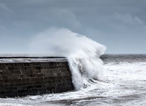
Large waves are also expected in coastal areas around the South West including the Bristol Channel, throughout Tuesday, moving along the English Channel as the day progresses. Beachgoers are advised to take extra care.
Storm Francis will clear to the East of the UK by Wednesday lunchtime, leaving a brighter and more settled outlook for the remainder of the day. After a showery day on Friday the Bank Holiday weekend should bring sunshine to most parts for a time with scattered showers before further unsettled weather is expected to move in from Tuesday next week.
Stay connected
You can check the latest weather warnings on our severe weather warnings pages and you can get the most accurate and up to date forecast for your area using our forecast pages and by following us on Twitter and Facebook, as well as using our mobile app which is available for iPhone from the App store and for Android from the Google Play store. Whatever the weather we are all being urged to remember the Government Coronavirus guidelines.


