UK weather forecast: warm weather for now, rain for the weekend
Author: Press Office
11:05 (UTC+1) on Wed 9 Apr 2025
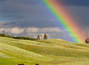
Dry and settled weather continues for many through much of this week, but there’s a change on the way this weekend.
High pressure currently remains in charge of the UK’s weather, bringing plenty of sunshine and above average temperatures for the time of year.
Scotland and Northern Ireland both recorded their highest temperatures of the year so far on Tuesday, with a chance of these figures being surpassed further later this week. Perthshire got to 20.9°C on Tuesday, while Castlederg reached 19.4°C.
Further warmth is in the forecast this week, but there will be a shift in where the highest temperatures will be.
Met Office Chief Meteorologist Andy Page said: “Warm and dry weather continues for much of the UK this week, but we’ll see a shift in where the highest temperatures will be over the next few days.
“Those living along North Sea coasts, who have so far had generally lower temperatures and more cloud at times, will start to see the higher temperatures on Thursday, possibly reaching as high as 23°C in eastern Scotland and northeast England. This is due to a shift in the dominant wind direction from the east to the west.”
Temperatures are finally set to increase across eastern parts of the UK in the next few days, after the chilly weather of late here
— Met Office (@metoffice) April 8, 2025
Honor looks into this, amongst other aspects of our weather in this week's deep dive 👇 pic.twitter.com/unvsZMIRik
When will it rain?
Largely dry and fine conditions will continue for the vast majority on Friday, with plenty of sunshine and highs of around 23°C possible in southern England and Wales. The far northwest of Scotland will start to see some rain and drizzle later in the day and overnight into Saturday as the UK’s weather starts to gradually transition to more unsettled weather.
Met Office Deputy Chief Meteorologist Mark Sidaway explained: “The high pressure that has been responsible for our recent high temperatures gradually shifts away over the weekend, as more of an unsettled regime begins to take charge and introduces more frequent rain and cloud, as well as a drop in temperatures.
“Those in the far northwest will see the first of the rain late on Friday and into Saturday, and while Saturday will start dry for much of the UK, we are likely to see areas of showers moving in from the south later in the day, although this aspect is still quite uncertain. However, by Sunday fresher conditions with showers are expected to move in from the west.”
Low pressure is likely to lie west of the UK into next week with showers and some longer spells of rain likely, but also some drier and sunnier intervals, with temperatures around average for the time of year.
Keep up to date with weather warnings, and you can find the latest forecast on our website, on YouTube, by following us on X and Facebook, as well as on our mobile app which is available for iPhone from the App store and for Android from the Google Play store.