
A warm welcome for fine weather conditions next week
Author: Press Office
10:58 (UTC+1) on Fri 25 Apr 2025
Temperatures are forecast to rise next week across parts of the UK, with some areas in southern England expected to reach 27°C on Wednesday.
Into this weekend a weakening weather front will bring some rain to western parts of the UK before fine conditions start to build into early next week.
A cool, wet and breezy afternoon across Northern Ireland, with some heavy rain over the hills. Showery rain edging into western Scotland, west Wales and Cornwall too 🌧️
— Met Office (@metoffice) April 25, 2025
A mixture of cloud and hazy sunny periods elsewhere and feeling pleasant in the sunshine and lighter winds ⛅ pic.twitter.com/vwiJsCUTcS
David Oliver is a Met Office Deputy Chief Meteorologist. He said: “Despite media speculation, next week’s conditions are likely to fall just outside of official Met Office heatwave thresholds. However, this shouldn’t lead to any disappointment as many can anticipate a very fine spell of weather with temperatures reaching 27°C during the middle of the week.”
The highest recorded April temperature was way back in 1949 when Camden Square in London recorded 29.4°C on 16 April. Met Office Chief Forecaster Matthew Lehnert said: “We are not expecting the April UK temperature record to be broken, but some locations may nudge local records.
“Often warm spells are driven by warmer air arriving from further south, but the origins of next week’s air are from Scandinavia and central Europe. This air mass will be warmed by compression as the high pressure begins to build, and this warmth will be boosted by daytime heating from the April sun.”
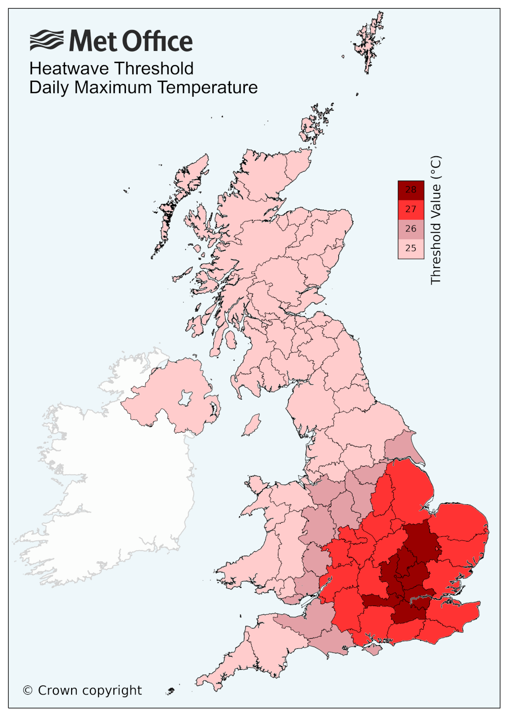
What is the definition for a UK heatwave?
A UK heatwave threshold is met when a location records a period of at least three consecutive days with daily maximum temperatures meeting or exceeding the heatwave temperature threshold. The threshold varies by UK county, see the UK temperature threshold map below.
Keep up to date with weather warnings, and you can find the latest forecast on our website, on YouTube, by following us on X and Facebook, as well as on our mobile app which is available for iPhone from the App store and for Android from the Google Play store.