Wind and rain warnings issued for unsettled spell of weather
Author: Press Office
10:48 (UTC+1) on Sat 28 Sep 2024
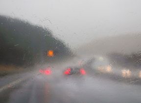
After a settled and drier interlude on Saturday, conditions will turn increasingly wet and windy, with further rain possible in flood hit areas.
As a low pressure system approaches the southwest of England and Wales, conditions will become increasingly wet and windy through the day on Sunday. Yellow National Severe Weather Warnings have been issued for rain across southern and southwest England and Wales, with a strong wind warning for parts of southwest England and west Wales.
⚠️ Yellow weather warning issued ⚠️
— Met Office (@metoffice) September 28, 2024
Heavy rain across southern England and Wales
Sunday 1600 – Monday 0900
Latest info 👉 https://t.co/QwDLMfRBfs
Stay #WeatherAware⚠️ pic.twitter.com/OKi7E5RYQr
Met Office Chief Meteorologist, Jason Kelly, said: “Sunday will bring a return to wet and windy weather across the southern half of the UK. A warning for rain has been issued for southwestern England and south Wales from 1600 on Sunday through to Monday morning. Within the warning area 20-30mm of rain is expected quite widely, with up to 50-80mm possible over the higher ground of Dartmoor, south Wales and the Dorset Downs.
“A Yellow warning for wind has also been issued from 0900 to midnight on Sunday. The area covers the far southwest of England and western Wales. Gusts of 50-55mph are likely within the Yellow warning area, up to 60mph is possible in the most exposed coasts and areas of higher ground."
Rain in flood hit areas
Through Monday as the area of low pressure clears to the east, further rain will sink south and is likely to fall over areas impacted by flooding through the last week across the Midlands. A separate Yellow warning for rain is in place from 08:00 on Monday to 03:00 on Tuesday covering parts of the north-east Midlands and east and northeast England. There is significant uncertainty in the amount of rainfall and location of the largest totals for this warning, but 20-40 mm of rain could fall quite widely with a chance that a few places could see 60-80 mm. Strong northeasterly winds will accompany the rain.
Katharine Smith, Flood Duty Manager at the Environment Agency, said: "Rainfall arriving on Sunday, Monday and Tuesday gives potential for further minor surface water and river flooding impacts across parts of England and Wales.
"Environment Agency teams continue to be out on the ground, supporting local authorities in responding to surface water flooding. We urge people to plan their journeys carefully, follow the advice of local emergency services on the roads and not to drive through flood water – it is often deeper than it looks and just 30cm of flowing water is enough to float your car.
"People should check their flood risk, sign up for free flood warnings and keep up to date with the latest situation as well as following @EnvAgency on X for the latest flood updates."
Rain over recent days
Southern and central parts of England have had a very wet period of weather in the last few days, with recent Amber weather warnings preceding flooding and travel disruption for some.
Some counties in southern and central England have already had more than 250% of their average September rainfall, with the month’s full provisional statistics to be released on 1 October.
Next week
After the further rain on Monday, which could extend into Tuesday in some eastern and southeastern areas, it should become somewhat drier and brighter more widely around midweek. However, there are signals for the potential of further wet and windy weather towards the end of next week.
There has been some speculation about the impact of Hurricane Isaac on the UK weather next week. Hurricane Isaac is expected to transition into an ex-tropical storm through Sunday night and into Monday while over the middle of the Atlantic. If it does move towards the UK it will have significantly weakened and would bring nothing more than a normal autumn spell of rain.
You can find the latest forecast on our website, on YouTube, by following us on X and Facebook, as well as on our mobile app which is available for iPhone from the App store and for Android from the Google Play store.

Updated at 11:27 (UTC+1) on Sun 29 Sep 2024