
Warming up next week
Author: Press Office
13:05 (UTC+1) on Fri 21 Jun 2024
Forecasters are signalling the prospect of higher temperatures to come into the early part of next week.
A weak weather front will push east across most areas today and into tomorrow. This will bring some wetter conditions to parts of Northern Ireland and western Britain, but will quickly weaken as it comes east on Saturday morning.
Making plans this weekend? 🚗
— Met Office (@metoffice) June 21, 2024
Here is the latest forecast 👇 pic.twitter.com/TGxGIJeZWG
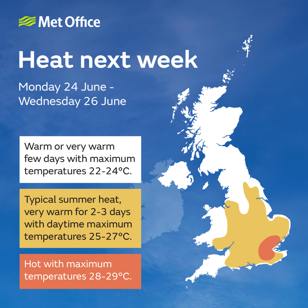
Dan Rudman is a Met Office Deputy Chief Meteorologist. He said: “After a brief, less settled interlude today and tomorrow, fine conditions will return by Sunday and into the beginning of next week. For much of the UK this will be accompanied by a boost in temperatures with many places reaching the mid-20°Cs.
"Some central and southern areas are likely to see temperatures approaching the values needed for heatwave conditions. Heatwave conditions need to remain in situ for three consecutive days, and by the beginning to middle of next week it is possible that some parts of the UK could be reaching heatwave thresholds.
“However, whether or not everyone experiences heatwave thresholds, the majority of the UK will experience the highest temperatures so far this year."
Further ahead
Although temperatures could reach a peak on Wednesday, it also looks like we may see the breakdown of this high-pressure from Tuesday night into Wednesday as things turn more unsettled. With this breakdown, there is also the chance of some heavy showers or thunderstorms in places, with the most persistent rain likely in the west or southwest.
“Confidence in the forecast reduces markedly from Wednesday onwards, with uncertainty in both how long the heat will last and how it will break down, which we will be keeping an eye on for the coming days. However, by next weekend, cooler, changeable conditions become more likely.
"The best advice for anyone wanting to know how the weather is shaping up from mid-next week, is to keep an eye on our latest forecast," said Dan Rudman, Met Office Deputy Chief Meteorologist.
Staying safe in the sea and the sun
Samantha Hughes, National Water Safety Partner at the RNLI said: “The forecasted warm weather will mean we’ll see more visitors at the coast and we always want people to enjoy themselves safely.
“Entering the water during warm weather can increase the risk of cold water shock due to the sudden changes in skin temperatures. Enter the water gradually and avoid jumping or diving straight in to reduce your risk of cold-water shock.
“If you’re planning on heading to the beach, we highly recommend you visit one that is lifeguarded and you swim between the red and yellow flags. This is the safest area and is most closely monitored by lifeguards.
“If you get into trouble in the water, Float to Live. Tilt your head back with ears submerged and try to relax and control your breathing. Use your hands to help you stay afloat and then call for help or swim to safety if you can.
“In an emergency at the coast, call 999 or 112 and ask for the Coastguard or ask for the fire service if you are near inland waters.”
Stay up to date with the forecast
You can find the latest forecast on our website, on YouTube by following us, on Twitter and Facebook, as well as on our mobile app which is available for iPhone from the App store and for Android from the Google Play store