New warnings issued ahead of Storm Bert this weekend
Author: Press Office
11:46 (UTC) on Fri 22 Nov 2024
New National Severe Weather Warnings have been issued for Saturday and Sunday as Storm Bert heads towards the UK. The weather system will bring heavy rain and snow, together with strong winds to large swathes of the country.
Ahead of Storm Bert, wintry showers will continue to impact parts of the UK on Friday, particularly exposed areas in the north. As a brief ridge of high pressure moves in though, Friday will bring a drier and brighter end to the week. It will still feel very chilly, with maximum temperatures of just 7 or 8 degrees Celsius.
Storm Bert will arrive across the UK on Saturday bringing:
— Met Office (@metoffice) November 22, 2024
⚠️
Snow
Ice
Heavy rain
Gale force winds
Lots of warnings have been issued ⚠️
Stay up-to-date with the latest:https://t.co/cEBjqKJgfS
Jason Kelly is a Met Office Chief Meteorologist and said: “Storm Bert starts to arrive overnight on Friday and into Saturday, initially over Northern Ireland. As we go through the first part of Saturday morning, it will start to show its hand across Scotland, north Wales and northern England, with the potential for some heavy snowfall, especially over higher ground. Warnings are in place, including an amber warning for snow and ice for parts of Scotland.”
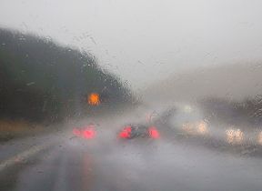
Storm Bert is also expected to bring heavy rain through Saturday and Sunday, especially in southern and western parts of the UK.
#StormBert is expected to bring several weather impacts across the UK on Saturday ⚠️
— Met Office (@metoffice) November 22, 2024
Here is an overview of what we can expect
Stay #WeatherAware ⚠️ pic.twitter.com/HWsihjB5tB
Jason said: “Heavy rainfall will affect much of the UK this weekend. Rain is expected to develop during Saturday morning across southwest and southern England, becoming particularly heavy and persistent overnight and into Sunday.
“Accumulations of 50-75 mm are expected to fall fairly widely during this time. There is a chance that some places over Dartmoor for example, could see 100-150 mm. In addition, rapid melting of lying snow over the weekend may bring flooding for some.”
Strong southerly winds will accompany the heavy rain, and warnings are in place in both the south and north. Gusts could peak at 50-60 mph in many parts of the warning areas, and could even reach in excess of 70 mph along some exposed coasts of Northern Ireland and western Scotland.
Jason Kelly said: “Storm Bert is what we call a ‘multi-hazard event’, bringing snow, rain and wind to the UK for the majority of the weekend. Multiple National Severe Weather Warnings are in place and will be added to and amended over the weekend. It’s possible this may be at short notice, so it is important people keep up to date with the very latest forecast.”
Mark Nash, National Network Manager at National Highways, said: “With the arrival of Storm Bert it is important to plan ahead for your journey, and if weather conditions become challenging, adjust your driving behaviour and take extra care.
“A section of our website provides practical advice for travelling in storms, high winds and gales. It’s also a good idea for people to remember TRIP – Top-up your vehicle; Rest every two hours, Inspect tyres and lights and Prepare for the journey ahead.”
Further ahead
Storm Bert is quite slow moving and only really clears from Monday. The start of the week will continue to be unsettled, with strong winds and showers in the forecast. Although temperatures will be around average for most places, strong winds mean it will feel rather cold.
Looking further ahead, there are indications we could see a brief return to colder conditions although for many, it will be drier than of late. How long the more settled conditons last is uncertain, with rain probably returning to western areas at least by the end of the week.
You can find the latest forecast on our website, on YouTube, by following us on X and Facebook, as well as on our mobile app which is available for iPhone from the App store and for Android from the Google Play store.


