More heavy rain to come
Author: Press Office
11:30 (UTC+1) on Sat 7 Sep 2024
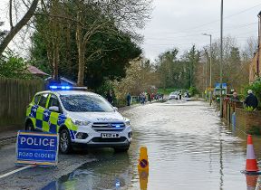
The southern half of the of the UK will continue to see rainfall over the weekend with some areas seeing heavy showers, and prolonged rain causing more flooding and disruption in places.
A yellow weather warning for rain has been issued for Saturday night and Sunday, covering much of southern Britain. Heavy rain and thunderstorms are expected to arrive in the southeast on Saturday evening and develop into a more organised band of rain across central and western areas into Sunday. Whilst some sunshine is likely to develop in the southeast on Sunday, further slow-moving thunderstorms are likely. This yellow warning is in place until 6pm on Sunday and it is possible that further updates to warnings may be issued during that time, including escalation to amber on a more localised scale if confidence in impacts occurring increases.
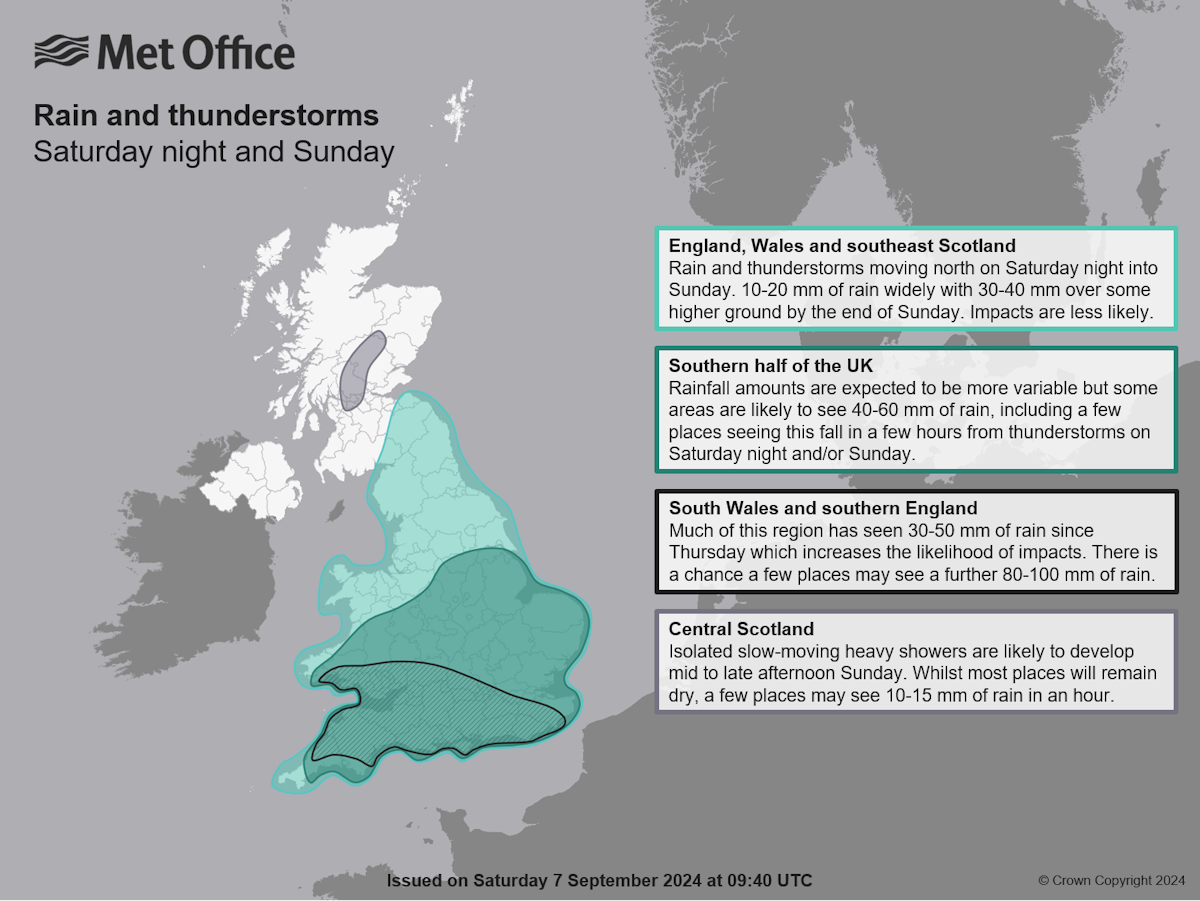
Rainfall amounts will vary considerably within the warning area, with some places seeing less that 10mm of rainfall while others see 40-60mm of rain over the weekend. Some isolated areas, most likely in the southern half of the warning area could see as much as 80-100mm of rain by the end of Sunday, which coming on the back of the already wet conditions, could result in greater impacts than would usually be expected at this time of year here.
This weather set up is due to a more complex than usual meteorological pattern involving multiple corridors of heavy, locally thundery rain revolving around a slow-moving area of low pressure.
Met Office Chief Meteorologist Matthew Lehnert explained: “Further spells of rain are likely to affect southern Britain this weekend, generating some localised impacts on Saturday night and Sunday. We currently have a yellow weather warning for rain in place, and there’s potential for further updates over the weekend.”
“It’s a different story further north though, as high pressure brings warmer and sunnier conditions, with higher-than-average temperatures, particularly across parts of western Scotland. Eastern areas are likely to be cooler and at times, cloudier due to winds blowing off the North Sea.”
“We are keeping warnings under review and will look to issue them over the weekend as confidence increases, so please keep up to date with our latest forecasts and warnings."
For advice in staying safe during heavy rain, please see our WeatherReady tips.
Further ahead
Looking further ahead, and we’re likely to see fresher, cooler temperatures sweeping across the UK, becoming notably cool in the north by mid-week. Conditions look to remain generally unsettled during next week, with showers or longer spells of rain at times for most regions, accompanied by blustery winds.
Stay up to date
You can find the latest forecast on our website, on YouTube by following us, on Twitter and Facebook, as well as on our mobile app which is available for iPhone from the App store and for Android from the Google Play store.