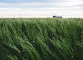
A return to more settled weather and an increase in temperatures
Author: Press Office
12:08 (UTC+1) on Fri 13 Sep 2024
After a chilly few days and nights, things will turn a bit warmer this weekend with much of the south fine and sunny, but some rain in parts of the north.
Friday got off to a cold and crisp start, with a widespread frost overnight seeing all four countries of the UK dropping below zero degrees Celsius and temperatures getting as low as -2.7°C in Topcliffe in North Yorkshire.
Despite the chilly start, there'll be plenty of sunshine to compensate and just an isolated shower possible for Scotland. Cloud will build across Northern Ireland in the afternoon, with rain by evening, and it will turn breezier in the northwest.
After a chill this morning, things are warming up this afternoon
— Met Office (@metoffice) September 13, 2024
Although temperatures are generally below average, it will still feel pleasant in the sunshine with lighter winds
Plenty of sunny spells though cloud thickening in the northwest with some rain and drizzle 🌧️ pic.twitter.com/56rsPmoGmz
Friday night won’t be as cold as Thursday, but some places will still touch freezing, especially under clearer skies further southeast. There will be outbreaks of rain across Northern Ireland and parts of Scotland, with gales in the far northwest by dawn.
Temperatures increasing from Saturday
Many areas will be fine and dry on Saturday. It will be a chilly start in the south, but we’ll start to see temperatures recover to near-average throughout the day.
Jason Kelly is a Chief Meteorologist at the Met Office and said: “The cold Arctic air we have been experiencing will be replaced with warmer westerlies over the weekend. High pressure will bring fine weather to the south, but there is an area of low pressure to the northwest, which will push some weather fronts across Scotland and Northern Ireland, bringing rain and thicker cloud. It will also be windy across Northern Scotland, especially on Saturday.”
On Sunday, that front moves southeast, bringing cloud and patchy rain to parts of the northern England and Wales and perhaps some heavier bursts on western hills. There will be clear and sunny spells either side of this front, dry in the south but with some showers in the north.
Expected temperatures will be into the high teens, perhaps even 20°C.
Next week
With a ridge of high pressure expected to be in charge, next week looks to be dry and warmer for many.
David Oliver is a Deputy Chief Meteorologist at the Met Office and explained: “In the wake of the front on Sunday, high pressure then builds, bringing fine and dry conditions to most parts of the UK for much of next week.
“If any rain develops it is expected to be confined to the extreme northwest of Scotland on Monday and Tuesday. There is a risk of some fog patches overnight and temperatures continue to increase, with many places a little above average by mid-week.”
Stay up to date
You can find the latest forecast on our website, on YouTube, by following us on Twitter and Facebook, as well as on our mobile app which is available for iPhone from the App store and for Android from the Google Play store.