Warning issued ahead of thundery shift
Author: Press Office
14:15 (UTC+1) on Fri 16 Jun 2023
A Yellow Weather Warning for thunderstorms has been issued by the Met Office, with a more unsettled weekend of weather on the way for some.
Though temperatures will remain above average for the time of year, a low-pressure system in the Atlantic is helping to introduce more rain into the forecast, with the possibility of this falling as thundery downpours for some.
For the vast majority of the UK Friday will see a continuation of the dry and sunny conditions of recent days, with temperatures widely into the mid-20s Celsius, possibly peaking around 28C on Friday.
A change from the west at first
From Friday afternoon, the hint of a change in weather type is likely to affect western parts of Northern Ireland at first, with thundery showers possible and the chance this could give around 25mm of rain for an unlikely few.
Whilst some showers and sporadic rain will extend into parts of Wales and the southwest of England on Friday afternoon the majority of these places will remain dry, though cloudier than recently.
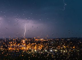
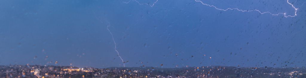
The risk of more showers and thunder does increase in these areas overnight and into Saturday however. There is then a trend to more showers and thunderstorms through the weekend, resulting in a Yellow Thunderstorm Warning being issued for the majority of England and Wales on Sunday.
⚠️ Yellow weather warning issued ⚠️
— Met Office (@metoffice) June 16, 2023
Thunderstorms across England and Wales
Sunday 0000 – 2359
Latest info 👉 https://t.co/QwDLMfRBfs
Stay #WeatherAware⚠️ pic.twitter.com/EBy6nM6jWb
Met Office Deputy Chief Meteorologist Chris Almond said: “Over the weekend we’ll be transitioning to a more unsettled regime for the UK, though temperatures will remain high and it’ll feel very humid for many.
“Heavy showers and thunderstorms are likely to become more frequent and impactful through the weekend, with the potential for associated hail, lightning and some gusty winds. The risk of thundery downpours initially starts in the far west on Friday afternoon, but spreads more widely through the weekend, resulting in the warning the Met Office has issued.
“There’s an ongoing likelihood of further warnings being issued and revised in the coming days, so keep an eye on the forecast for the latest outlook.”
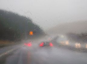
Though details are still being determined on the positioning of the heaviest thundery downpours, some places within the yellow warning area could see in excess of 30mm of rainfall within an hour, while some could see around 60mm over a six hour period on Sunday. However, due to the nature of these thunderstorms, some places will see much lower rainfall amounts, or even manage to avoid them altogether.
Sarah Cook, National Flood Duty Manager at the Environment Agency said: “On Sunday afternoon and into the night, slow-moving heavy showers and thunderstorms could lead to localised surface water flooding across England.
“Environment Agency teams are out on the ground and will support local authorities in responding to surface water flooding. We urge people not to drive though flood water – it is often deeper than it looks and just 30cm of flowing water is enough to float your car.
“People should check their flood risk, sign up for free flood warnings and keep up to date with the latest situation at https://www.gov.uk/check-if-youre-at-risk-of-flooding or follow @EnvAgency on Twitter for the latest flood updates.”
When there is a thunderstorm warning in place, there are some practical things you can do to stay safe. Find five tips for staying safe in a thunderstorm.
Remaining warm
Despite the shift to more thundery conditions, a plume of warm air is still influencing the UK weather, with temperatures through the weekend likely to remain in the mid-to-high 20 Celsius for some, though some places could dip slightly below the threshold for the official heatwave to continue.
Accompanied with warm days, night-time temperatures will remain well above average; providing little relief to those more vulnerable to high temperatures. The UK Health Security Agency, which covers the healthcare sector in England, has a Heat Health Alert in force.
Help to protect the vulnerable people that you know including older people, those with underlying conditions and those who live alone; they may need support to keep cool and hydrated. For more advice check out the NHS advice on how to cope in hot weather.
Further ahead
Although the details of the forecast are still being determined, the risk of heavy, thundery showers is likely to continue early next week; with the most frequent showers more likely in the northeast of the UK.