Christmas outlook
Author: Press Office
11:49 (UTC) on Mon 20 Dec 2021
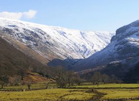
The outlook for Christmas Day looks unsettled with the chance of snow in some northern parts of the UK.
Although the early part of the week will remain settled with high pressure in charge, more changeable weather will move in from Wednesday.
As the area of high pressure retreats to continental Europe, milder air and more unsettled weather will move in across the UK from the southwest. Where the initial front meets the colder air in place across Scotland there is a risk of sleet, snow and ice over higher ground before turning to rain later on Wednesday morning. Elsewhere bands of rain will move eastwards across the UK through the day.
Through Thursday further spells of rain push in from the west, running in to colder air trying to push south, which is likely to fall as snow over the highest ground of Scotland. Further south, under any cloud breaks areas of fog could develop overnight, slowly improving through Friday morning.
Northerly winds strengthen across Scotland on Christmas Eve, helping drive the intersection between cold and milder air further south. These strong winds will make it feel cold with the chance of blizzards over high ground in northern Scotland. In the south, mild air remains in place, with cloud and further spells of rain from the west.
The key uncertainty for Christmas Day is where the boundary between cold and milder air will meet and therefore where the greater chances of any snow are. Currently the most likely regions to be in the colder air are Scotland, the far north of England and Northern Ireland where there is the possibility of some snow, particularly over higher ground. However small changes in the positioning of this boundary will significantly change the outlook. To the south of this, conditions remain unsettled; cloudy with spells of rain and some stronger winds at times, while to the north drier and brighter spells, with some wintry showers develop likely feeling very cold in the brisk northeasterly winds.
Deputy Chief meteorologist, Helen Caughey, said: “After a relatively benign start to the week, the forecast turns more unsettled and finely balanced as we approach Christmas. With colder air meeting milder air over the UK, the specific details of the forecast for Christmas day are still a little uncertain.
“Milder air moves northeast over much of the country by the middle of the week, with spells of rain for most at times, which will turn to snow over higher ground in northern Scotland initially. The boundary between the milder and colder air is then forecast to sink south later on Christmas Eve and through Christmas Day, introducing colder, clearer conditions for some. However exactly where this boundary gets to is hard to pin down at the moment, and is key as to where can expect any snow over Christmas, so keep up to date with the forecast for the latest information as we move through the week”.
Check the latest forecast for your area on our website, by following us on Twitter and Facebook, as well as on our mobile app which is available for iPhone from the App store and for Android from the Google Play store. Keep track of current weather warnings on the weather warning page.


