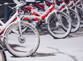
Turning colder with snow in places – December 2020
Author: Press Office
12:29 (UTC) on Wed 2 Dec 2020
It’ll turn colder across the UK this week with wintry showers and snow for northern areas and overnight frosts for many.
Lower temperatures
Cold polar maritime air will make its way across the UK today (Wednesday), introducing much lower temperatures nationwide and blustery showers across western areas. These showers will be heavy and frequent in Scotland, turning increasingly to snow this evening and overnight.
National Severe Weather Warning
The Met Office has issued a snow & ice warning for parts of Scotland valid from 1800 this evening until 1200 on Thursday, along with an ice warning for Northern Ireland tonight.
Chief Meteorologist at the Met Office, Dan Suri said: “It’ll certainly feel more wintry this week, with colder weather bringing a risk of frost, ice and wintry showers.
"The risk of snow accumulating is largely confined to the northern half of the UK - mainly over higher ground in Scotland, Wales and northern England.
“By tomorrow (Thursday) morning parts of northwest Scotland could see 2cm of snow accumulations to low levels, with 2-5cm above 200m and up to 10cm gathering over the highest routes, leading to some travel disruption.”
Many hills and #mountains will see the first substantial #snow falls of #winter over the next few days ❄️ 🏔️
— Met Office (@metoffice) December 2, 2020
If you are planning a trip within the current local restrictions, make sure you are prepared by checking out our mountain forecasts 👇https://t.co/SdLKagg2uX pic.twitter.com/NbLhG1AsGR
Be prepared
Traffic Scotland operator manager Douglas Cairns said: “The first severe weather warning of the winter for snow and ice is always a timely reminder for people to check they are winter ready and have made appropriate preparations.
“The safest and best advice is to check Traffic Scotland twitter, radio and the website before you travel and to always drive to the conditions.
Winter gritting
“A record number of gritters are available to keep the trunk road network moving this winter and we are grateful to our frontline teams, operators and operating companies for the comprehensive planning and preparations that have been made this week.”
Deputy Chief Meteorologist at the Met Office, Dan Harris said: "It’ll remain cold and unsettled on Friday as low pressure brings strong winds and spells of rain to many parts of the UK."
Snow in Scotland
"We’ve issued a snow warning for southern and eastern Scotland, with snow expected across hills and possibly to lower levels, before turning to persistent rain. We’re keeping an eye on other areas where there is potential for disruptive snow - in particular central and south-east England and the hills of northern England – however confidence at this stage is low with details only becoming clearer at short notice.”
Dan continued: “It’ll stay cold into the weekend with rain, showers and hill snow continuing across many areas, along with overnight frosts. We could also see some stubborn areas of freezing fog develop more widely, which at this time of year can persist all day. However, it's not all doom and gloom, as there’s likely to be an increased chance of dry, bright, and perhaps even sunny weather on offer as the weekend progresses.”
Stay connected
You can check the latest weather warnings on our severe weather warnings pages and you can get the most accurate and up to date forecast for your area using our forecast pages and by following us on Twitter and Facebook, as well as using our mobile app which is available for iPhone from the App store and for Android from the Google Play store. Whatever the weather we are all being urged to remember the Government Coronavirus guidelines.
Updated at 12:29 (UTC) on Wed 2 Dec 2020


