
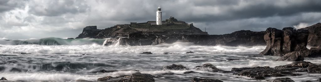
Coast and sea
The general synopsis at 0600
New low expected Trafalgar 1009 by 0600 tomorrow. New high expected south Wales 1029 by same time. Lows German Bight 1009 and FitzRoy 1011 losing their identities
Issued at: .
For the period to .
Shipping forecast and gale warnings map
Loading map…
Viking
- Wind
- West backing southwest 3 to 5.
- Sea state
- Moderate, occasionally rough in north.
- Weather
- Showers.
- Visibility
- Good.
North Utsire
- Wind
- Variable 2 to 4.
- Sea state
- Slight or moderate.
- Weather
- Showers.
- Visibility
- Good, occasionally moderate.
South Utsire
- Wind
- Variable 2 to 4, becoming northwesterly 3 to 5.
- Sea state
- Slight or moderate.
- Weather
- Showers.
- Visibility
- Good, occasionally moderate.
Forties
- Wind
- In east, variable 2 to 4. In west, northwesterly backing westerly or southwesterly, 3 to 5.
- Sea state
- In east, slight or moderate. in west, slight occasionally moderate.
- Weather
- In east, showers. In west, showers.
- Visibility
- In east, good, occasionally moderate. In west, good.
Cromarty
- Wind
- Northwesterly backing westerly or southwesterly, 3 to 5.
- Sea state
- Slight occasionally moderate.
- Weather
- Showers.
- Visibility
- Good.
Forth
- Wind
- Northwesterly backing westerly or southwesterly, 3 to 5.
- Sea state
- Slight.
- Weather
- Showers.
- Visibility
- Good.
Tyne
- Wind
- North or northwest 4 to 6, decreasing 2 to 4.
- Sea state
- Slight or moderate.
- Weather
- Showers.
- Visibility
- Good, occasionally moderate.
Dogger
- Wind
- North or northwest 4 to 6, decreasing 2 to 4.
- Sea state
- Slight or moderate.
- Weather
- Showers.
- Visibility
- Good, occasionally moderate.
Fisher
- Wind
- Cyclonic becoming north, 3 to 5.
- Sea state
- Slight or moderate.
- Weather
- Rain then showers.
- Visibility
- Good, occasionally poor.
German Bight
- Wind
- Cyclonic becoming north, 3 to 5.
- Sea state
- Slight or moderate.
- Weather
- Rain then showers.
- Visibility
- Good, occasionally poor.
Humber
- Wind
- Cyclonic 5 to 7, becoming north 3 to 5.
- Sea state
- Slight or moderate.
- Weather
- Showers.
- Visibility
- Good, occasionally poor.
Thames
- Wind
- Cyclonic 5 to 7, becoming north 3 to 5.
- Sea state
- Slight or moderate, occasionally rough at first.
- Weather
- Showers.
- Visibility
- Good, occasionally poor.
Dover
- Wind
- Northwest veering north or northeast, 3 to 5, occasionally 6.
- Sea state
- Slight occasionally moderate.
- Weather
- Showers.
- Visibility
- Good.
Wight
- Wind
- Northwest veering north or northeast, 3 to 5.
- Sea state
- Slight occasionally moderate.
- Weather
- Showers.
- Visibility
- Good.
Portland
- Wind
- Northwest veering north or northeast, 3 to 5.
- Sea state
- Slight occasionally moderate.
- Weather
- Showers.
- Visibility
- Good.
Plymouth
- Wind
- Easterly or northeasterly 3 to 5.
- Sea state
- Moderate or rough becoming slight or moderate.
- Weather
- Fair.
- Visibility
- Good.
Biscay
- Wind
- Easterly or northeasterly 3 to 5, occasionally 6 in south.
- Sea state
- Moderate or rough.
- Weather
- Showers.
- Visibility
- Good, occasionally moderate.
Trafalgar
Forecast issued:
- Wind
- Cyclonic, mainly southwest, 4 to 6, occasionally 7 at first.
- Sea state
- Moderate or rough, occasionally very rough later in west.
- Weather
- Thundery showers.
- Visibility
- Good, occasionally poor.
FitzRoy
- Wind
- In south, cyclonic becoming northeasterly 4 to 6, occasionally 7 until later. In north, northeasterly 5 to 7, veering easterly or southeasterly 4 to 6.
- Sea state
- In south, rough, occasionally moderate in east. in north, rough, becoming mainly moderate later.
- Weather
- In south, thundery showers. In north, showers.
- Visibility
- In south, good, occasionally poor. In north, good, occasionally moderate.
Sole
- Wind
- Northeasterly veering southeasterly, 3 to 5, occasionally 6 later in west.
- Sea state
- Moderate or rough.
- Weather
- Fair.
- Visibility
- Good.
Lundy
- Wind
- Northwest 3 to 5, becoming variable 2 to 4.
- Sea state
- Slight or moderate.
- Weather
- Fair.
- Visibility
- Good.
Fastnet
- Wind
- Northwest 3 to 5, becoming variable 2 to 4.
- Sea state
- Slight or moderate, occasionally rough in southwest.
- Weather
- Fair.
- Visibility
- Good.
Irish Sea
- Wind
- Northwest 3 to 5, becoming variable 2 to 4.
- Sea state
- Slight or moderate becoming smooth or slight.
- Weather
- Fair.
- Visibility
- Good.
Shannon
- Wind
- Variable 2 to 4, becoming south 4 to 6, occasionally 7 later, perhaps gale 8 later.
- Sea state
- Moderate or rough, becoming very rough later in far northwest.
- Weather
- Showers.
- Visibility
- Good.
Rockall
- Gale warning
-
Issued:
Southerly gale force 8 expected later
- Wind
- West 4 to 6, backing southwest 5 to 7, then south 7 or gale 8 later.
- Sea state
- Rough or very rough, occasionally high later in northwest.
- Weather
- Showers.
- Visibility
- Good, occasionally poor.
Malin
- Wind
- West backing southwest, 4 to 6, occasionally 7 later, perhaps gale 8 later.
- Sea state
- Moderate or rough, occasionally very rough later in west.
- Weather
- Showers.
- Visibility
- Good.
Hebrides
- Gale warning
-
Issued:
Southwesterly gale force 8 expected later
- Wind
- South or southwest 5 to 7, increasing 7 or gale 8 later.
- Sea state
- Rough or very rough.
- Weather
- Showers.
- Visibility
- Good.
Bailey
- Gale warning
-
Issued:
Southerly severe gale force 9 expected later
- Wind
- South or southwest 5 to 7, increasing 7 or gale 8 later, occasionally severe gale 9 later.
- Sea state
- Rough or very rough, becoming very rough or high later.
- Weather
- Showers, rain later.
- Visibility
- Good, occasionally poor later.
Fair Isle
- Wind
- Southwest 4 to 6, occasionally 7 later.
- Sea state
- Moderate or rough, occasionally very rough later in west.
- Weather
- Showers.
- Visibility
- Good.
Faeroes
- Gale warning
-
Issued:
Southerly gale force 8 expected later
- Wind
- Southerly or southwesterly 5 to 7, occasionally gale 8 later.
- Sea state
- Rough or very rough.
- Weather
- Showers, rain later.
- Visibility
- Good, occasionally poor.
Southeast Iceland
- Gale warning
-
Issued:
Southerly gale force 8 expected later
- Wind
- Southerly or southwesterly 5 to 7, occasionally gale 8 later.
- Sea state
- Rough or very rough, becoming very rough or high later.
- Weather
- Showers, rain later.
- Visibility
- Good, occasionally poor.
Shipping forecast information
The shipping forecast is issued four times a day at 2300, 0500, 1100, 1700 UTC and covers a period of 24 hours from 0000, 0600, 1200 and 1800 UTC respectively.
The waters around the British Isles are divided into 31 sea areas shown on the map.
The forecast contains details of gale warnings in force, a general synopsis and sea-area forecasts containing wind direction and force, sea state, weather and visibility.
Gale warnings are issued as required throughout the day (for winds of Gale Force 8 or more).
Marine forecasts disclaimer
In the UK, the Maritime & Coastguard Agency (MCA) is responsible for the provision of Maritime Safety Information (MSI) to ships at sea, which includes the broadcast of warnings and forecasts. The Met Office initiates warnings and prepares routine forecasts for dissemination on behalf of the MCA.
Caution: The internet is not part of the Maritime Safety Information system and should never be relied upon as the only means to obtain the latest forecast and warning information. Access to the service may be interrupted or delayed from time to time, updates may also be delayed.
Please refer to GMDSS services, INMARSAT SafetyNET or international NAVTEX for the latest information. When using these web pages, always check that the page on your screen is not from your cache. Use the Refresh or Reload button if in any doubt.