
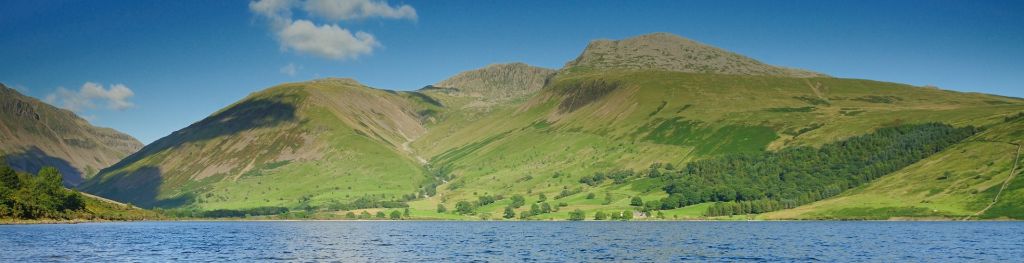
Mountain weather
Lake District Mountain weather forecast table
Confidence
High for generally settled conditions on Wednesday. Some uncertainty on the extent of showers on Thursday.
Mountain weather hazards
Hazards apply at or above 300m, reflecting the more severe conditions which can occur at altitude.
 Strong Sunlight
Harmful UV levels from sunlight increase with altitude giving a greater risk of sunburn and eye damage, even on some overcast days. On breezy days, the cooling effect of wind on exposed skin may disguise any feeling of sunburn until it is too late. If there is snow cover, glare increases the effect of UV rays especially on the eyes. It is advisable to wear sun block, protective clothing such as a long-sleeved top and hat and have good quality eye protection.
Mountain weather forecast
Mainly dry day with lengthy periods of sunshine.
| 06:00 | 09:00 | 12:00 | 15:00 | 18:00 | 21:00 | |
|---|---|---|---|---|---|---|
Weather (at 800m) |
|
|
|
|
|
|
Chance of precipitation (at 800m) |
<05% | <05% | 10% | 10% | 10% | <05% |
Wind direction and speed (mph)
Altitude above mean sea level
| 06:00 | 09:00 | 12:00 | 15:00 | 18:00 | 21:00 | |
|---|---|---|---|---|---|---|
| 900m |
SW
13
|
SW
10
|
SW
15
|
SW
15
|
SW
13
|
S
13
|
| 600m |
SW
7
|
SW
9
|
SW
15
|
SW
14
|
SW
10
|
S
9
|
| 300m |
W
1
|
SW
5
|
SW
9
|
SW
8
|
S
4
|
S
2
|
| Valley |
W
1
|
SW
5
|
SW
9
|
SW
8
|
SW
4
|
S
4
|
Wind gust (mph)
Altitude above mean sea level
| 06:00 | 09:00 | 12:00 | 15:00 | 18:00 | 21:00 | |
|---|---|---|---|---|---|---|
| 900m | 15 | 14 | 21 | 21 | 17 | 16 |
| 600m | 9 | 13 | 21 | 20 | 14 | 13 |
| 300m | 8 | 10 | 17 | 17 | 12 | 10 |
| Valley | 4 | 9 | 15 | 15 | 10 | 9 |
Altitude above mean sea level
| 06:00 | 09:00 | 12:00 | 15:00 | 18:00 | 21:00 | |
|---|---|---|---|---|---|---|
| 900m |
9°
|
10°
|
11°
|
11°
|
11°
|
10°
|
| 600m |
11°
|
12°
|
13°
|
14°
|
13°
|
12°
|
| 300m |
13°
|
15°
|
16°
|
17°
|
16°
|
14°
|
| Valley |
14°
|
17°
|
18°
|
18°
|
18°
|
16°
|
| Freezing Level |
2,300m
|
2,300m
|
2,400m
|
2,500m
|
2,400m
|
2,400m
|
Altitude above mean sea level
| 06:00 | 09:00 | 12:00 | 15:00 | 18:00 | 21:00 | |
|---|---|---|---|---|---|---|
| 900m |
6°
|
7°
|
8°
|
8°
|
8°
|
8°
|
| 600m |
9°
|
10°
|
10°
|
11°
|
12°
|
11°
|
| 300m |
13°
|
15°
|
15°
|
16°
|
16°
|
14°
|
| Valley |
15°
|
16°
|
16°
|
17°
|
17°
|
16°
|
Additional weather information
Meteorologist's view
Nothing to add.
Weather
Isolated mist and fog patches in the valley at first. Some patchy summit cloud through the morning, otherwise a mainly dry day with lengthy periods of sunshine.
Chance of cloud-free hill tops
80%.
Low cloud and visibility
Generally excellent visibility, but perhaps poor or very poor in any valley mist or fog patches at first. The odd patch of summit cloud in the morning, rising above the summits by afternoon.
Ground conditions
No recent ground conditions report available.
Mountain weather information
Weather
Bright or sunny spells and a few scattered showers, mainly across western fells.
Chance of cloud-free hill tops
70%
Maximum wind speed expected
25-30mph in the afternoon.
Temperature
- At 800m Plus 9 Celsius rising 12 Celsius.
- Valley Plus 13 Celsius rising 20 Celsius.
- Freezing level Above the summits.
Low cloud and visibility
Generally very good visibility, dropping briefly in showers. A few patches of cloud around summit level at times.
Mountain weather information
Fri 19 Jul
Sunrise:
Sunset:
Morning low cloud and mist clearing to leave a dry and sunny day. Fresh to strong summit winds.
Sat 20 Jul
Sunrise:
Sunset:
Fairly cloudy with heavy and perhaps thundery showers at times. Moderate to fresh summit winds.
Sun 21 Jul
Sunrise:
Sunset:
Bright or sunny spells and scattered showers. Moderate to fresh summit winds.
Updated at:
Summit specific forecast
Mountain summit forecast map
Loading map…
Key
The Lake District covers an area of 885 square miles with its highest point, Scafell Pike, standing at 978 metres.