
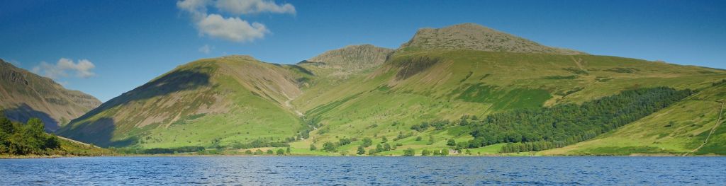
Mountain weather
Lake District Mountain weather forecast table
Confidence
High for a fine, mild day on Sunday and for the change to more unsettled, colder conditions through Monday, although some uncertainty over timing of the arrival of the cold front introducing the colder conditions.
Mountain weather forecast
Dry and largely sunny. Winds easing. Very mild
| 06:00 | 09:00 | 12:00 | 15:00 | 18:00 | 21:00 | |
|---|---|---|---|---|---|---|
Weather (at 800m) |
|
|
|
|
|
|
Chance of precipitation (at 800m) |
<05% | <05% | <05% | <05% | <05% | <05% |
Wind direction and speed (mph)
Altitude above mean sea level
| 06:00 | 09:00 | 12:00 | 15:00 | 18:00 | 21:00 | |
|---|---|---|---|---|---|---|
| 900m |
SE
20
|
E
23
|
E
17
|
E
12
|
E
12
|
E
11
|
| 600m |
SE
16
|
E
15
|
E
14
|
E
11
|
E
7
|
E
8
|
| 300m |
SE
1
|
E
5
|
E
8
|
E
7
|
E
4
|
E
4
|
| Valley |
NE
1
|
NE
2
|
E
8
|
E
6
|
NE
7
|
NE
7
|
Wind gust (mph)
Altitude above mean sea level
| 06:00 | 09:00 | 12:00 | 15:00 | 18:00 | 21:00 | |
|---|---|---|---|---|---|---|
| 900m | 24 | 27 | 22 | 16 | 15 | 14 |
| 600m | 23 | 20 | 18 | 15 | 10 | 11 |
| 300m | 9 | 18 | 16 | 13 | 9 | 9 |
| Valley | 9 | 12 | 15 | 11 | 9 | 9 |
Altitude above mean sea level
| 06:00 | 09:00 | 12:00 | 15:00 | 18:00 | 21:00 | |
|---|---|---|---|---|---|---|
| 900m |
10°
|
10°
|
9°
|
9°
|
8°
|
7°
|
| 600m |
10°
|
10°
|
11°
|
12°
|
10°
|
8°
|
| 300m |
8°
|
12°
|
14°
|
14°
|
10°
|
9°
|
| Valley |
11°
|
13°
|
15°
|
16°
|
12°
|
11°
|
| Freezing Level |
1,700m
|
1,800m
|
1,700m
|
1,700m
|
1,700m
|
1,600m
|
Altitude above mean sea level
| 06:00 | 09:00 | 12:00 | 15:00 | 18:00 | 21:00 | |
|---|---|---|---|---|---|---|
| 900m |
6°
|
6°
|
5°
|
6°
|
5°
|
5°
|
| 600m |
6°
|
7°
|
8°
|
9°
|
8°
|
6°
|
| 300m |
7°
|
11°
|
13°
|
13°
|
10°
|
8°
|
| Valley |
11°
|
12°
|
13°
|
14°
|
11°
|
9°
|
Additional weather information
Meteorologist's view
A fine, very mild early spring day. Valley temperatures locally plus 17 or 18 Celsius
Weather
Dry with long clear or sunny spells, although cloud above the summits will tend to increase through the evening.
Chance of cloud-free hill tops
Close to 100%
Low cloud and visibility
Little or no cloud expected below the summits with very good visibility.
Ground conditions
Date: Saturday 8 March 2025 Location: High Street summit 828m at 11:37 Full report: Today's report was taken on the summit of High Street in the eastern fells. Sun, blue sky, warm breeze... The smell of Spring is definitely in the air today and the fells are almost entirely snow free with the exception of the odd very isolated patch in gully heads and high rims mainly on the Helvellyn range. These are entirely avoidable but still obviously would be hazardous to try and cross without winter equipment. This said it is fair to say that almost all routes on the fells are now snow free. With weather like this on the hills and snow free conditions it is important to remind ourselves that it is still only early March and so a return to full winter conditions is certainly still possible, but even wet and windy weather will still feel cold at this time of year and full winter clothing could still be required at any point. For now though, time to enjoy the sunshine and longer daylight hours! Temperature: plus 8.8 C, Maximum wind speed 20.7 mph, Wind chill: plus 4.8 C, Average wind speed: 11.9 mph.
Mountain weather information
Weather
Dry with long clear spells overnight. However, increasing cloud will bring outbreaks of mainly light rain south from the late morning, these turning increasing to snow above about 600m before clearing south through late afternoon. Mainly dry through the evening with clear spells developing the evening.
Chance of cloud-free hill tops
Close to 100% at dawn falling to around 25% by late morning and through much of the afternoon. Chances rise to 75% through the late afternoon and evening.
Maximum wind speed expected
Light winds overnight becoming northeasterly 20-25mph through the morning, with gusts around 45mph over higher ridges and summits.
Temperature
- At 800m Around plus 6 Celsius at dawn falling to plus 2 Celsius by mid-afternoon and minus 1 Celsius in evening
- Valley Around plus 3 or 4 Celsius at dawn and again in evening, but rising to 7 or 8 Celsius by day
- Freezing level Above the summits but falling to 900m by mid-afternoon and then 600m in the evening
Low cloud and visibility
Periods of cloud above 600-750m developing through the morning, with patches to 450m at times, the cloud becoming more occasional through the late afternoon and evening. Away from cloud visibility, very good falling to several kilometres in rain and close to a kilometre in snow.
Mountain weather information
Tue 11 Mar
Sunrise:
Sunset:
A few wintry showers, especially for eastern fells, with sunny spells. Strong northerly or northeasterly winds easing. Freezing level 450-600m.
Wed 12 Mar
Sunrise:
Sunset:
Again a few wintry showers across eastern fells, but most places dry with long sunny spells. Fresh northerly or northeasterly winds continuing to ease. Freezing level 450-600m.
Thu 13 Mar
Sunrise:
Sunset:
Another cold day with some wintry showers, again mainly in the east, and, especially in west, sunny spells. Occasionally strong northerly or northeasterly winds. Freezing level 450-600m.
Updated at:
Summit specific forecast
Mountain summit forecast map
Loading map…
Key
The Lake District covers an area of 885 square miles with its highest point, Scafell Pike, standing at 978 metres.