
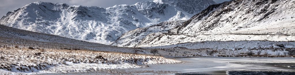
Mountain weather
Eryri / Snowdonia Mountain weather forecast table
Confidence
High confidence in changeable conditions, low for cloud details and timings of rain.
Mountain weather hazards
Hazards apply at or above 300m, reflecting the more severe conditions which can occur at altitude.
 Poor Visibility
Poor visibility presents challenging route finding conditions. Visibility could be significantly less than 50 metres in all directions with few or no visual references, especially on featureless moors or plateaux. Distances become hard to judge and cliff or cornice edges can be difficult to recognise. These conditions require good navigational skills. There is a risk of white-out conditions when mist or fog is combined with extensive snow cover.
Severe Chill Effect
Wind significantly lowers the ‘feels-like’ temperature relative to the actual temperature, with even moderate winds significantly adding to the chilling effect. Strong winds can result in a severe and debilitating wind chill many degrees below the actual temperature. This effect will be enhanced in rain or wet snow. Without protection, prolonged exposure could result in frost nip or frostbite on exposed parts of the body and/or hypothermia.
Strong Sunlight
Harmful UV levels from sunlight increase with altitude giving a greater risk of sunburn and eye damage, even on some overcast days. On breezy days, the cooling effect of wind on exposed skin may disguise any feeling of sunburn until it is too late. If there is snow cover, glare increases the effect of UV rays especially on the eyes. It is advisable to wear sun block, protective clothing such as a long-sleeved top and hat and have good quality eye protection.
Mountain weather forecast
Cloudy with some sunny intervals and isolated showers.
| 06:00 | 09:00 | 12:00 | 15:00 | 18:00 | 21:00 | |
|---|---|---|---|---|---|---|
Weather (at 800m) |
|
|
|
|
|
|
Chance of precipitation (at 800m) |
10% | 10% | 30% | 30% | 20% | 20% |
Wind direction and speed (mph)
Altitude above mean sea level
| 06:00 | 09:00 | 12:00 | 15:00 | 18:00 | 21:00 | |
|---|---|---|---|---|---|---|
| 900m |
NW
18
|
NW
19
|
NW
18
|
NW
17
|
NW
14
|
W
13
|
| 600m |
NW
12
|
NW
15
|
NW
14
|
NW
14
|
NW
12
|
W
9
|
| 300m |
NW
8
|
NW
11
|
NW
11
|
NW
11
|
NW
8
|
W
5
|
| Valley |
NW
8
|
NW
12
|
NW
12
|
NW
11
|
NW
8
|
W
6
|
Wind gust (mph)
Altitude above mean sea level
| 06:00 | 09:00 | 12:00 | 15:00 | 18:00 | 21:00 | |
|---|---|---|---|---|---|---|
| 900m | 21 | 24 | 24 | 23 | 20 | 16 |
| 600m | 15 | 20 | 21 | 20 | 17 | 12 |
| 300m | 12 | 17 | 19 | 19 | 15 | 10 |
| Valley | 13 | 18 | 20 | 19 | 15 | 11 |
Altitude above mean sea level
| 06:00 | 09:00 | 12:00 | 15:00 | 18:00 | 21:00 | |
|---|---|---|---|---|---|---|
| 900m |
5°
|
6°
|
7°
|
7°
|
8°
|
7°
|
| 600m |
7°
|
8°
|
9°
|
10°
|
10°
|
9°
|
| 300m |
9°
|
11°
|
12°
|
13°
|
13°
|
11°
|
| Valley |
11°
|
12°
|
13°
|
14°
|
14°
|
12°
|
| Freezing Level |
2,200m
|
2,200m
|
2,200m
|
2,200m
|
2,300m
|
2,500m
|
Altitude above mean sea level
| 06:00 | 09:00 | 12:00 | 15:00 | 18:00 | 21:00 | |
|---|---|---|---|---|---|---|
| 900m |
1°
|
1°
|
2°
|
3°
|
4°
|
4°
|
| 600m |
4°
|
5°
|
6°
|
7°
|
8°
|
6°
|
| 300m |
8°
|
8°
|
10°
|
10°
|
11°
|
10°
|
| Valley |
9°
|
10°
|
11°
|
12°
|
12°
|
12°
|
Additional weather information
Meteorologist's view
Conditions changing quickly with elevation and some significant wind chill possible at height so be prepared if heading to the higher tops. Strong sun and high UV levels also likely in any brightness through the middle of the day.
Weather
Largely cloudy with some brighter spells at times but also the risk of the odd shower, these tending to be fairly light. Winds fairly light but feeling somewhat cooler.
Chance of cloud-free hill tops
60%.
Low cloud and visibility
Scattered cloud bases in the morning obscuring hills above 600m gradually lifting to 800-900m often shrouding the higher tops and bringing some poorer visibility, particularly in association with passing showers. Generally excellent visibilities at lower levels away from showers.
Ground conditions
Please see - https://yrwyddfa.live/
Mountain weather information
Weather
Overcast cloud for much of the day with extensive low cloud during the afternoon. Spells of rain likely during the morning, with a brief drier interlude mid-morning before further rain and drizzle in the afternoon.
Chance of cloud-free hill tops
20%.
Maximum wind speed expected
Westerly 15-20mph gusting 25-30mph
Temperature
- At 800m Plus 5 Celsius, rising to 8 Celsius.
- Valley Plus 11 Celsius, rising to 15 Celsius.
- Freezing level Above summits.
Low cloud and visibility
Largely cloudy with periods of low cloud down to 400-500m at times, and spells of rain and drizzle particularly early and late in the day bringing some poor visibility at height. Visibility better at lower levels, particularly during the afternoon.
Mountain weather information
Tue 2 Jul
Sunrise:
Sunset:
Drier on Tuesday, with sunny spells. Small chance for the odd shower. Moderate to fresh northwesterly winds.
Wed 3 Jul
Sunrise:
Sunset:
After a brighter start, another band of rain and low cloud expected to move in from the west. Fresh to strong southwesterly winds.
Thu 4 Jul
Sunrise:
Sunset:
Another breezy day with some brighter spells and the odd shower. Fresh to strong westerly winds.
Updated at:
Summit specific forecast
Mountain summit forecast map
Loading map…
Key
The Eryri (Snowdonia) mountains are made up of 90 mountain peaks including the tallest mountain in Wales, Yr Wyddfa (Snowdon), standing at 1,085 metres.