The storm that shaped the Shipping Forecast
The Royal Charter Gale in October 1859 was the most severe storm to hit the Irish Sea during the 19th Century, taking 800 lives and 133 ships.
The night of the storm
A severe, slow moving storm, later named the Royal Charter Gale, hit the Irish Sea on the night of 25 October of 1859. Wind speeds in the adjoining River Mersey were higher than any previously recorded.
800 people were killed and 133 ships destroyed, with 90 more badly damaged. The most famous ship to be lost during the night was the steam clipper, Royal Charter, which foundered on the coast of Anglesey. She was one of the fastest emigrant ships operating during the Australian gold rush, and was on the last leg of her two-month journey from Melbourne to Liverpool.
As conditions in the Irish sea deteriorated, the Royal Charter was driven inshore. Her anchor chains snapped, and her engines were unable to make headway against the gale. She struck the rocks at Point Alerth and, battered by huge waves, quickly broke up. Around 460 lives were lost, including all of the women and children aboard. There were only 40 survivors, and it remains the highest death toll of any shipwreck on the welsh coast.
The sinking of the Royal Charter inspired Robert Fitzroy to start a national storm warning system that would become the shipping forecast. It was also the earliest beginnings of today’s Met Office forecasting service.
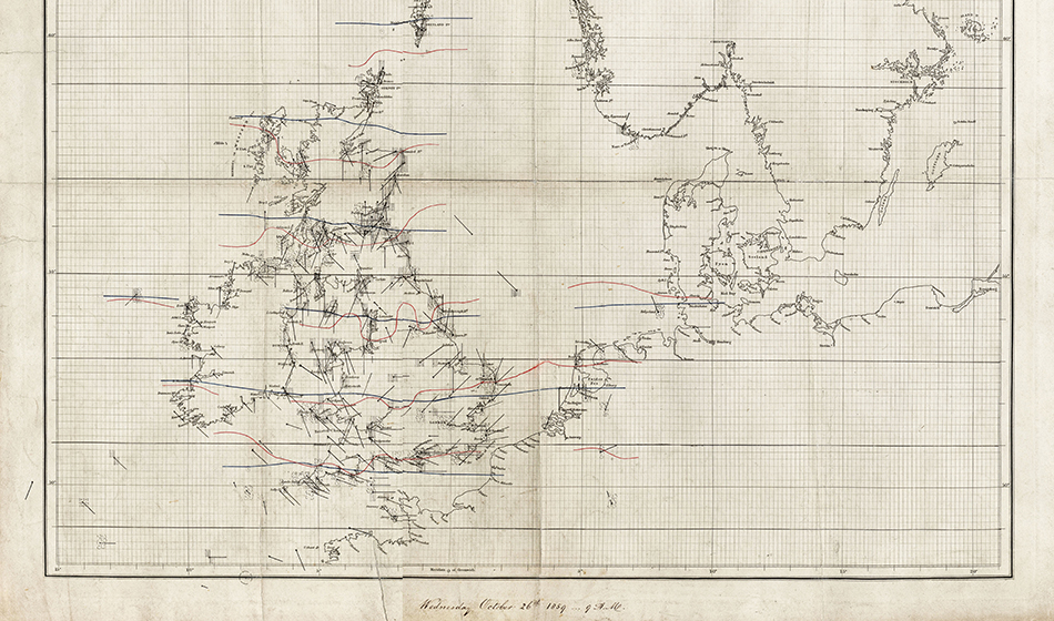 The above image shows the original weather chart produced by Met Office founder Robert FitzRoy to depict the Royal Charter Gale in October 1859.
The world’s first national forecast warning service
Widespread national press coverage after the tragedy focused on the need for storm warnings to reduce similar losses in future.
Robert Fitzroy, founder of the fledgling meteorological office, had been collecting observations from around the British coast since 1854. He believed his department could provide such a service. Fitzroy produced a detailed report with charts to prove that the storm could have been predicted. Through his analyses of the Royal Charter and other storms, Fitzroy demonstrated the validity of his models and proposed a national storm warning system.
Many in the scientific establishment doubted that weather could be predicted in any meaningful way. However, the government permitted Fitzroy to test his science of weather forecasting and establish a gale warning service.
In February 1861, the first warning was issued using a combination of cones and drums hoisted on a mast to warn vessels both in harbour and along the coast of an approaching gale. On the Tyne, the warning was disregarded and many lives were lost. However, its accuracy ensured that further warnings were heeded and the scheme was widely popular.
The Royal Charter's legacy
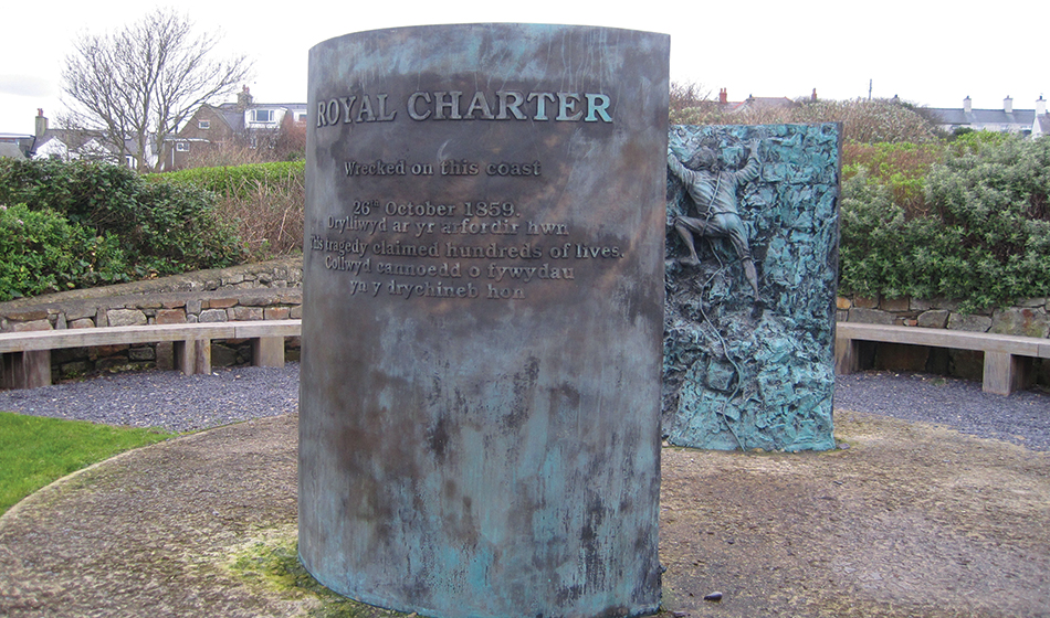
Memorials to the Royal Charter were erected on the headland at Point Alerth, Anglesey and at the RNLI Gwylfan Moelfre Sea Watch Centre. Moelfre lifeboat station was founded in 1868, and the dangerous nature of the Anglesey coastline has resulted in its lifeboat crews being awarded 37 medals for gallantry.
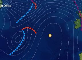
Today the storm warning service is known as the Shipping Forecast. Issued by the Met Office on behalf of the maritime and coastguard agency, it is the longest running national forecasting service in the world.
 The Royal Charter was destroyed during a severe storm in the Irish Sea in October 1859 and 460 lives were lost. Its sinking inspired Robert Fitzroy to start a national storm warning system that would become the Shipping Forecast.