Easter weather forecast
Author: Press Office
12:10 (UTC) on Wed 27 Mar 2024
Winds and rain are on the way for some this week, with unsettled Easter weekend weather likely for many.
Warnings this week
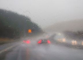
The Met Office have issued weather warnings this week, with gusty winds and heavy rain likely for some on Thursday.
Ahead of these warnings, rain will push northwards on Wednesday night, with a risk of snow over higher ground of western England and Wales, followed by scattered showers.
A yellow warning for wind has been issued for Thursday covering much of the southern coast of England. The warning highlights the potential for travel disruption within the area and hazardous conditions near immediate coastlines.
⚠️ Yellow weather warning issued ⚠️
— Met Office (@metoffice) March 27, 2024
Strong winds across parts of southern England
Thursday 0700 – 1800
Latest info 👉 https://t.co/QwDLMfRBfs
Stay #WeatherAware⚠️ pic.twitter.com/pwf9Vp1Lbv
Met Office Chief Meteorologist Neil Armstrong said: “A deep area of low pressure will see increasing wind speeds along the south coast of England on Thursday. Gusts of 50mph are likely quite widely, with 60-70mph possible in exposed coastal areas.
“These winds will be accompanied by some heavy showers at times, with the possibility of hail and thunder in some locations, which will worsen travel conditions.”
Northern Ireland has a yellow warning for rain in force for much of Thursday, with totals continuing to top up after a wet few days.
⚠️ Yellow weather warning issued ⚠️
— Met Office (@metoffice) March 27, 2024
Rain across eastern parts of Northern Ireland
Thursday 0700 – 1700
Latest info 👉 https://t.co/QwDLMfRBfs
Stay #WeatherAware⚠️ pic.twitter.com/UEbNvNVT1q
Neil continued: “Thursday will see further showers for many areas of the UK, but Northern Ireland will see further rain falling on very saturated ground, which increases the chances of some travel disruption within the warning area. 10-20mm of rain is likely quite widely, possibly higher across the Antrim hills.”
Easter weather forecast
The unsettled weather will continue on Good Friday, with low pressure continuing to feed showers and longer spells of rain across the UK, although drier spells will develop later in the day from the east.
Saturday sees a continuation of this showery theme in southern and western areas, though there is an increasing chance of brighter spells further north and east. Sunday looks to be the best day of the week; however, conditions will return to more unsettled from the south later Sunday and into Monday. This will bring a widely unsettled day, at least across southern areas, for Easter Monday, with the best of the conditions, at least to begin, further north.
Met Office Deputy Chief Meteorologist Helen Caughey said: “Showers will continue into the weekend, especially for southern and western areas. However, it is likely that we will see something of an improvement for most areas, with showers tending to become less frequent, and a better chance of longer spells of sunshine for eastern and northern areas, especially on Sunday.
“It will also become less windy, and temperatures should start to trend upwards, feeling quite warm in any sunshine. However, more widely unsettled conditions look likely to return into Easter Monday, but there is still some uncertainty in the timing of this deterioration.”
RAC Breakdown Spokesperson Rod Dennis said: “With plenty of classic early spring weather over the Easter bank holiday weekend – showers and gusty winds along with some brighter interludes – drivers getting away will definitely need to be on their guard and ready to cope with rapidly changing road conditions. Slowing down in the heaviest of downpours on Good Friday and Easter Saturday is a must as stopping distances will be far greater.
“It’s vitally important drivers don’t travel through any standing water at speed, however shallow, as this dramatically increases the risk of aquaplaning and losing control of their vehicles.
“When it comes to an easier time on the roads, Sunday could be drivers’ best bet before the weather deteriorates once again on Easter Monday. As the weather over the weekend is so changeable, it’s also a good idea to have sunglasses to hand to make driving safer when the sun makes an appearance and causes wet roads to dazzle.”
You can keep up to date with the latest forecast on our website, by following us on Twitter and Facebook, as well as on our mobile app which is available for iPhone from the App store and for Android from the Google Play store.