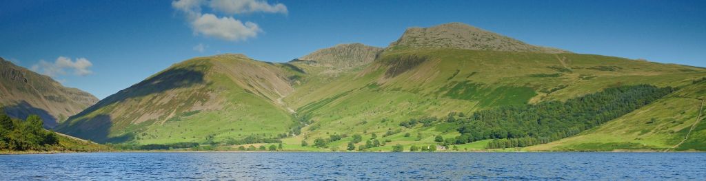
![](/binaries/content/gallery/metofficegovuk/hero-images/advice/mountains/lake-and-hills-in-the-lake-district.jpg/lake-and-hills-in-the-lake-district.jpg/metofficegovuk%3AheroMedium)
Lake District Mountain weather forecast table
Confidence
High but Medium for cloud details.
This evening forecast
Mostly cloudy. Patchy sleet and snow in east. Moderate or fresh east or northeast winds at height.
Mountain weather hazards
Hazards apply at or above 300m, reflecting the more severe conditions which can occur at altitude.
Severe Chill Effect
Poor Visibility
Mountain weather forecast
Mostly cloudy. Cold and windy at height. Wintry showers.
00:00 | 03:00 | 06:00 | 09:00 | 12:00 | 15:00 | 18:00 | 21:00 | |
---|---|---|---|---|---|---|---|---|
Weather (at 800m) |
|
|
|
|
|
|
|
|
Chance of precipitation (at 800m) |
50% | 50% | 40% | 30% | 30% | 30% | 30% | 30% |
00:00 | 03:00 | 06:00 | 09:00 | 12:00 | 15:00 | 18:00 | 21:00 | |
---|---|---|---|---|---|---|---|---|
900m |
NE
13
|
NE
19
|
NE
25
|
E
26
|
E
30
|
E
21
|
E
19
|
NE
24
|
600m |
NE
10
|
NE
11
|
NE
15
|
NE
16
|
E
21
|
E
17
|
NE
15
|
NE
17
|
300m |
NE
5
|
NE
7
|
NE
8
|
NE
10
|
E
14
|
NE
12
|
NE
10
|
NE
9
|
Valley |
NE
9
|
NE
9
|
NE
12
|
NE
12
|
NE
14
|
NE
13
|
NE
14
|
NE
12
|
00:00 | 03:00 | 06:00 | 09:00 | 12:00 | 15:00 | 18:00 | 21:00 | |
---|---|---|---|---|---|---|---|---|
900m | 17 | 23 | 31 | 33 | 39 | 29 | 27 | 32 |
600m | 14 | 16 | 20 | 23 | 29 | 25 | 22 | 26 |
300m | 14 | 15 | 19 | 22 | 27 | 22 | 20 | 22 |
Valley | 16 | 16 | 23 | 23 | 27 | 23 | 22 | 23 |
00:00 | 03:00 | 06:00 | 09:00 | 12:00 | 15:00 | 18:00 | 21:00 | |
---|---|---|---|---|---|---|---|---|
900m |
-1°
|
-1°
|
-1°
|
-1°
|
0°
|
0°
|
-1°
|
-2°
|
600m |
0°
|
0°
|
0°
|
1°
|
2°
|
3°
|
1°
|
0°
|
300m |
2°
|
2°
|
3°
|
3°
|
5°
|
5°
|
3°
|
3°
|
Valley |
4°
|
4°
|
5°
|
5°
|
7°
|
7°
|
6°
|
5°
|
Freezing Level |
600m
|
800m
|
800m
|
800m
|
900m
|
900m
|
900m
|
800m
|
00:00 | 03:00 | 06:00 | 09:00 | 12:00 | 15:00 | 18:00 | 21:00 | |
---|---|---|---|---|---|---|---|---|
900m |
-7°
|
-8°
|
-9°
|
-9°
|
-8°
|
-7°
|
-7°
|
-9°
|
600m |
-5°
|
-5°
|
-5°
|
-5°
|
-4°
|
-3°
|
-4°
|
-5°
|
300m |
-1°
|
-1°
|
-1°
|
0°
|
1°
|
2°
|
-1°
|
-1°
|
Valley |
1°
|
1°
|
1°
|
2°
|
4°
|
4°
|
2°
|
2°
|
Additional weather information
Meteorologist's view
Caution around exact Freezing Level, but note variation during the day.
Weather
Rather cloudy with the best of any breaks across the Western and Southwestern Fells. Occasional wintry showers with snow over the summits, these mainly across the Eastern and Far Eastern Fells.
Chance of cloud-free hill tops
30% east, 60% west
Low cloud and visibility
Occasional or extensive cloud, base around 600m, lowering to 300m at times across the east of the park. However, occasional or patchy cloud, base 600 to 900m at times in the west. Visibility good or very good falling moderate to very poor in cloud and wintry showers.
Ground conditions
Date: Saturday 8 February Location: Catstye Cam summit (Summit of the Wild Cats) 890m at 16:37. Temperature minus 1.9degC. Maximum wind speed 9.3mph.Wind chill minus 8degC. Average wind speed 6.6mph. Full report: Another cold day on the Lake District Fells, which looks set to continue up high with freezing conditions. There was a dusting of fresh snow above 650m on Helvellyn which complicated what has been dry rock on Striding Edge for the last couple of days. Footpaths above 400m were frozen, creating slippery walking where the use of micro-spikes over footwear was useful and will be again on Sunday. Mountain Rescue Teams have been called out this week to assist people off the fells because they were not able to deal with ice on footpaths. Above 700m there is still substantial patches of snow which are now 'boiler plate' hard snow and ice (neve). This makes for a great firm surface to crampon up however they are treacherous where a slip can easily turn into a slide. This steep and consequential ground is particularly apparent on Swirral Edge where crampons and an ice axe are definitely needed. The exit is a barrel shape of stepped hard ice. High pressure looks set to continue the conditions of the last few days where crampons and an ice axe are needed on steep ground and winter clothing including hat and gloves, waterproof/windproof over trousers, insulating layers and a shell top. This is an automated email. If you need a response please email [email protected]
Mountain weather information
Weather
Cloudy or bright, again best of any break in the west and southwest of the park, the east often cloudy. Occasional snow showers, again mostly likely in the east. Cold with severe wind chill at height.
Chance of cloud-free hill tops
40% east, 70% west
Maximum wind speed expected
East or Northeast 25mph gusting 35mph
Temperature
- At 800m Zero to Minus 2 Celsius
- Valley Plus 2 Celsius rising to 5 Celsius
- Freezing level 300 to 600m
Low cloud and visibility
Occasional or extensive cloud, base 600 to 900m, lowering at times across the east of the park in and around snow showers. However, occasional or patchy cloud above the summits at times in the west. Visibility good or very good falling moderate to very poor in cloud and snow showers.
Mountain weather information
Tue 11 Feb
Cloudy or bright. Occasional snow showers. Fresh to strong easterly winds at height with a severe wind chill. Freezing level 200 to 600m.
Wed 12 Feb
Mainly dry and bright. A few snow flurries possible in the east. Moderate or fresh easterly winds at height with a significant wind chill. Freezing all levels, rising to 600m around the middle of the day.
Thu 13 Feb
Cloudy or bright. Occasional snow showers. Moderate or fresh easterly winds at height with a significant wind chill. Freezing all levels, rising to 400m around the middle of the day.
Summit specific forecast
Mountain summit forecast map
The Lake District covers an area of 885 square miles with its highest point, Scafell Pike, standing at 978 metres.